Rayssac hiking trail (short version)
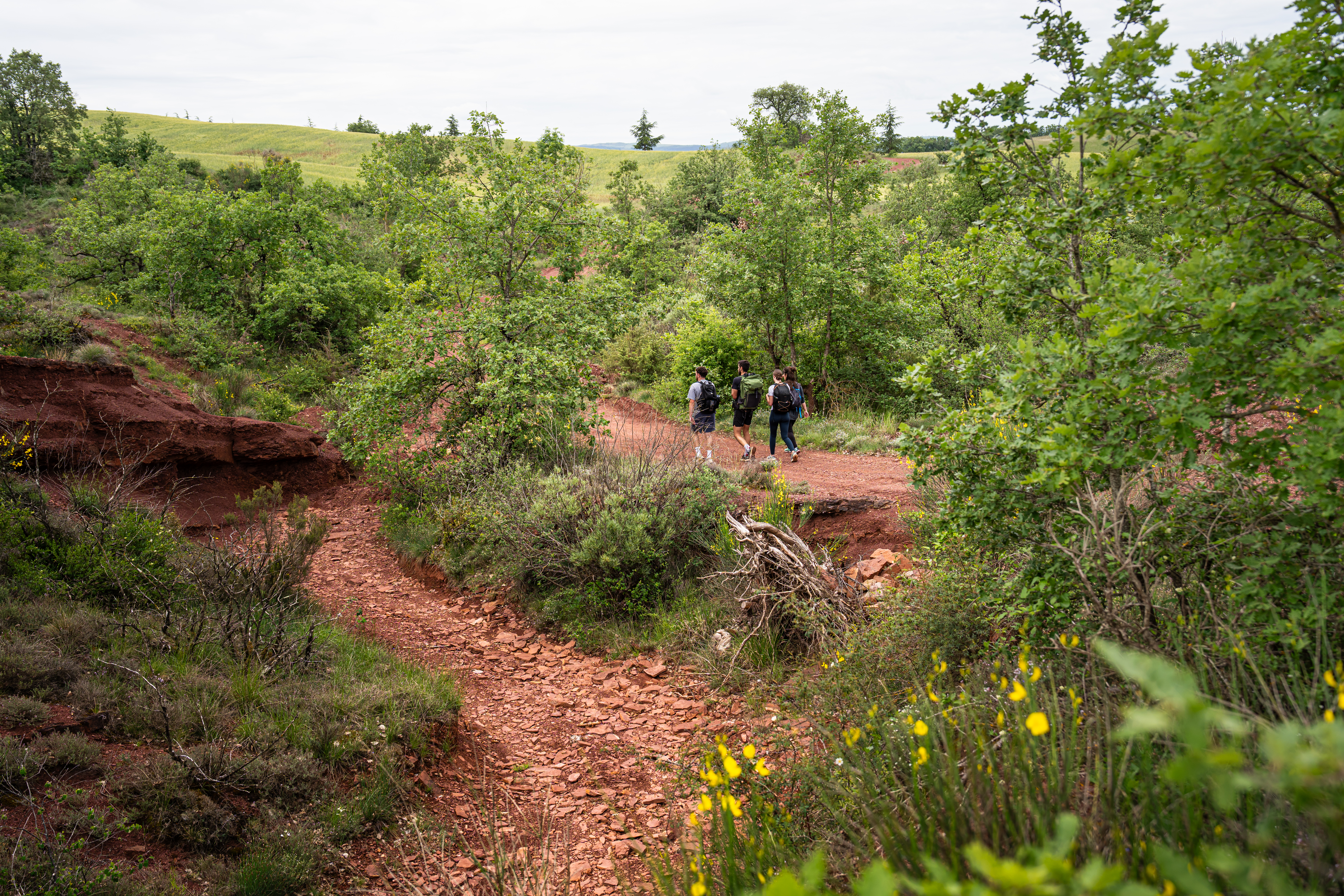
The village of Rayssac, situated at the edge of the Rougier, welcomes you to enjoy a pleasant and shady circuit in an oak woodland, through thickets of white heather (May is the blossoming season). An entire local heritage awaits you: rock tombs, medieval sarcophagi, but also a water bridge which provides evidence of irrigation in the Dourdou plain during the 19th century.
2 points of interest
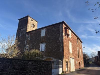
La laiterie - Roquefort Tourisme  History and heritage
The Dairy
Part of this building once housed the village dairy. It was rented by the Roquefort Société cellars. A worker from the company produced the cheeses there using milk collected in the village and surrounding area (around 15 to 20 Roquefort cheeses per day). These cheeses were then collected once a week by a cart that transported them to the Roquefort cellars.
The dairy ceased operations in the mid-1950s. From that time on, the villagers took their milk to the dairy in Vabres-l’Abbaye.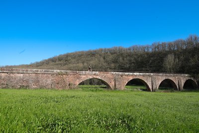
Aqueduc du Graouzou - Gilles Bertrand  Small heritage
Graouzou aqueduct
Designed to meet water needs in the 19th century, the Graouzou aqueduct is an example of engineering serving agriculture. In 1862, under the initiative of Hippolyte Barascud, a project was launched to create an irrigation canal connecting the Dourdou River to the Montet farm. Stretching 9 km, it was built from 1865 and allowed the irrigation of the lands of Montlaur and the surrounding area.
However, its proximity to the Dourdou made the structure vulnerable. Floods caused silting and damage to the canal, requiring constant maintenance. Despite these challenges, the aqueduct operated for over a century before being abandoned for economic reasons. Today, it remains a testament to the efforts of local communities to optimize water resources.
Description
When leaving the carpark, turn right and walk up the single street for 180 m.
- At the stone cross turn to the right, following signs for "Aqueduc direct".
- At the junction with a wider path (trail), head to the right and follow the trail for 300 m up to an intermittent stream.
- After a short ascent, go left and follow the path that runs along the ridge. Turn to the right after 250 m. Walk downhill through an oak grove up to the well restored water bridge.
- Follow the trail for 50 m, then leave it and turn left following the sign "Rayssac par les tombes".
- Walk up the path
- Make a round trip to the tombs, then follow the wide trail.
- At the intersection turn right, then reach the road that leads to the village.
- Departure : Rayssac (Commune de Vabres l'Abbaye)
- Arrival : Rayssac (Commune de Vabres l'Abbaye)
- Towns crossed : Vabres-l'Abbaye
Forecast
Altimetric profile
Recommandations
Information desks

Avenue de Lauras, 12250 Roquefort/Soulzon
Situated in the Grands Causses Regional Natural Park, the cheese village of Roquefort stretches on the hillside over the famous scree of the Combalou Rock, in southern Larzac. The village is at an elevation of 630 m and has 700 inhabitants.
OPENING PERIODS:
The Tourist Office is open all year round:
- In July and August, Monday to Saturday: 9.30 to 18.30, Sunday: 10.00 to 17.00.
- April, May, June, September, October; Monday to Saturday: 9.30 to 12.15 & 13.00 to 17.30, closed on Sunday.
- January, February, November, December; Monday to Friday: 9.30 to 12.15 & 13.00 to 17.00, closed on Saturday and Sunday.
Transport
Travel by bus or train: https://lio.laregion.fr/
Carpooling : BlaBlaCar, Rézo Pouce, Mobicoop, Idvroom, LaRoueVerte, Roulez malin
Access and parking
From Saint-Affrique/Millau follow the D999 towards Albi, drive through Vabres l'Abbaye and 5 km further on, turn left to reach the village of Rayssac. From Saint-Sernin/Albi follow the road towards Millau, drive across the village of Moulin-Neuf and 500 m further on, turn to the right to reach Rayssac.
Parking :
Report a problem or an error
If you have found an error on this page or if you have noticed any problems during your hike, please report them to us here: