On the trail of the women of the land
1 point of interest
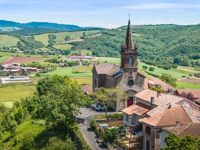
Église du Viala du Dourdou - Virginie Govignon  History and heritage
Church of Viala-du-Dourdou
Built in 1840 on the site of a former fortress, the Church of Viala stands out for its bell tower made of finely cut red sandstone. Inside, you can discover a small bronze bell dating from 1660, once used to announce approaching storms and ward off bad weather.
Description
These women of the land raised their families, often composed of many children, made bread in the ovens which are still visible today in the village, worked in the steep sloping fields, cared for poultry and took charge of the farms when their husbands were away at war. They handed down their ancestral skills and knowledge (preparing cold cuts, gardening and picking wild plants for their medicinal virtues), invigorated the life of the parish community and made sure that people lived together in harmony. Madame Carriere from the Mas Viala, Rosa from the Borie de Boyer, Marie from the Cagné, Denise, Marthe, La Vayssettoune and la Durante from the Viala, all of these women are well remembered and deserve this tribute.
- From the car park, walk up the D632 for about 100m and very next to the village hall, take a right turn up a road with hair pin bends. On reaching the reservoir, leave the road taking a right turn onto a grassy footpath. Cross a ravine and leave a path on your right. Walk up to join the road that leads to the Combe.
- At the intersection, take the path that goes towards the South and that leads to the Mas Viala. On reaching the Mas, carry straight on for about 100 m, then turn left and follow the trail that makes a wide curve to the right and climbs up towards the crest.
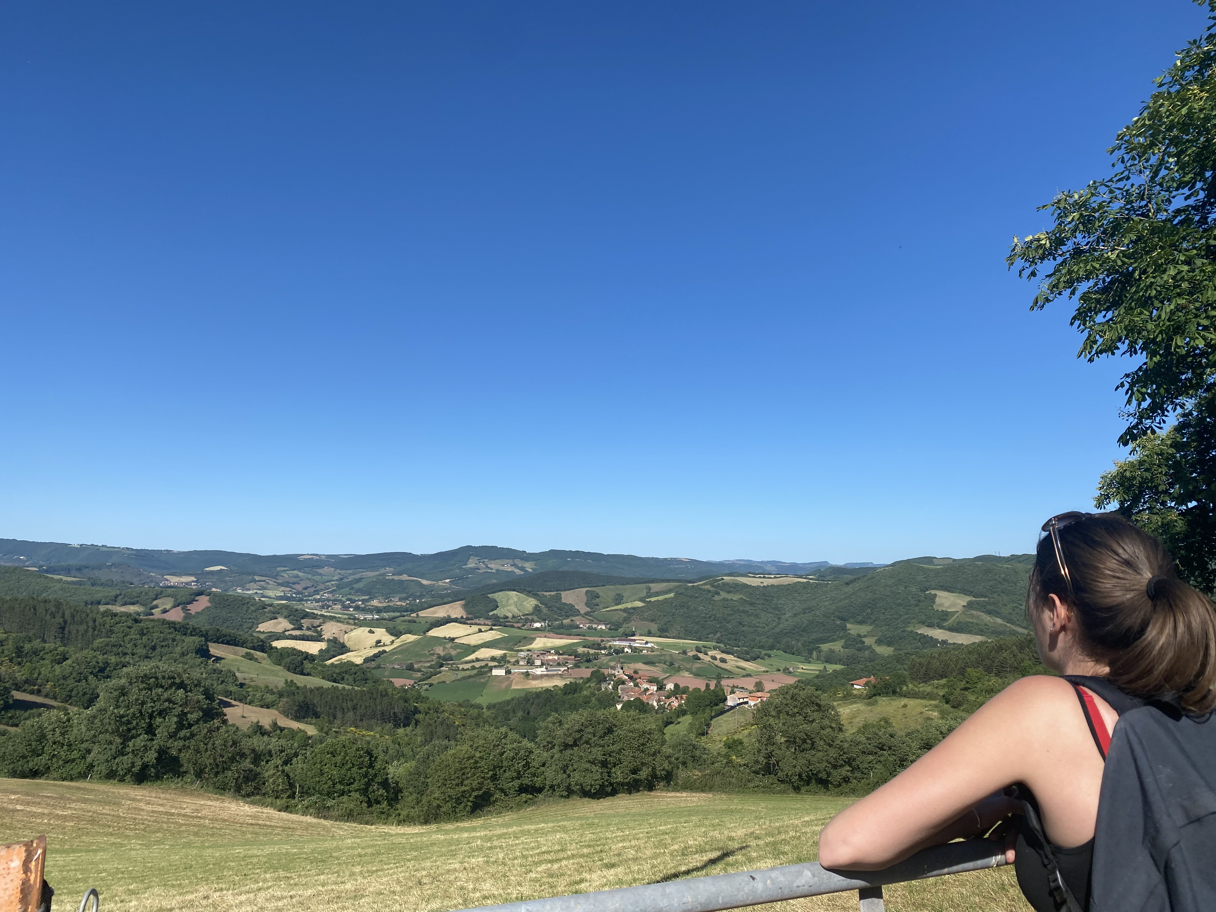
- At the junction of the trails, take right fork along the hill a shady path that meets another trail after 550 m and provides a very nice view over the Gos valley. Follow a hair pin bend to the left and walk down a gentle slope towards the D632.
- Cross the road and take the path on the opposite side that ascends southward up a slope. At the junction with a small road, take the left turn and follow this road for approximately 600m.
- Just before the Borie du Boyer, follow the left hand path that goes down towards the valley where you can enjoy the beautiful view. Walk close to the Cagné and after a hair pin curve, leave on your right a path that goes downhill towards the Maxillou stream, and keep going NW, first on the road and then on a trail through woodlands.
- Follow a wide curve which takes you back onto the road and after a hair pin bend keep straight on towards the village.
- Departure : as you enter the village
- Arrival : as you enter the village
- Towns crossed : Calmels-et-le-Viala and Saint-Juéry
Forecast
Altimetric profile
Recommandations
Information desks

Saint-Affrique Tourist Office
Boulevard Aristide Briand, 12400 Saint-Affrique
OPENING TIMES:
The Tourism Office is open all year round, the opening hours are:
·July and august:
From Monday to Saturday: 9h – 13h & 15h – 19h
Sunday: 9h – 13h
·From September to June:
From Tuesday to Saturday: 9h – 13h & 14h – 17h
Closed: Sundays, Mondays and bank holidays
From November to April, the office is also closed on Saturday afternoon.
Transport
Travel by bus or train: https://lio.laregion.fr/
Carpooling : BlaBlaCar, Rézo Pouce, Mobicoop, Idvroom, LaRoueVerte, Roulez malin
Access and parking
From the road D999, at the roundabout situated near Vabres-l’Abbaye, take the D25 towards Saint-Izaire. After the hamlet of la Borie, turn left onto the D632, then cross the bridge over the Dourdou river and turn to your left.
Parking :
More information
Report a problem or an error
If you have found an error on this page or if you have noticed any problems during your hike, please report them to us here: