Through Causses and Cevennes
At the confluence of crystal-clear rivers, the Dourbie and the Durzon, this itinerary where the Causse Bégon looks up and down the foothills of the Cévennes, reserves sumptuous panoramas of the gorges of Dourbie and Trévezel. A route marked with the history of Nant and its canals, old calamine ovens, and St-Jean du Bruel, a Cevenol enclave in Aveyron.
3 points of interest
Four à Calamine - Delphine ATCHE  Small heritage
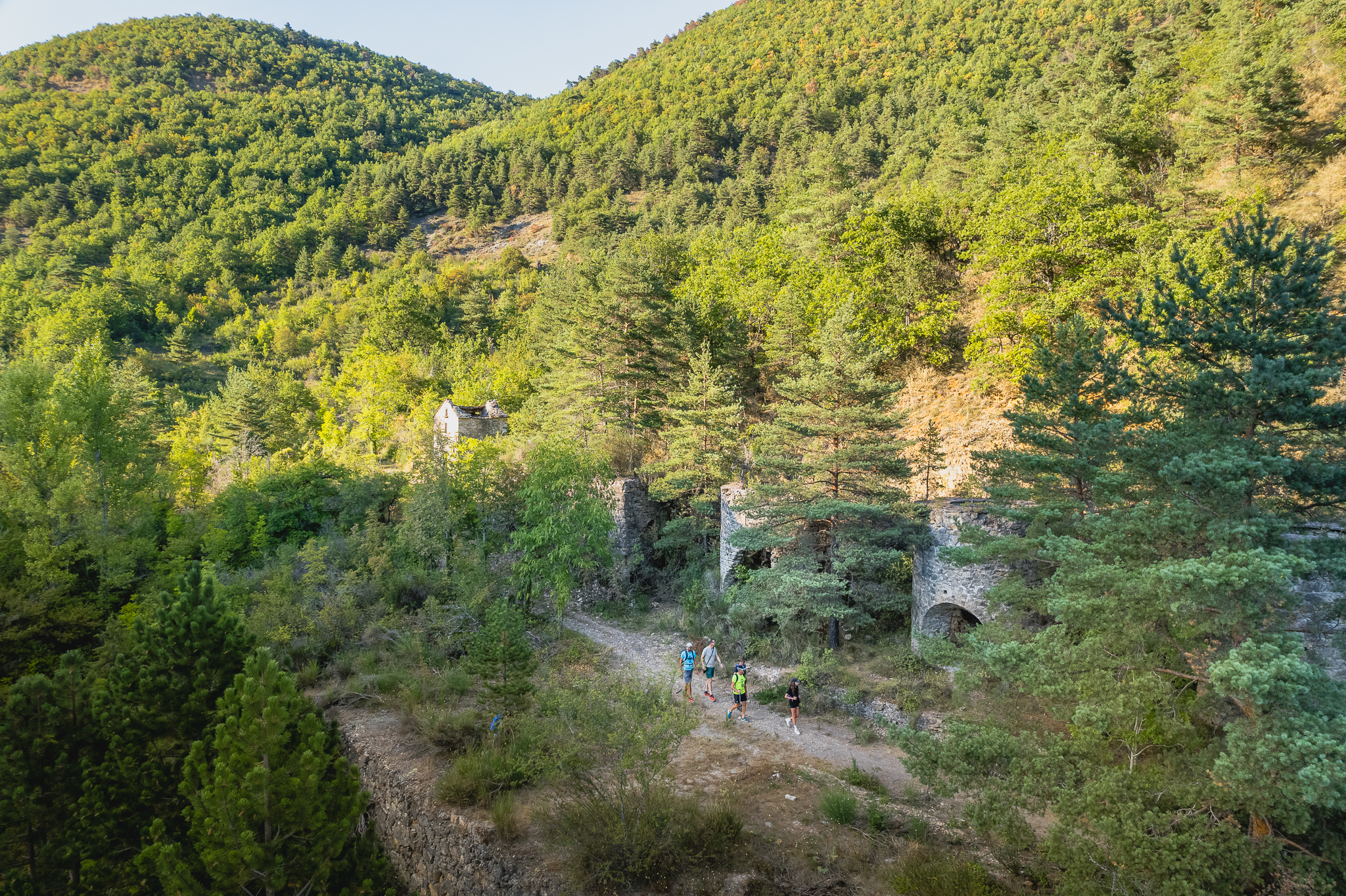
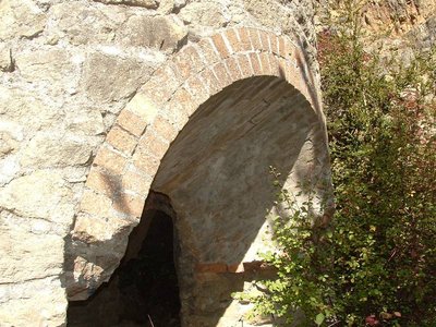
The kilns of Valettes
The kilns of Valettes were inaugurated in 1905, the concession having been obtained the same year by the Metal Mining Company of Aveyron. Its perimeter extends between Saint-Jean du Bruel and Causse-Bégon and the works concern "La Gardiole", the Valettes (above the kilns), "Les Baldy" and "L'Yfer" above the brook called Saint-Gleys between Barjac and the confluence of Valettes. The main ore is constituted by calamine containing 35 to 40% zinc. The five furnaces are intended for enrichment by the so-called reduction method.
As the research progresses, the results soon turn out to be disappointing, because if from 1901 to 1904, 800 tons of calamine are extracted, 390 tons in 1905, 435 tons in 1906, it is treated only 160 tons in 1909. Work must stop in 1914 and will never be resumed.
After their abandonment, the five kilns will serve as a quarry. The three openings of the kilns are each coated with two rows of refractory bricks. These bricks will be used by a local artisan to make small metal ovens for baking bread, to keep cozy warmth under the feet and beds of the inhabitants of St-Jean, and finally to build the heating fireplace of the church. .
Source: written by Claude Bouteiller, revue Causses et Cévennes du Club Cévenol n°4-Août Septembre Octobre 2004
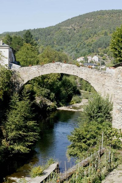
Le pont vieux - Studio Martin  Architecture
The old Bridge
Located in the oldest area of the village, this roman bridge with a single arch spans the Dourbie River.
Dating from the 13th century, it was the main bridge of the village until the 18th century. In the neighborhood of the old bridge, manholes still exist, hiding places dating from religion wars.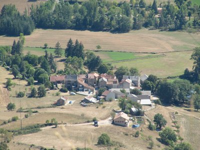
Ambouls depuis le Roc Nantais - Alain Bonnemayre  History and heritage
Ambouls
The village of Ambouls, municipality of Nant, built on the right bank of the Dourbie River, would date from the installation of the Romans in the area of Nant.
The hillock of Ambouls peak (641 m high) was fortified in the Iron Age from 700 or 600 BC., a clear sign of an older occupation.
On the peak or “gallo-Roman oppidum”, pieces of pottery were discovered 40 years ago and are preserved at the Museum of Montrozier.
On the east side we can still see todays the entrance of the “grotte des fées” (cave of the fairies), where Ernest André discovered in 1913 human bones dating from around 4500 BC.
Ambouls is one of those agricultural hamlets, emptied by the rural exodus, but which recovers now a new soul, thanks to the city dwellers who come back and restore the houses.
Some houses are typical with the external stone staircase, the porch and under the stable which opens on a wide arched porch.
You can also discover an original fireplace above an old bread oven and a stone cross from 1710.
Description
- From the Place du Claux, follow the D999 towards Saint-Jean du Bruel. After the war memorial, take the street on the left towards Ambouls. Cross the bridge of La Prade and continue on the road for 50 meters.
- Turn left on the trail which goes up along the horse club lands. At 1 km, at the crossroad take on the left towards Roc Nantais-Trèves.
- At the exit of the woods, opposite a large field, and far away the ruins of the farm of Anguiral, take on the right the path towards Œil-de-Bœuf (excavation in a rock).
- Oblique right, cross a field (be attentive to the marks) and take the stony path which goes down steep slope and reaches the stream of Valettes. Follow it and pass near old calamine ovens. Continue keeping right in the valley and arrive to Saint-Gleys. Cross the hamlet and continue on the road to the left towards Saint-Jean-du-Bruel. At the entrance of the village turn right and cross the old bridge.
- Go left to discover the center of the village, then return to the bridge. Take the road D999 towards Nant for 500m, then turn left towards Fougayrolles. Cross the hamlet and continue left towards a path which goes up to a cross. Follow right the road which leads to the ruins of Algues Castle. Possibility to go and back to the panorama.
- Continue on a wide dirt road which goes down to the valley and arrives to the fortified Castelnau farm. Take the D999 on left for 1,2km.
- Take right the road which crosses the Dourbie river on a submersible bridge. 50m after the bridge, turn left on the road and continue north.
- Cross the La Prade bridge and return to Nant.
- Departure : Place du Claux
- Arrival : Place du Claux
- Towns crossed : Nant and Saint-Jean-du-Bruel
Forecast
Altimetric profile
Recommandations
Yellow signs.
Steep uphill and downhill.
Information desks

Tourist Office Larzac et Vallées
Place du Claux, 12230 NANT
Located on the ground floor of the Town Hall (mansion of the 18th century), The Tourist Office welcomes you all year and offers tourist information on the Larzac and its valleys, the department of Aveyron, and also on neighboring counties. Free Wifi access.
Opening hours :
From Novembre to February: Tuesday morning 9:00-12:30
March and October : Tuesday to Friday 9:00-12:30
April : Tuesday to Friday 10:00-12:30 and 14:00-17:30
May, June : Tuesday to Saturday 10:00-12:30 and 14:00-17:30
July and August : every day 09:00-13:00
September : Tuesday to Saturday 10:00-12:30 and 14:00-17:30
Transport
To find a means of transport go to Transport Aveyron.
Think about carpooling and hitchhicking: Rezopouce; Aires de covoiturage
Access and parking
From Millau, take the D809 towards Montpellier, then at La Cavalerie turn left on the D999 to the village of Nant.
From the motorway A75:
- Coming from the north, take exit 47 La Cavalerie, then take the D999 to Nant
- Coming from the south, take exit 49 Le Caylar, follow the direction of La Couvertoirade and continue on the D55 to Nant.
Parking :

Report a problem or an error
If you have found an error on this page or if you have noticed any problems during your hike, please report them to us here: