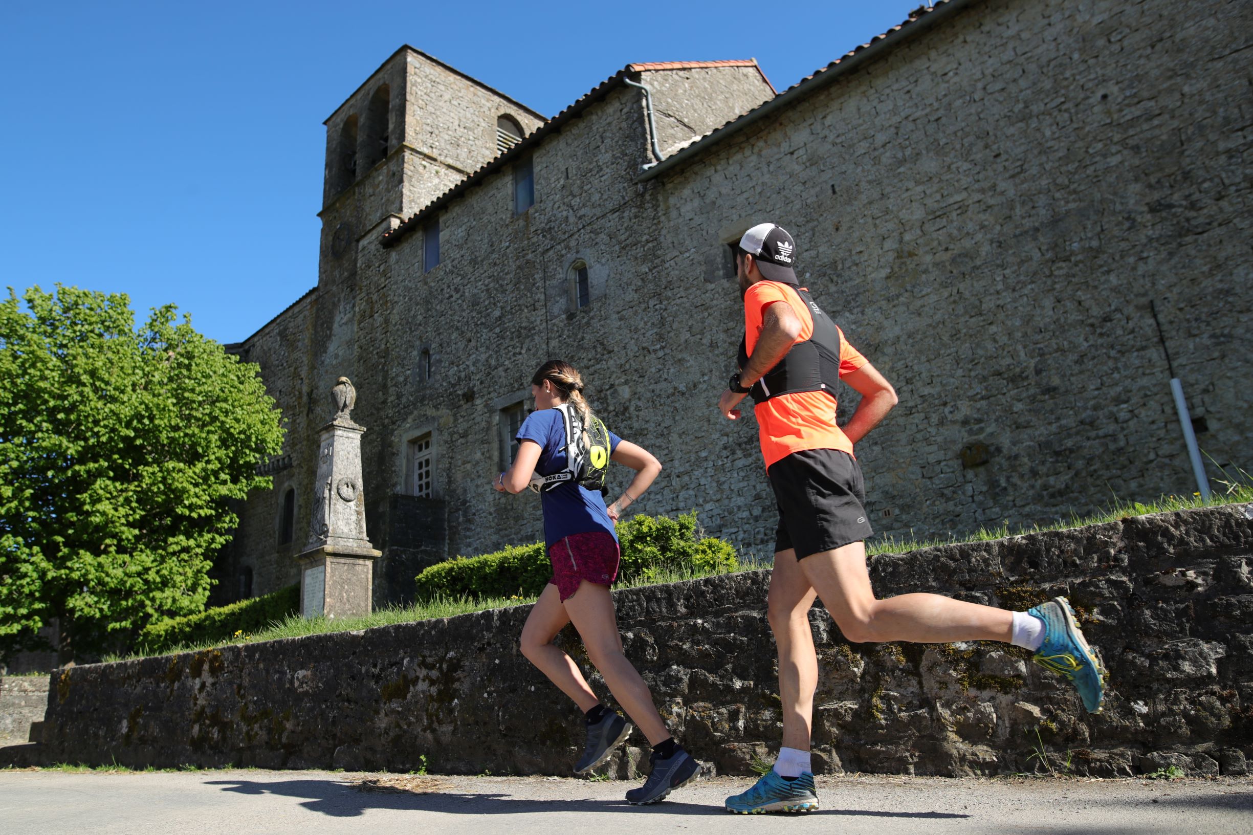
Trail running No. 27 Saint Jean d'Alcapiès
With an old railway turned into a green path as a backbone, this initially gentle route soon raises the difficulty level and holds in store some challenging passages for you, a real treat of a running trail. However, as a jewel of Cistercian architecture, Saint-Jean d'Alcas fort is an important place to visit that adds to the charm and mystery of this little known part of the causse.
1 point of interest

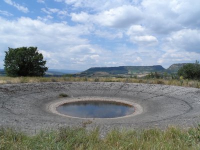
Lavogne de Caussanuejouls - (c) DelphineAtche  History and heritage
Caussaunejouls Lavogne
How a lavogne works is very easy to understand; imagine a gigantic upturned umbrella that collects rainwater!
In the beginning, there was a natural pond with impervious clay soil. This small pond was a real boon for people who quickly set these watering sources up as they were so critical on the causses where water seeps into the cracked limestone. First, they tiled the inside of the pond and finished off the work by laying paving stones around the edge of the pond to preserve the water quality and prevent gullying due to the large flocks trampling the soil when the sheep come to drink.
The pond tiling was made either with lauzes, flat stones or with paving stones laid one after the other.
Once completed, this gigantic upturned umbrella would provide a great variety of animals with a welcoming habitat, just look down over a lavogne and see how it swarms and buzzes with life; what a frenzy of activity!
From this lavogne, you will enjoy a stunning view to the north over the Combalou, a residual mound that shelters the Roquefort maturing caves.
Description
- You start at a gentle pace on a large trail that runs alongside the St-Jean brook. The tempo is steady, and you warm up on a rising false flat to reach the D93 (in the future, this section will be replaced by the green lane, which is under development) and the hamlet of Massergues.
- Once you have passed the last house, at km 4, the circuit becomes tricky and technically demanding. You first jump the Quajos ravine, then ascend the small valley to head towards the medieval city of St Jean d'Alcas, a beautiful and superbly preserved stronghold.
- From here, you start a nice descent on the hillside of the emerging Verzolet valley to join the Moulin de Gauty.
- Once you have run past this beautiful gite classified with a Panda label, you climb back to the causse by taking a path that can be considered as typically caussenard, allowing access to Caussanuéjouls (and its lovely lavogne).
- You are now at the halfway point with, first of all, a long section overall downward, passing at Mas d'Alzac to reach the green lane (leading to St Affrique) after a gratifying technical part in the boxwoods.
- In the final third of this circuit, the return back to St Jean d'Alcapiès is carried out via a well-known path to hikers, the Volcano path. This path goes around the Coste du Rouquet, overlooking the Pradelles brook, and can be graded a « small » 100 m D+ that makes muscle sore a bit at the end of the route.
- Departure : Saint-Jean d'Alcapiès, Alcapia
- Arrival : Saint-Jean d'Alcapiès, Alcapia
- Towns crossed : Saint-Jean-d'Alcapiès, Saint-Jean-et-Saint-Paul, Roquefort-sur-Soulzon, Versols-et-Lapeyre, and Saint-Affrique
Altimetric profile
Recommandations
Information desks
Saint-Affrique Tourist Office
Boulevard Aristide Briand, 12400 Saint-Affrique
OPENING TIMES:
The Tourism Office is open all year round, the opening hours are:
·July and august:
From Monday to Saturday: 9h – 13h & 15h – 19h
Sunday: 9h – 13h
·From September to June:
From Tuesday to Saturday: 9h – 13h & 14h – 17h
Closed: Sundays, Mondays and bank holidays
From November to April, the office is also closed on Saturday afternoon.
Transport
Getting around by bus or train : https://lio.laregion.fr/
Carpooling: BlaBlaCar, Rézo Pouce, Mobicoop, Idvroom, LaRoueVerte, Roulez malinAccess and parking
From Saint-Affrique, take the D999 towards Millau. After 6 km, turn to the right in the direction of Saint-Jean-d'Alcapiès.
Parking :
Report a problem or an error
If you have found an error on this page or if you have noticed any problems during your hike, please report them to us here:

