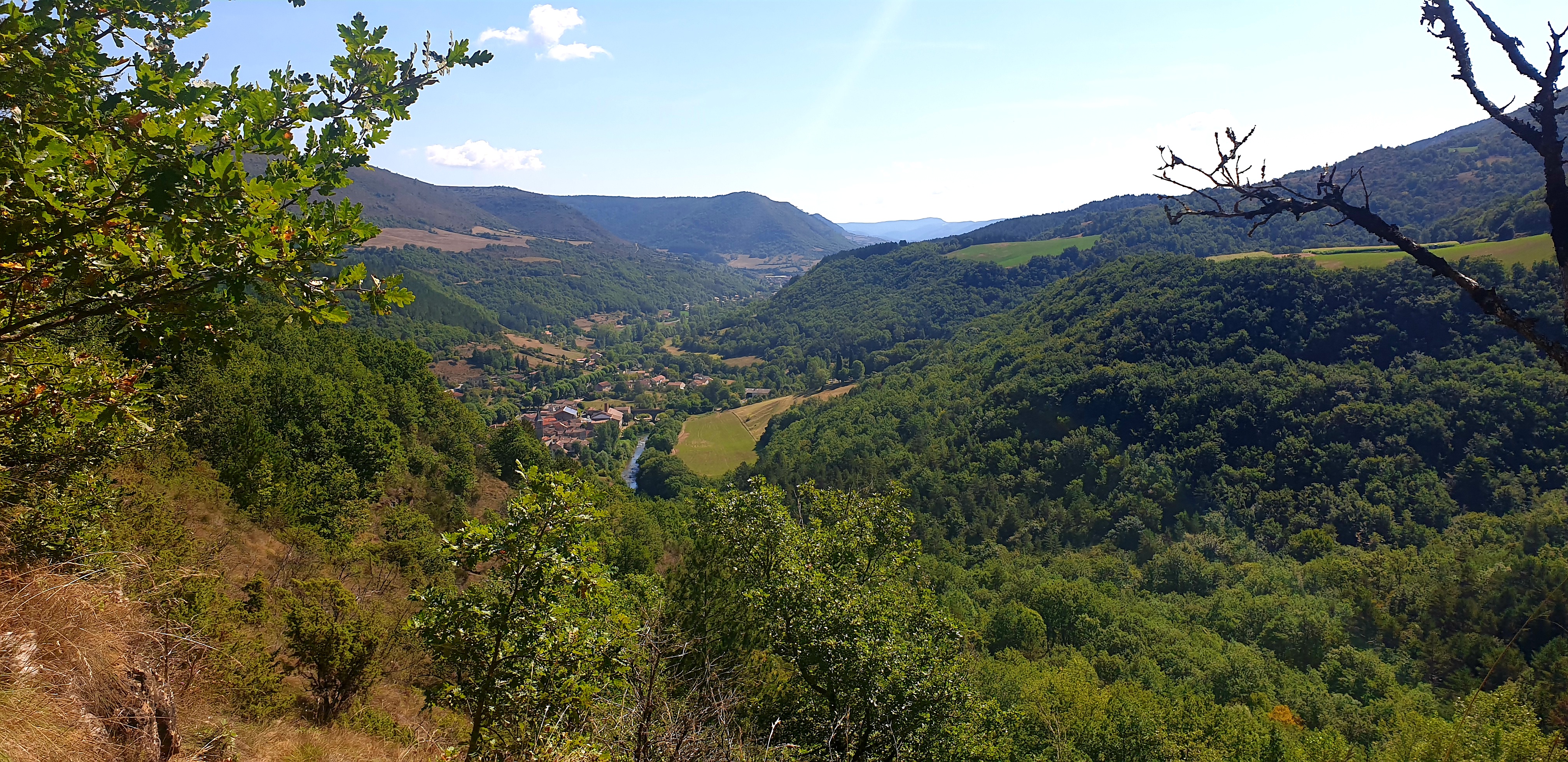
A walking tour around Clipis via the Frégière
Be prepared for coolness: there’s a good reason this site is called La Frégière! Remains of a disused gypsum quarry and plant are evidences of an obsolete industry: gypsum quarrying, which was flourishing around Montaigut at the end of the 19th century. Small springs and steep-sided paths punctuate this circuit that leads you to a plateau, with a view over the Sorgues valley.
Description
- From Lapeyre to the Plo de Labade: From the carpark take right the D92 for a few metres, fork to the right onto a path called "la Mine" which runs along the Frégière brook, and walk past a building of which only remains the restored dwelling part. The ground level and the rear part of the building used to host the plaster plant. Carry on the path which runs along the fields up to the Clipis intersection.
- From the Plo de Labade to Clipis: Take right towards Clipis, pass the building and walk along a lake.
- From Clipis to Lapeyre: Take to the right the Bourgatte path that runs downhill towards the Lapeyre old bridge. Do not cross the bridge, but take the descending path on the right that goes across a footbridge, then passes by a cave and reaches the road to Gissac and the carpark.
- Departure : Lapeyre
- Arrival : Lapeyre
- Towns crossed : Versols-et-Lapeyre
Forecast
Altimetric profile
Recommandations
Box tree months are active from May to October. During the caterpillar phase, they feed on the leaves of box trees. They crawl down trees and move on long silken threads, although these threads are annoying when hiking they do not pose any health risk
Information desks

Avenue de Lauras, 12250 Roquefort/Soulzon
Situated in the Grands Causses Regional Natural Park, the cheese village of Roquefort stretches on the hillside over the famous scree of the Combalou Rock, in southern Larzac. The village is at an elevation of 630 m and has 700 inhabitants.
OPENING PERIODS:
The Tourist Office is open all year round:
- In July and August, Monday to Saturday: 9.30 to 18.30, Sunday: 10.00 to 17.00.
- April, May, June, September, October; Monday to Saturday: 9.30 to 12.15 & 13.00 to 17.30, closed on Sunday.
- January, February, November, December; Monday to Friday: 9.30 to 12.15 & 13.00 to 17.00, closed on Saturday and Sunday.
Transport
Travel by bus or train: https://lio.laregion.fr/
Carpooling : BlaBlaCar, Rézo Pouce, Mobicoop, Idvroom, LaRoueVerte, Roulez malin
Access and parking
Parking :
Report a problem or an error
If you have found an error on this page or if you have noticed any problems during your hike, please report them to us here: