The Loubière plateau via Clipis
Versols-et-Lapeyre
The Loubière plateau via Clipis
Medium
3h
9km
+442m
-439m
Loop
Embed this item to access it offline
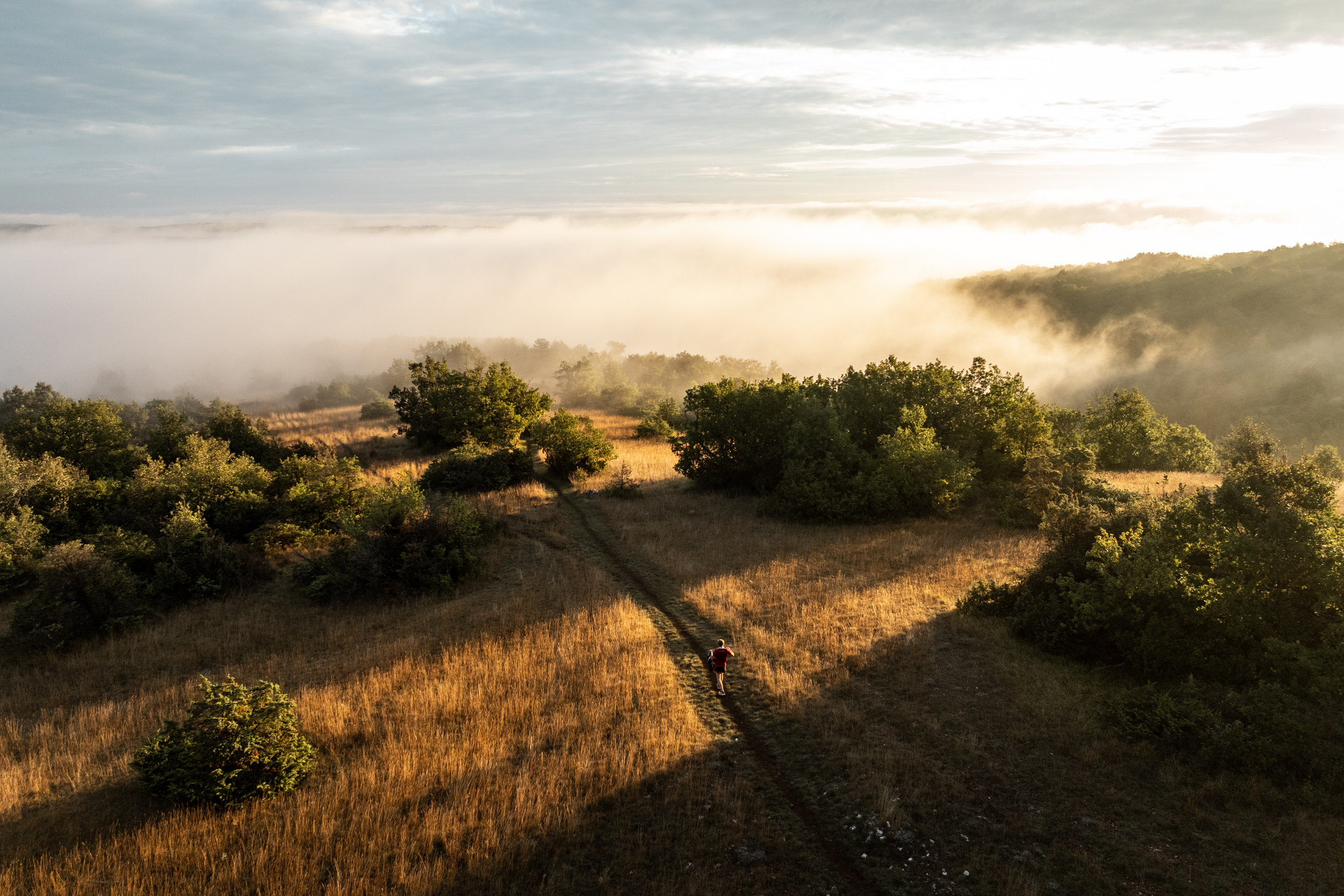
On the northeast side, the village of Lapeyre and the town of Saint-Affrique linked by the blue line of the Sorgues river. On the southwest side, the small valleys and red soils of the Camarès area, the proud-looking castle of Montaigut standing on its hilltop. The Loubière plateau with its vast stretches of fields and undergrowth gives you the assurance of enjoying wonderful panoramic views wherever you look!
Description
- From the carpark of Lapeyre to the Croix del Pas: from the carpark head towards the village and before the bridge take left the path that runs along the river up to the old bridge. Right after the bridge, take the Bourgatte path for approximately 1km. At the junction with the logging trail turn to the left, walk above the Clipis farm and take right an ascending track towards the Croix del Pas.
- From the Croix del Pas to the Serre des Cabros: at the pass take the most left track, walk through a wooded area and then along a field. At the junction with the logging trail, take right for a few dozen metres a narrow footpath that leads to a scenic view over the Rougier and the castle of Montaigut. Walk back to the trail up to a signpost indicating Lapeyre.
- From the Serre des Cabros to Lapeyre: take the path that runs downhill through boxtrees up to the Puech Mets road. Turn to the right and follow the road until the junction with the D92. Take opposite a path that goes downhill and passes nearby a building. Reach the old track connecting Lapeyre to Sylvanès that runs along the Fon Rouge brook. Once at the D92, take opposite a path that goes downhill across woodlands allowing you to get back to the road near Lapeyre.
- Departure : Lapeyre
- Arrival : Lapeyre
- Towns crossed : Versols-et-Lapeyre and Gissac
Forecast
Altimetric profile
Information desks

Avenue de Lauras, 12250 Roquefort/Soulzon
Situated in the Grands Causses Regional Natural Park, the cheese village of Roquefort stretches on the hillside over the famous scree of the Combalou Rock, in southern Larzac. The village is at an elevation of 630 m and has 700 inhabitants.
OPENING PERIODS:
The Tourist Office is open all year round:
- In July and August, Monday to Saturday: 9.30 to 18.30, Sunday: 10.00 to 17.00.
- April, May, June, September, October; Monday to Saturday: 9.30 to 12.15 & 13.00 to 17.30, closed on Sunday.
- January, February, November, December; Monday to Friday: 9.30 to 12.15 & 13.00 to 17.00, closed on Saturday and Sunday.
Transport
Travel by bus or train: https://lio.laregion.fr/
Carpooling : BlaBlaCar, Rézo Pouce, Mobicoop, Idvroom, LaRoueVerte, Roulez malin
Access and parking
From Saint-Affrique, follow the D7 towards Cornus. Once in Lapeyre, which is the first village you drive through, turn right towards Gissac and park your vehicle next to the graveyard.
Parking :
Cimetary carpark
Report a problem or an error
If you have found an error on this page or if you have noticed any problems during your hike, please report them to us here: