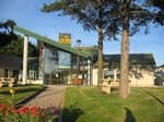
The hamlet of Salmanac spreads across a plain which already heralds the rougiers sceneries and welcomes you to enjoy an immersive stroll towards Ségonzac, another village built in red sandstone and nestled unobtrusively in a small valley. Between those two havens of peacefulness, explore trails, hills and woodlands and experience the natural beauty of the place.
1 point of interest
 Panorama
Viewpoint
View over the Salmanac plain
Description
- From the car park, walk to the hamlet entrance, cross the bridge and follow the rural path to the left which runs alongside Grays brook. After approximately 1 km cross the brook, and a little further on, take the extreme right path into the woodland. Your path follows the course of another brook and then rises up towards a crest and after a hair pin bend joins a trail.
- Follow this trail to the left which takes you towards the farm la Gariette. Take a look at the ancient farm buildings, and then carry on along the tarmacked road for about 400 m.
- Leave the road taking dirt path to your left which passes under a power line, then rises along a crest and eventually reaches the plateau and a second power line.
- You will arrive at a fork in the track, where you have the possibility of extending your hike with a brief diversion by carrying straight on the grassy trail (30 m), then you take a small path running down to the left towards the village of Ségonzac. After your visiting the village, retrace your way back to the second power line. Follow the line southward. You will see a cross on the left hand side of the path, and eventually reach the road leading to le Taillerou. Turn left onto this road and walk past some buildings, then take a path running down to the East across the fields. Pass under the power line and enjoy the views over the landscape: to your left, la Gariette, in front of you, the Dourdou valley, a little further on, the castle of Montaigut, and in the far distance to your right the Merdélou crests. You will pass by two trails to your right, and keeping to the path you are on, walk beside a small pond to your left and then up a slope to the edge of the wood towards the summit (509 m). Now follow the path down a little to meet the small road which leads to a place called Le Bousquet.
- Carry on this road for approximately 400 m. Just before the bend in the road (nice view over the Salmanac plain), take a hair pin bend on the left and follow a path that widens out into the woodland. Walk along the edge of a field on your left and then take again the path which joins a trail. Take that trail to the right, carry on down into the wooland, paying attention to the markings and reach Salmanac by a wider trail.
- Departure : dans le hameau de Salmanac
- Arrival : dans le hameau de Salmanac
- Towns crossed : Vabres-l'Abbaye
Altimetric profile
Recommandations
Information desks
Avenue de Lauras, 12250 Roquefort/Soulzon
Situated in the Grands Causses Regional Natural Park, the cheese village of Roquefort stretches on the hillside over the famous scree of the Combalou Rock, in southern Larzac. The village is at an elevation of 630 m and has 700 inhabitants.
OPENING PERIODS:
The Tourist Office is open all year round:
- In July and August, Monday to Saturday: 9.30 to 18.30, Sunday: 10.00 to 17.00.
- April, May, June, September, October; Monday to Saturday: 9.30 to 12.15 & 13.00 to 17.30, closed on Sunday.
- January, February, November, December; Monday to Friday: 9.30 to 12.15 & 13.00 to 17.00, closed on Saturday and Sunday.
Transport
Travel by bus or train: https://lio.laregion.fr/
Carpooling : BlaBlaCar, Rézo Pouce, Mobicoop, Idvroom, LaRoueVerte, Roulez malin
Access and parking
Parking :
Report a problem or an error
If you have found an error on this page or if you have noticed any problems during your hike, please report them to us here:

