
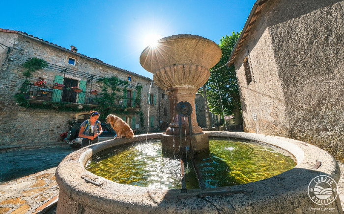
Sauclières, a path a school
From tunnels and viaducts to retaining walls, the old railway line connecting Tournemire (Aveyron) to Le Vigan (Gard)—which operated between 1896 and 1952—has left its mark on Sauclières. Situated at the edge of the causse plateau and the Cévennes mountains, this charming village also boasts vernacular heritage waiting to be discovered along this family-friendly hike.
Attachment
- Downloadpdf
RPI-St-Jean-du-Bruel-Sauclières-1
Credit: Livret un chemin, une école RPI St-Jean Sauclieres - CRDP
Description
- From the car park, head towards the church; go around it to the north, passing the washhouse. Take Rue du Caussanel.
- At the cross, bear left onto the road heading northwest. Pass a stone cross and continue along the road past oak trees and then fruit trees (look to the left to see a small aqueduct).
- At the crossroads, continue straight ahead along the old railway line. Pass through the 241-meter-long tunnel, then continue in the open. The path formes a horseshoe and continues to the south through a trench. Ignore the path to the left. Cross the quarry, the viaduct, a second quarry, a second viaduct, and a bridge spanning a road. The path makes a tight loop and passes under the bridge.
- Cross the D7 road (be careful). Take the path leading down below. It winds through a switchback and a curve before straightening out across the fields. Continue along the D7 for 120 meters.
- At the barn, head up the path passing to the right of the building; it overlooks the village hall. Continue straight ahead, leaving the football field on your right, and walk up the road (heading northeast). Follow Rue de la Faysse to the right, then continue north to return to the car park.
- Departure : Sauclières
- Arrival : Sauclières
- Towns crossed : Sauclières
Forecast
Altimetric profile
Recommandations

Information desks

Tourist Office Larzac et Vallées
Place du Claux, 12230 NANT
Located on the ground floor of the Town Hall (mansion of the 18th century), The Tourist Office welcomes you all year and offers tourist information on the Larzac and its valleys, the department of Aveyron, and also on neighboring counties. Free Wifi access.
Opening hours :
From Novembre to February: Tuesday morning 9:00-12:30
March and October : Tuesday to Friday 9:00-12:30
April : Tuesday to Friday 10:00-12:30 and 14:00-17:30
May, June : Tuesday to Saturday 10:00-12:30 and 14:00-17:30
July and August : every day 09:00-13:00
September : Tuesday to Saturday 10:00-12:30 and 14:00-17:30
Transport
To travel by bus or train, by carpooling Aires de covoiturage and hitchhiking Rezopouce
Access and parking
Sauclières, 44 km southeast of Millau via the D809, A75 (exit 48), and D7.
Parking :
Source

Report a problem or an error
If you have found an error on this page or if you have noticed any problems during your hike, please report them to us here: