Around La Couvertoirade
The climb to the Larzac causse allows to relocate the jewel of la Couvertoirade in its natural setting. In an arid site shaped by the sheep breeding, the “lavogne” (cobbled watering place) and tank-roofs bear witness to a “caussenarde” architecture dedicated to the water canalization. A whole typical heritage refers to the historic building of the Templar city.
9 points of interest
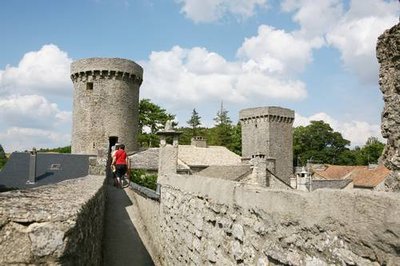
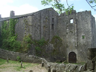
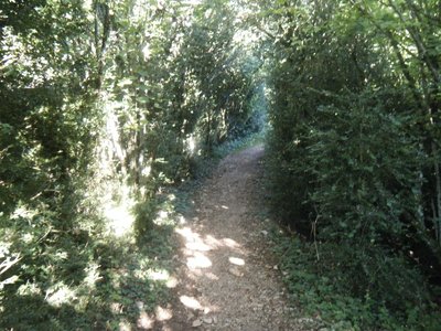
Chemin de ronde - ©Studio Martin  Architecture
The ramparts
La Couvertoirade preserves all its walls, built in the mid-fifteenth century. As early as 1346, robbers called "routiers" plunder the Larzac. Because of fear of the armed gangs, villagers were asking in 1439 the permission to fortify the village. The construction continued until 1445 under the direction of master mason Déodat d'Alaus.
This wall of 420 m long and 1.30 m of thickness is pierced by arrow slits and is surmounted by a walkway.
Sources: Information Office of La Couvertoirade.
Four banal - H. Ucheda  Small heritage
The oven
This oven owes its name to the tax people had to pay for using it: this tax was called “la banalité”.
Built in the 15th century by the Hospitallers and restored in 2000s. Today, it works and batches are regularly made by the village baker.
Eglise Saint-Christophe - ©PNR Grands Causses  History and heritage
The church Saint-Christophe
The present church has replaced the old parish church of the 11th century, situated outside the village. This new building, partly carved into the rock in the 14th century will attend the final constitution of a village.
During construction of the walls in the 15th century, the church flat chevet will be a complete portion of the wall. A defense tower will also be added to the above the choir, but will unfortunately be destroyed in the 18th century representing too much weight to the original building.
Sources: Infirmation Office of La Couvertoirade.
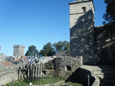
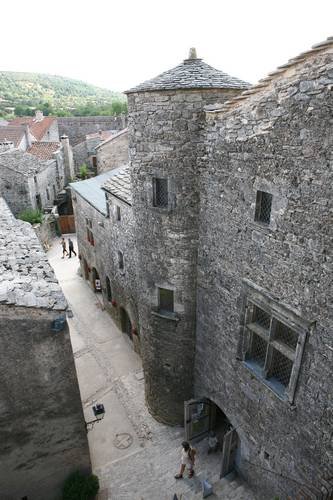
Château templier - Point Information La Couvertoirade History and heritageThe Castle
The Templar castle was built in the late twelfth century on the rocky outcrop of the village. Until the construction of the walls in the fifteenth century, its mission was to protect the villagers in case of attack, evidenced by its barbican, this primitive enclosure, as well as the remains of a gatehouse, located above the front door. This building has three parts : a farmyard, a main building and a dungeon.
Sources: point Home Tourism Couvertoirade
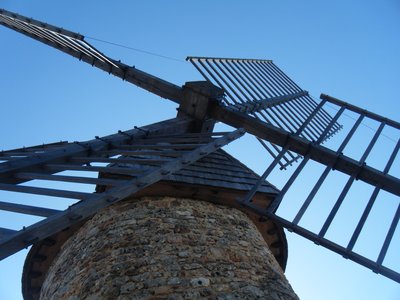
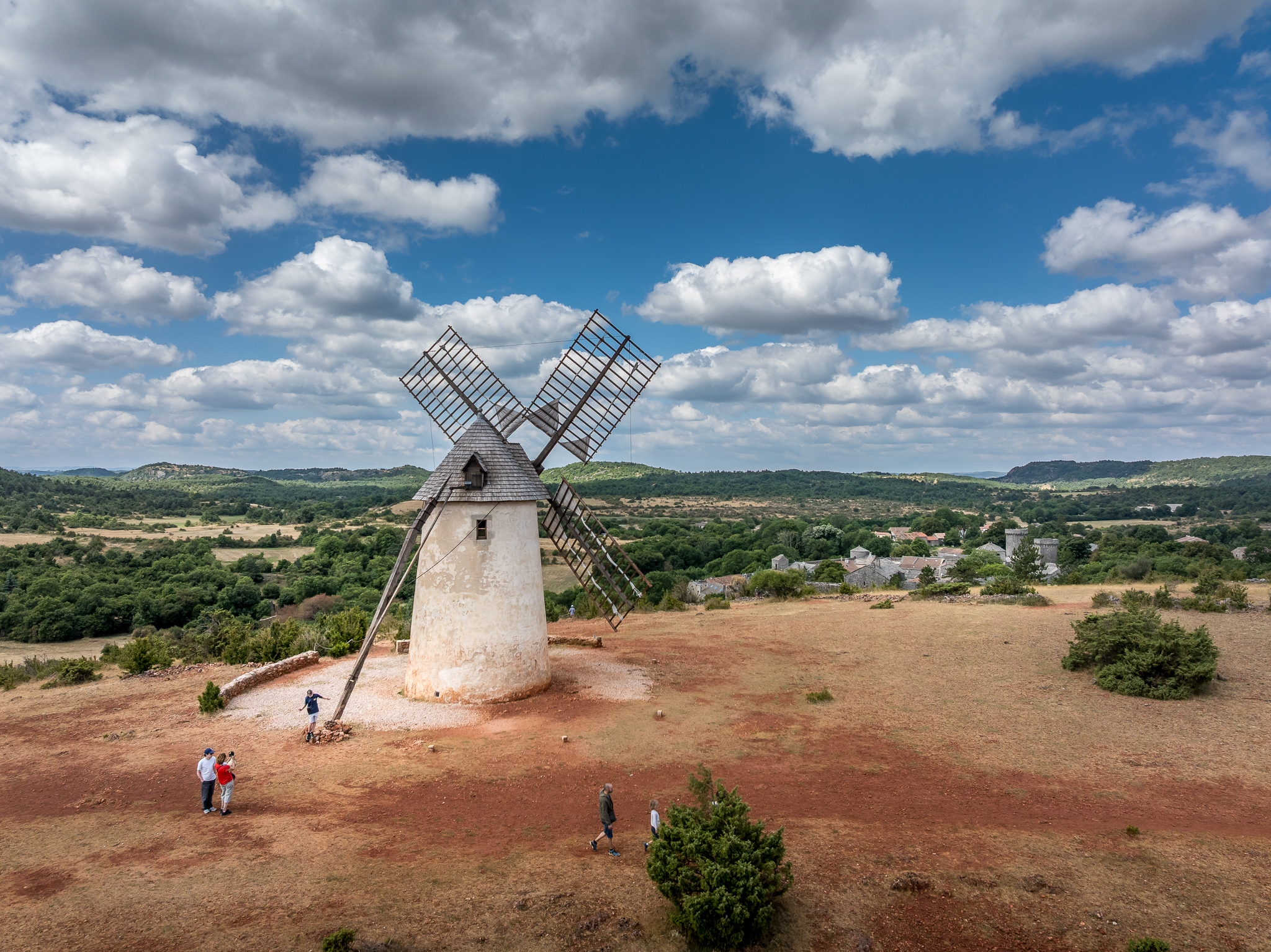
Le moulin de Rédounel - ©PNR Grands Causses ArchitectureThe mill of Redounel
The first notes about windmills appear in England and France at the end of the 12th century. They were much developed in the early 13th century and stopped turning at the end of the 19th century without any exception. In La Couvertoirade, there were two windmills, one disappeared but was mentioned in the 17th century in a place called “the Cross of wind”, the other still dominates the city at Redounel. “Le Moulin de Redounel”: altitude: 808 m, outer diameter: 5.56 m, height 6.60 m, thickness of walls: 1.08 m. It is made up of one of the only remains of windmills in South Aveyron, among the 60 windmills known in Aveyron. The windmills were used to grind wheat (flour), to press nuts (oil) or crush apples (cider).
Sources: PNRGC_DA
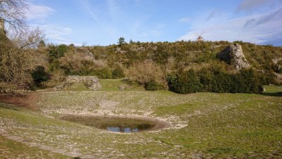
La lavogne et le moulin de La Couvertoirade - Sandrine Perego - OT LV Small heritageThe "lavogne" (cobbled watering place)
The lavogne and the tank have a dual function, vital to the plateau. The lavogne is a pond developed on the clay funds, impervious to water. It is often paved with stones to prevent gully erosion that cause trampling of sheep flocs came to drink it. The cistern collects rainwater and stores. It also feeds the lavogne, which, in its side receives runoff from Puech of Lavogne.
Sources: PNRGC_DA
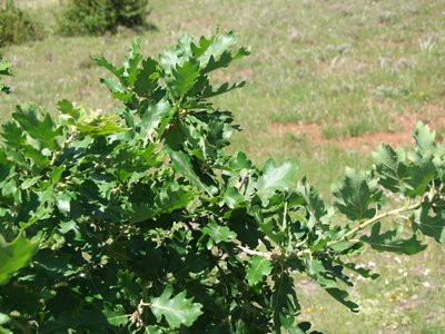
Chêne pubescent - ©PNR Grands Causses  Flora
FloraThe pubescent oak
The pubescent oak (Quercus pubescens) is widespread in the areas of the south of France. Its leaves are hairy on their underside, which is an adaptation to drought (the hairs limit evaporation and retain moisture). Formerly, the acorns were collected for animals or eaten by the herds on site.
Sources: PNRGC_DA
Buissière - ©PNR Grands Causses  Agropastoralism
The buissière.
The slow progression inside dense hedges of boxwood trees arboreal, they were intended to protect and channeling herds.
Sources: PNRGC_DA
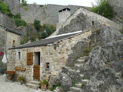
Maison de la Scipione - Studio Martin History and heritageThe Scipione House
This house built in the end of 15th century has a superb mullion window and a turret added in the 17th century, which suggest the wealth of the owners.
The Information Office of the village is located in this house, which owes its name from one of its owners (Sir Scipion Sabde’s widow, nicknamed “La Scipione”. Inside, a superb vaulted room served as a sheepfold. It‘s possible to visit the floors and the spiral staircase leading to it also gives access to the walkway.
Description
- Through the parking, you have to get the ramparts of the village at the north gate and go through the village on the left to join the church.
- You can leave the village by the small door of access located between the church and the castle. Walking up and down till Moulin de Redounel, you have to take down on the way back to the left along the ramparts to lavogne.
- Follow the road in left approximately for 250 m and to pass beyond a disused barn. To veer right on the track that rises smoothly on the tray. After a wide turn, it turns towards south and reaches 1 km, at a fork.
- To leave GR de Pays to go down in right through the pasture of 100 m, then to appear on a dirt track. To follow it towards west for 900 m and reach an intersection with the GR 71.
- To turn right on the stony path. Being narrow, it then widens and passes through a small oak wood. You have to go through the Boussière, then in a small meadow and continue through the hollow road that leads to the foot of the wall, facing the south gate.
- To enter the village through the south door and to the car park via the north door.
- Departure : Parking at the entrance of the village
- Arrival : Parking at the entrance of the village
- Towns crossed : La Couvertoirade
Forecast
Altimetric profile
Recommandations
You cross sometimes classified areas, presenting protected species. Close the gate in the grazing area, don’t near the sheep, keep the animals on a leash. Stay on marked trails, respect private property and nature. Don’t pick flowers. Bring back your waste, take care of the risk of fires. Put on good shoes and take enough water. Check the weather forecast before leaving.
Information desks

Tourist Office Larzac et Vallées
Place du Claux, 12230 NANT
Located on the ground floor of the Town Hall (mansion of the 18th century), The Tourist Office welcomes you all year and offers tourist information on the Larzac and its valleys, the department of Aveyron, and also on neighboring counties. Free Wifi access.
Opening hours :
From Novembre to February: Tuesday morning 9:00-12:30
March and October : Tuesday to Friday 9:00-12:30
April : Tuesday to Friday 10:00-12:30 and 14:00-17:30
May, June : Tuesday to Saturday 10:00-12:30 and 14:00-17:30
July and August : every day 09:00-13:00
September : Tuesday to Saturday 10:00-12:30 and 14:00-17:30
Transport
Think about carpooling and hitchhiking: Rezopouce ; Aires de covoiturage
Access and parking
La Couvertoirade, 42 km south-east of Millau by the D809 (or by the A75 motorway) and the D185
Parking :

Report a problem or an error
If you have found an error on this page or if you have noticed any problems during your hike, please report them to us here: