
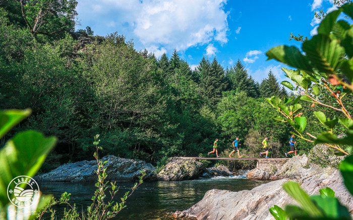
Trail running No. 21 Haute Dourbie Tour
From the forests of the Brante mountain to the chestnut groves of Labarthe, a fantastic playground awaits you in the heart of the Dourbie gorges. Challenging climbs, crossings of typical hamlets, and exhilarating descents follow one another, offering splendid panoramas at every turn of this rollercoaster ride.
Description
The duration of the route can vary between 2 and 4 hours depending on the trail runner's level.
- From the Roque leisure base, head towards the hamlet of Viala and cross through it.
- At the edge of the hamlet, take the path on the right that climbs in large switchbacks through this beautiful forest. The route is shared with the two other trail circuits (Saint-Guiral Vertical and Saint-Guiral Circus) until kilometer 2.3.
- Then, this Haute Dourbie circuit heads northeast to reach the magnificent little hamlet of Tayrac, nestled in the valley near the clear and sometimes roaring waters of the Dourbie River. This stream is crossed by a footbridge (583 m altitude and kilometer 5.9), and then the first major challenge begins on the slopes of the Trescol peak to reach the hamlet of Coulet (kilometer 9.1).
- Then we pass the highest point of this circuit at 806m altitude (km 9.4) before immediately descending to the hamlet of La Brunelerie (km 10), where you shouldn't miss the opportunity to admire the architecture of these typical little houses. Leaving the hamlet, we embark on a magnificent descent (350m of negative elevation) in a breathtaking setting overlooking the Dourbie gorges, with panoramic views of the rocky outcrops, the stream, and the Bondon mill. It's technical, it's fun, ideal for enjoying yourself.
- Arriving at the hamlet of La Rougerie (km 12.8), we finally tackle the third climb through a chestnut grove, adding another 260m of elevation gain. For the curious and the adventurous, a 1.4km out-and-back detour to Notre-Dame de la Sentinelle is possible (after 14.6km of running, a small sign indicates the left turn, shortly before reaching the road).
- The final stretch begins with a pleasant surprise on this downhill section: a steep, straight run carved into the woods with a gradient approaching 30% in places. At the bottom of the Seingleys valley, all that remains is to glide down for a gentle return to St Jean du Bruel and the old bridge spanning the Dourbie River. The route returns to the starting point via the village of St-Jean du Bruel and the hamlet of Bruel.
Recommendations: A 1.5L water supply is essential, along with a windbreaker and energy food supply.
- Departure : Leisure base of La Roque (D114), St-Jean du Bruel
- Arrival : Leisure base of La Roque (D114), St-Jean du Bruel
- Towns crossed : Saint-Jean-du-Bruel
Forecast
Altimetric profile

Information desks

Tourist Office Larzac et Vallées
Place du Claux, 12230 NANT
Located on the ground floor of the Town Hall (mansion of the 18th century), The Tourist Office welcomes you all year and offers tourist information on the Larzac and its valleys, the department of Aveyron, and also on neighboring counties. Free Wifi access.
Opening hours :
From Novembre to February: Tuesday morning 9:00-12:30
March and October : Tuesday to Friday 9:00-12:30
April : Tuesday to Friday 10:00-12:30 and 14:00-17:30
May, June : Tuesday to Saturday 10:00-12:30 and 14:00-17:30
July and August : every day 09:00-13:00
September : Tuesday to Saturday 10:00-12:30 and 14:00-17:30
Transport
To travel by bus or train, by carpooling Aires de covoiturage and hitchhiking Rezopouce.
Access and parking
42 km southeast of Millau via D809, D999 or via D991 and D999 (Gorges of the Dourbie), then the D114.
Parking :
Source


Report a problem or an error
If you have found an error on this page or if you have noticed any problems during your hike, please report them to us here: