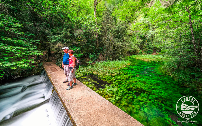
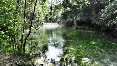
The Durzon Spring
Ideal for an easy family stroll, this walk punctuated by the runoff of the Durzon, a tributary of the Dourbie River, takes you to the heart of a quiet and plenty of charm valley. At the end of the path, the resurgence of the Durzon awaits in haven of a freshness and shade where clear water flows in abundance.
1 point of interest
Source du Durzon - SandrinePerego  Geology
The Durzon Spring
Located at the foot of the Larzac Causse, in the south-west of Nant, the Durzon Spring is a karstic resurgence whose supplying basin extends over 100km² between L'Hospitalet du Larzac, Le Caylar, Cazejourdes and Egalières. The Karstic system doesn't retains water on surface and constitutes big undergroung water reserves.
The flow of the source varies between 0,8m3/s and 35m3/s and has an average temperature of 11,13°C. The Durzon river runs for 6km and flows into the Dourbie river at the place "La Mouline".
Description
- From the car park, take the road on the left towards Mas du Pré and cross the pretty bridge (you can see the hamlet on the left).
- At the iron cross, turn right on a wide dirt track which successively runs along meadows and fields. Then it shrinks to enter the wood. The Durzon River is nearby.
- At the intersection, leave the small tuff bridge on the right (private property of the descendants of Victor Hugo) and turn off towards left. 200m further, at the junction, take the right path along the river and continue for 800m to reach the spring.
- From the source, cross the Durzon on the concrete footbridge and take, at the bottom of the meadow, the path that goes up on the right towards Mas de Pommiers. Then follow the asphalt road to the starting point.
From the point 4: you can return to the starting point by the same route as on the way out.
- Departure : Nant, Bridge of Mas du Pré (D178)
- Arrival : Nant, Bridge of Mas du Pré (D178)
- Towns crossed : Nant
Forecast
Altimetric profile
Recommandations
Information desks

Tourist Office Larzac et Vallées
Place du Claux, 12230 NANT
Located on the ground floor of the Town Hall (mansion of the 18th century), The Tourist Office welcomes you all year and offers tourist information on the Larzac and its valleys, the department of Aveyron, and also on neighboring counties. Free Wifi access.
Opening hours :
From Novembre to February: Tuesday morning 9:00-12:30
March and October : Tuesday to Friday 9:00-12:30
April : Tuesday to Friday 10:00-12:30 and 14:00-17:30
May, June : Tuesday to Saturday 10:00-12:30 and 14:00-17:30
July and August : every day 09:00-13:00
September : Tuesday to Saturday 10:00-12:30 and 14:00-17:30
Transport
Access and parking
From Millau by the D809 and D999, then D178 towards the "Source du Durzon".
Parking :

Report a problem or an error
If you have found an error on this page or if you have noticed any problems during your hike, please report them to us here: