
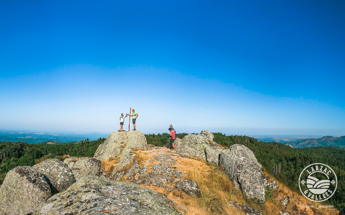
Trail running No. 22 - St-Guiral Vertical
Manage your pace carefully! With its post-climb accelerations and changes in rhythm, this ascent to near the Saint-Guiral rock promises to be highly technical. A vertical climb with an average gradient of 11.4% and sections reaching 37%, and to cap it all magnificent panoramic views of the Causses and the Cévennes.
Description
The duration of the route can vary from 1 hour 15 minutes to 2 hours 30 minutes depending on the trail runner's level.
- From the parking area, head towards the hamlet of Viala and cross through it.
- Just after leaving the hamlet, and only after 400 meters of flat terrain, take the path on the right. The ascent begins on this path, climbing in large switchbacks through a beautiful forest to reach a huge rocky slab, forming a very distinctive triangular cliff. This is a technically challenging section, with beautiful rocky terrain where caution and vigilance are required.
- After passing this natural obstacle, having climbed 235 meters (km 2.6 and 764m altitude), head right towards the Labarthe mountain, this long ridge that undulates in the open, gorse-covered landscape above the Viala stream and the hamlets nestled in this deep valley, Refregiès and Le Serieys.
- Near the Pointe du Pal (km 6.9 and 1120m altitude), the route becomes gentler as you reach this beautiful balcony trail leading to the Col de la Guérite (km 8.9 and 1150m altitude).
- After this large forest junction, climb for the final part of this Vertical Kilometer, 1.8km and 180m of elevation gain, to catch a glimpse of the summit of St-Guiral, which rises like a rocket from this small oasis of heather. The end of this climb is the entrance to the Cévennes National Park, 80m from St-Guiral, which is not climbed.
Return to the starting point via the same route or via circuit no. 22 St-Guiral Circus (approximately 18km to St-Jean).
Recommendations: A 1.5L water tank is essential, as well as a windproof and energy food supply.
- Departure : Leisure base of La Roque (D114)
- Arrival : Leisure base of La Roque (D114)
- Towns crossed : Saint-Jean-du-Bruel and Sauclières
Forecast
Altimetric profile
Recommandations
1.5l water supply essential, windcheater and energy food supply.

Information desks

Tourist Office Larzac et Vallées
Place du Claux, 12230 NANT
Located on the ground floor of the Town Hall (mansion of the 18th century), The Tourist Office welcomes you all year and offers tourist information on the Larzac and its valleys, the department of Aveyron, and also on neighboring counties. Free Wifi access.
Opening hours :
From Novembre to February: Tuesday morning 9:00-12:30
March and October : Tuesday to Friday 9:00-12:30
April : Tuesday to Friday 10:00-12:30 and 14:00-17:30
May, June : Tuesday to Saturday 10:00-12:30 and 14:00-17:30
July and August : every day 09:00-13:00
September : Tuesday to Saturday 10:00-12:30 and 14:00-17:30
Transport
To travel by bus or train, by carpooling Aires de covoiturage and hitchhiking Rezopouce.
Access and parking
At 42 km south-east of Millau by D809, D999 or by D991 and D999 (Gorges of the Dourbie), then the D114.
Parking :
Source


Report a problem or an error
If you have found an error on this page or if you have noticed any problems during your hike, please report them to us here: