Le Cayla footpath
The beautiful village of Martrin welcomes you to enjoy a long-distance hike that goes up to the hamlet of le Cayla clinging to a rock above the Gos valley. From the hospitallers tower of Martrin to the steep paved streets in Le Cayla, through the Sant-Exupère magnificent site and along the low dry stone walls, a whole unexpected heritage unveils before your eyes.
Description
- From the village square, pass behind the cross and move forward into the lane that runs between two houses. Above the stadium, head your way towards the housing estate. On the height of the village, turn to your left and follow the track on the left hand side that runs along the crest of the ridge until you reach the road connecting Coupiac to Martrin.
- On reaching the Croix de l’Amandier intersection, carry straight on ahead walking along a tarmac road, then turn right along a dirt trail. At the bottom of the trail take the walled path to your left that goes towards Monteillet.
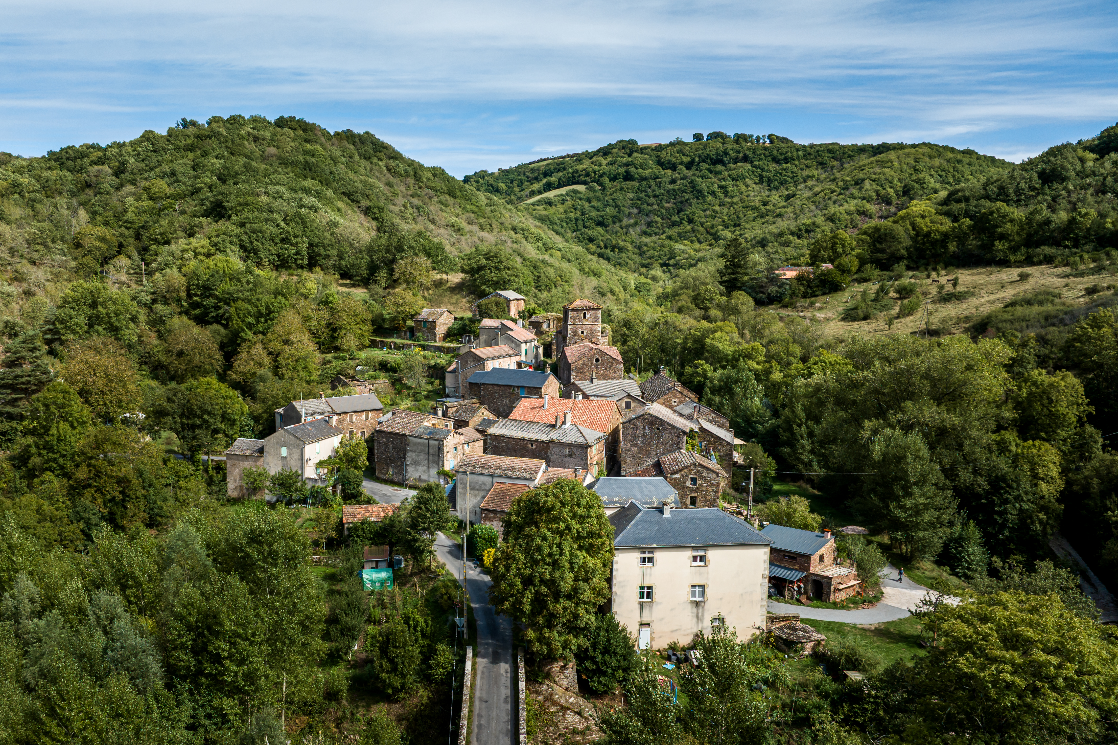
- Walk across the hamlet and turn right by the cross, take the path lined with box trees. Join the road nearby the St Exupéry church and turn left towards the bridge.
- During low-flow periods of the stream, rather than walking over the bridge, follow the road for 350 m and turn right towards Pouillé. Walk through the hamlet (ancient mill) and follow the trail for just over 1 km. Tread along the brook that marks the edge of the meadow, and then ford the brook and walk back to the D 106.
- Alternative route suitable during high-flow periods or if you are worried about having your feet wet: cross the bridge and follow the road to your left.
- Go along the road to your left then towards the village of Le Cayla and follow the small lanes towards the church, then turn left and take to the right hand the tarmac road. Follow the dirt path to the left and walk across the brook. Further on, walk across another “riu” (brook) just before a small path to the right that takes you up to the fields.
- Take the first left turn and then the next left immediately after that and walk along past the Livignac farm, then take the left hand path along the side of the sheepfold. As you make your way out of the woodland, head along a field and then join the dirt path to your left that brings you to a tarmac road.
- Just before a large chestnut tree, fork to the right towards Martrin and follow the signboard “La Parenque”: Here you pass behind a building and go back to Martrin by a steep-sided path. Cross the municipal road to get back to the village.
- Departure : Car park on the village square in Martrin
- Arrival : Car park on the village square in Martrin
- Towns crossed : Martrin and Coupiac
Forecast
Altimetric profile
Recommandations
Box tree months are active from May to October. During the caterpillar phase, they feed on the leaves of box trees. They crawl down trees and move on long silken threads, although these threads are annoying when hiking they do not pose any health risk
Information desks

Avenue de Lauras, 12250 Roquefort/Soulzon
Situated in the Grands Causses Regional Natural Park, the cheese village of Roquefort stretches on the hillside over the famous scree of the Combalou Rock, in southern Larzac. The village is at an elevation of 630 m and has 700 inhabitants.
OPENING PERIODS:
The Tourist Office is open all year round:
- In July and August, Monday to Saturday: 9.30 to 18.30, Sunday: 10.00 to 17.00.
- April, May, June, September, October; Monday to Saturday: 9.30 to 12.15 & 13.00 to 17.30, closed on Sunday.
- January, February, November, December; Monday to Friday: 9.30 to 12.15 & 13.00 to 17.00, closed on Saturday and Sunday.
Transport
Travel by bus or train: https://lio.laregion.fr/
Carpooling : BlaBlaCar, Rézo Pouce, Mobicoop, Idvroom, LaRoueVerte, Roulez malin
Access and parking
From Millau, via the D992 and D999 roads; from Clermont-Ferrand and Montpellier, via the A75, exit 46, then via the D999 road; from Toulouse/Albi via the D999 road.
Follow the D999 road towards Combret. Take right the D90 towards Coupiac / Martrin / St-Juéry.
Parking :
More information
Report a problem or an error
If you have found an error on this page or if you have noticed any problems during your hike, please report them to us here: