
The "canoles" via the Durzon spring
Winding along forest paths, this shady excursion offers an "immersive" journey into the heart of the causse—a delightful sensory experience that takes you through the canoles, or deep rocky fissures. An ancient prehistoric dwelling, along with caves and rock formations bearing mysterious names (such as the "Witch's Cave" and "Giant's Skull"), adds to the walk's enchanting charm.
Description
- From the car park, cross the bridge, turn right at the cross, and—70m later—continue right onto the dirt track. Leave the tufa bridge on your right and veer left.
- 200m further on, at the fork, keep right and continue for 800m to the spring. The path climbs above the spring (a steep ascent through woods and rocks for 500m). Then, the path winds through the woods for 1km before intersecting a wide track.
- Turn right and pass the Mousterian shelter. The path rises gently, then veers left. At the next junction, turn right and continue for 600m. The track heads due south, leading to a stone arch. Pass beneath it and bear right, passing by rock formations. Continue straight ahead, leaving a first cave on your right, then "Sanctuaire de l’Homme Mort" (Sanctuary of the Dead Man) on your left. Follow the path alongside water-sculpted rocks to the "Grotte de la Sorcière" ( the Witch's Cave) and leave it on your right.
- 50m further on, at the junction, turn right. The ground becomes sandy and stony, leading to the entrance of the first "canole" (a narrow, rocky fissure). Take the path to the right to explore it. At the far end, there is a cave with a vertical shaft (bring a flashlight). Retrace your steps and head back down to the right; 50m further on, turn right again to reach the second "canole". Walk to the end and back.
- Upon leaving the "canole", continue straight along the forest path, crossing a clearing and a stretch of woods before reaching a second clearing.
- Take a short detour to the left to see the "grotte de la Sébillère" (a cave), then continue along a wide track until you reach the junction with the main trail (cattle grid).
- Turn left onto the trail. After about 700m, leave it by turning left onto a path through the woods. Pass "la grotte éclairée" (the illuminated cave) and follow the marked path until you reach the track again. Follow the track to the left as far as the Canalettes forest house. Take a short detour behind the farmhouse to see the "lavogne" (cobbled watering place) and the arboretum. Then continue along the track towards La Portalerie for 300m.
- Bear left onto the grassy path heading towards Pas de la Mule. After 500m, make a sharp left turn and continue descending along the track for 600m through the forest. Turn right onto a narrow path at a concrete marker post inscribed with the number 21. The path winds along before beginning the descent through the rocks. Pass through Pas de la Mule and continue downhill until you reach the path running alongside the Durzon river (point 2). Turn right to return to the starting point.
- Departure : Nant, Pont du Mas du Pré (D178), 4 km from the village centre
- Arrival : Nant, Pont du Mas du Pré (D178), 4 km from the village centre
- Towns crossed : Nant
Forecast
Altimetric profile
Recommandations
This hike crosses private property. The Canalettes site is a sensitive and fragile area; please stay on the marked paths to protect it.
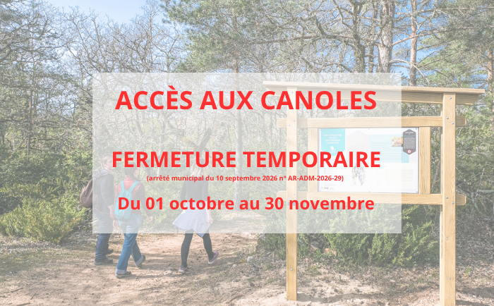
Access to Les Canoles is closed annually from October 1 to November 30, in accordance with by-law no. AR-ADM-2025-17 dated September 25, 2025.

Information desks

Tourist Office Larzac et Vallées
Place du Claux, 12230 NANT
Located on the ground floor of the Town Hall (mansion of the 18th century), The Tourist Office welcomes you all year and offers tourist information on the Larzac and its valleys, the department of Aveyron, and also on neighboring counties. Free Wifi access.
Opening hours :
From Novembre to February: Tuesday morning 9:00-12:30
March and October : Tuesday to Friday 9:00-12:30
April : Tuesday to Friday 10:00-12:30 and 14:00-17:30
May, June : Tuesday to Saturday 10:00-12:30 and 14:00-17:30
July and August : every day 09:00-13:00
September : Tuesday to Saturday 10:00-12:30 and 14:00-17:30
Transport
To travel by bus or train, by carpooling Aires de covoiturage and hitchhiking Rezopouce.
Access and parking
33 km southeast of Millau via the D809 and D999 (Larzac) or via the D991 (the Dourbie Gorges).
From Nant, follow the D178 towards the spring.
Parking :


Report a problem or an error
If you have found an error on this page or if you have noticed any problems during your hike, please report them to us here: