
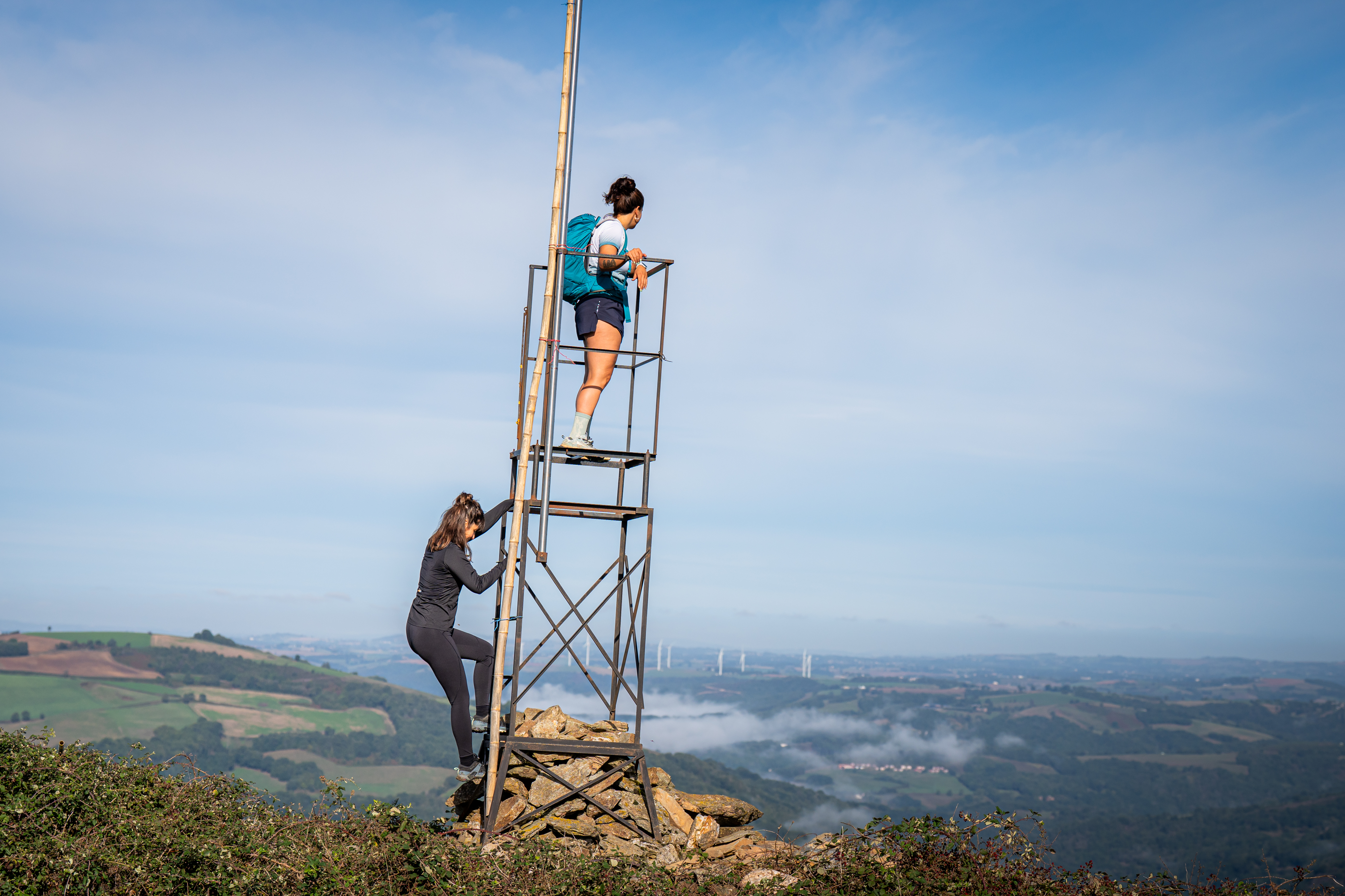
Suc-d'Armont walking trail
Starting from Plaisance, a gradual slope makes its way up towards Suc d’Armont. It features a difference in altitude of 260 m with, as the highlight, the hamlet of la Rouquette and its splendid view over the pays du Rance and the Albigensian plateau. Once you’ve left the hamlet of le Massebirot, look at the imprint cartwheels left on schist rock, as a poignant legacy of rural life of yesteryear.
3 points of interest

Le pressoir à vis - Mairie de Plaisance  Small heritage
The screw press
This monumental 18th-century press, displayed at the entrance of the village against the façade of the multipurpose hall, is a vivid testament to the region’s winemaking traditions. It is a lever press that was once used in the hamlet of Frayssignes, on the Bonnet family estate, where terraced vineyards thrived thanks to the ideal south-west facing slopes of the Rance Valley. Although screw presses have been known since Antiquity, they were perfected in the 18th century. This particular example, built with oak for the lever and vertical supports and chestnut for the horizontal beam, is especially rare and well preserved. At the beginning of the 20th century, the Frayssignes estate covered nearly three hectares of vineyards.
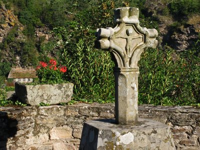
La croix Saint-Eutrope - Mairie de Plaisance Small heritageThe Saint-Eutrope Cross
Dating from the 15th century, the Saint-Eutrope Cross is a remarkable element of the local heritage, listed as a Historic Monument by decree on March 8, 1929. Although it was knocked over by a storm and now stands on a modern base, this stone cross remains a work of great interest. Its distinctive design features two independent faces linked by rings, while the lobes beneath the crossbar recall Gothic crosses. One side depicts the Crucifixion, offering a powerful and timeless representation of Christian faith in the medieval period.
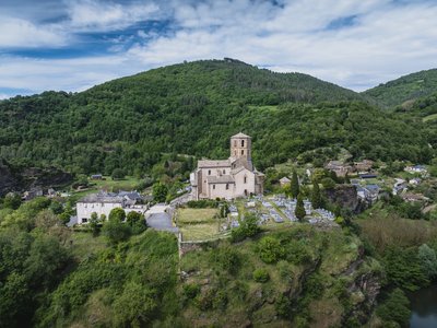
Eglise romane Saint-Martin - Virginie Govignon  History and heritage
The Romanesque Church of Saint Martin
Listed as a Historic Monument, the Romanesque Church of Saint Martin is a true gem of medieval architecture. Built in the 12th century, it stands out for the harmonious blend of styles it displays: the choir and transept reflect southern Romanesque features, while the nave, enlarged in the 15th century, adopts Gothic lines. Perched on a rocky promontory overlooking three meanders of the Rance River, this modest building offers a remarkable panorama and is instantly recognizable by its slender octagonal bell tower. Visible from afar – especially when illuminated at night – it seems to watch over the Rance Valley. Inside, a 15th-century cross, a relic of the Knights Hospitaller of Jerusalem, bears witness to the site’s rich religious history.
Description
To get to the trailhead, reach the village centre and turn to the right on road D106 towards Fon Del Mas for 1 km.
- The loop starts on the right side of a curve, 250 m after the bridge. The gently ascending path makes its way throughout woodlands on a rather wide trail. As it narrows and still runs in the undergrowth, it follows the contour line and opens onto a meadow. After you’ve closed the fences, walk across the field and join a broader path that runs down and passes close to the hamlet of le Rieu before going up towards Frayssines.
- Walk across the hamlet and follow the road for approximately 740 m towards le Massebirot. In the last bend before this hamlet, turn right and cross the undergrowth.
- In the hamlet of la Rouquette, take the road that goes downhill to the left. 700 m further, turn right just before an abandoned hut. The path goes up across fields. Carry on your way on a level path for 800 m until the junction with a road. Take the road to the left up the Vergnerette farm.
- Just before you get to the farm, turn to the left and walk down across a chestnut grove. After 400 m, leave the wide trail and take to the right a narrow footpath that leads to the hamlet of La Fon Del Mas.
- In La Fon Del Mas, take to the left and walk out the hamlet. Leave the first road on the left, walk out of the tarmac and take the left track that leads back to the starting point, the Gos bend.
- Departure : Car-park and starting point: press room square in Plaisance
- Arrival : Car-park and starting point: press room square in Plaisance
- Towns crossed : Plaisance, Balaguier-sur-Rance, and Coupiac
Forecast
Altimetric profile
Recommandations
Box tree months are active from May to October. During the caterpillar phase, they feed on the leaves of box trees. They crawl down trees and move on long silken threads, although these threads are annoying when hiking they do not pose any health risk
Information desks
Avenue de Lauras, 12250 Roquefort/Soulzon
Situated in the Grands Causses Regional Natural Park, the cheese village of Roquefort stretches on the hillside over the famous scree of the Combalou Rock, in southern Larzac. The village is at an elevation of 630 m and has 700 inhabitants.
OPENING PERIODS:
The Tourist Office is open all year round:
- In July and August, Monday to Saturday: 9.30 to 18.30, Sunday: 10.00 to 17.00.
- April, May, June, September, October; Monday to Saturday: 9.30 to 12.15 & 13.00 to 17.30, closed on Sunday.
- January, February, November, December; Monday to Friday: 9.30 to 12.15 & 13.00 to 17.00, closed on Saturday and Sunday.
Transport
Travel by bus or train: https://lio.laregion.fr/
Carpooling : BlaBlaCar, Rézo Pouce, Mobicoop, Idvroom, LaRoueVerte, Roulez malin
Access and parking
From St Sernin/Rance, take the D33 road up to Plaisance (a 20 minute drive approximately)
Parking :
More information

Report a problem or an error
If you have found an error on this page or if you have noticed any problems during your hike, please report them to us here: