
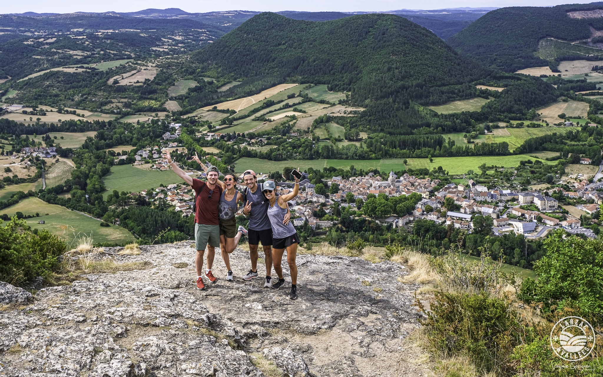
The "Roc Nantais"
From the outset, a steep slope greets you for a climb through broom, oaks, and pines. The ascent (45 min/1 hour) requires careful footing. At the summit, the Roc Nantais viewpoint offers a well-deserved reward. On the descent via Cazic, a dovecote and traditional stone huts with sloping roofs mark the end of this unforgettable hike.
Description
- From Place du Claux, head south and after the war memorial, turn left onto Rue Ernest André. Cross the Pont de la Prade bridge and then take the first path on the left (the entrance to the path makes a sharp hairpin turn).
- Walk alongside the Pony Club buildings, then immediately turn right onto the small path bordered by low walls. At the first slight incline, there are large broom bushes on the left. The path becomes stony and passes a little higher up beside a black pine plantation. As the dirt track climbs to the right, and the downy oaks give way to Scots pines, the hamlet of Les Cuns comes into view through a gap. Leave a large rock on your right and continue along the path that veers left, forming a series of steps. Make one last effort to reach the plateau.
- At a clearing, follow the path to the right that descends towards the Roc Nantais. Retrace your steps, then turn right to follow the small path that runs alongside the rocks. Continue for just over 1 km, then at the junction with the Cantobre path, continue on the track to the right.
- At the next intersection, turn right towards Nant. Descend this track for approximately 2.5 km.
- Continue to the right at the junction with the track coming from St-Jean du Bruel to reach the village of Nant.
- Departure : Nant
- Arrival : Nant
- Towns crossed : Nant
Forecast
Altimetric profile
Recommandations

Information desks

Tourist Office Larzac et Vallées
Place du Claux, 12230 NANT
Located on the ground floor of the Town Hall (mansion of the 18th century), The Tourist Office welcomes you all year and offers tourist information on the Larzac and its valleys, the department of Aveyron, and also on neighboring counties. Free Wifi access.
Opening hours :
From Novembre to February: Tuesday morning 9:00-12:30
March and October : Tuesday to Friday 9:00-12:30
April : Tuesday to Friday 10:00-12:30 and 14:00-17:30
May, June : Tuesday to Saturday 10:00-12:30 and 14:00-17:30
July and August : every day 09:00-13:00
September : Tuesday to Saturday 10:00-12:30 and 14:00-17:30
Transport
To travel by bus or train, by carpooling Aires de covoiturage and hitchhiking Rezopouce.
Access and parking
33km southeast of Millau, via the D809 and D999 (Causse du Larzac) or via the D991 (Gorges de la Dourbie).
Parking :

Report a problem or an error
If you have found an error on this page or if you have noticed any problems during your hike, please report them to us here: