Track Menhir
You will see on the creek bank an impressive 3 m metre high stone stuck in the ground. Different interpretations have been given about it: is it a mere remnant of the Combalou's fallen rocks, upon which two crosses were carved in the medieval times to turn it say, into a boundary stone between the Montclarat and the Tournemire communities? Or is it an ancient menhir that was Christianised as so many other megaliths were? In any case, this stone is an enthralling excuse to explore the Soulzon valley throughout a maze of rocks and lush vegetation.
2 points of interest
 Agropastoralism
A buissière is a protective pathway made of two rows of box trees. In this case, the right side of the first part of the hedge has been removed in order to allow an easier passage. Nevertheless, the remaining hedgerow is still efficient against the prevailing winds. The other side of the buissière is still intact. This means of traversing the Causses is still used, because of the harsh and contrasted climate – very hot in summer and freezing in winter. In the buissière, the sheep flocks are sheltered from wind, snow and heat...
No way to escape from this system of “channels”! People and carts also used to take these pathways for similar reasons. As connections between hamlets, grazing lands, sheepfolds and water ponds, buissières bear witness to the use of the pastoral areas.
Information : Box tree moths are active from May to October. During the caterpillar phase, they feed on the leaves of box trees. They crawl down trees and move on long silken threads, although these threads are annoying when hiking they do not pose any health risk Archeology
Soulzon Menhir
This large stone with rounded shapes is over three metres high and is often referred to as a “menhir”, although no features corresponding to an authentic menhir has been identified (a menhir is a large upright standing stone erected by man between 3500 and 2000 BC). Different interpretations have been given about its origins: is it a mere remnant of one of the Combalou's many fallen rocks, upon which a cross was carved in medieval times to turn it into a territorial marker, a boundary stone for instance, between the Montclarat and the Tournemire communities? Or is it an ancient menhir that was Christianised (2 crosses deeply engraved next to each other) as so many other megaliths were?
Description
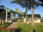
1 - When you come out of the Tourist Office, turn right alongside the Conteynes wood to the drinking water fountain. Take the little path on the right, and pass through the housing estate on a tarmac road. Continue straight on to a large green and white building.
2 - Leave this on your right and head left behind the municipal workshops, then take a left down a little shaded pathway.
At the end of this path, go left down to the crossroads with a wide path and turn left until you reach the sharp bends.
Before crossing the river over the footbridge, you can take a return trip to the menhir which is further downstream.
3- Walk along the river on the bank opposite the menhir to the second footbridge.
Cross the river again. After 300 m and a small slope, turn left to get back onto the road.
4 - Cross this road to take a path up to the Tourist Office through the Conteynes wood.
- Departure : Roquefort Tourist Office
- Arrival : Roquefort Tourist Office
- Towns crossed : Roquefort-sur-Soulzon
Altimetric profile
Recommandations
Box tree moths are active from May to October. During the caterpillar phase, they feed on the leaves of box trees. They crawl down trees and move on long silken threads, although these threads are annoying when hiking they do not pose any health risk
Information desks
Avenue de Lauras, 12250 Roquefort/Soulzon
Situated in the Grands Causses Regional Natural Park, the cheese village of Roquefort stretches on the hillside over the famous scree of the Combalou Rock, in southern Larzac. The village is at an elevation of 630 m and has 700 inhabitants.
OPENING PERIODS:
The Tourist Office is open all year round:
- In July and August, Monday to Saturday: 9.30 to 18.30, Sunday: 10.00 to 17.00.
- April, May, June, September, October; Monday to Saturday: 9.30 to 12.15 & 13.00 to 17.30, closed on Sunday.
- January, February, November, December; Monday to Friday: 9.30 to 12.15 & 13.00 to 17.00, closed on Saturday and Sunday.
Transport
Travel by bus or train: https://lio.laregion.fr/
Carpooling : BlaBlaCar, Rézo Pouce, Mobicoop, Idvroom, LaRoueVerte, Roulez malin
Access and parking
Parking :
Report a problem or an error
If you have found an error on this page or if you have noticed any problems during your hike, please report them to us here:

