
VTT N°93 - Lévézou and Pic du Pal
Vézins-de-Lévézou
VTT N°93 - Lévézou and Pic du Pal
Medium
2h15
17,7km
+414m
-418m
Loop
Embed this item to access it offline
Description
- From the La Clau car park, continue along the RD 2 towards Vezins for 1 km. At the junction with the RD 28, turn right and then, after a few metres, take a path leading uphill to the left.
- Follow the main track. Walk alongside the road, then turn left before the farm shed. You’ll join a single track that leads to Vezins-de-Lévézou. Head down towards the village, then, after the housing estate, turn right onto the track that joins the RD 28 at Les Devèzes.
- Take the road to the left for 500 m, then, at the junction with the RD 96, turn right onto a wide track heading towards the “Pic du Pal”. At the junction, take the track on the right which descends towards “Maison Neuve”; follow the ridge and, after a stretch through the forest, turn left (hairpin bend). The track climbs up to a large field.
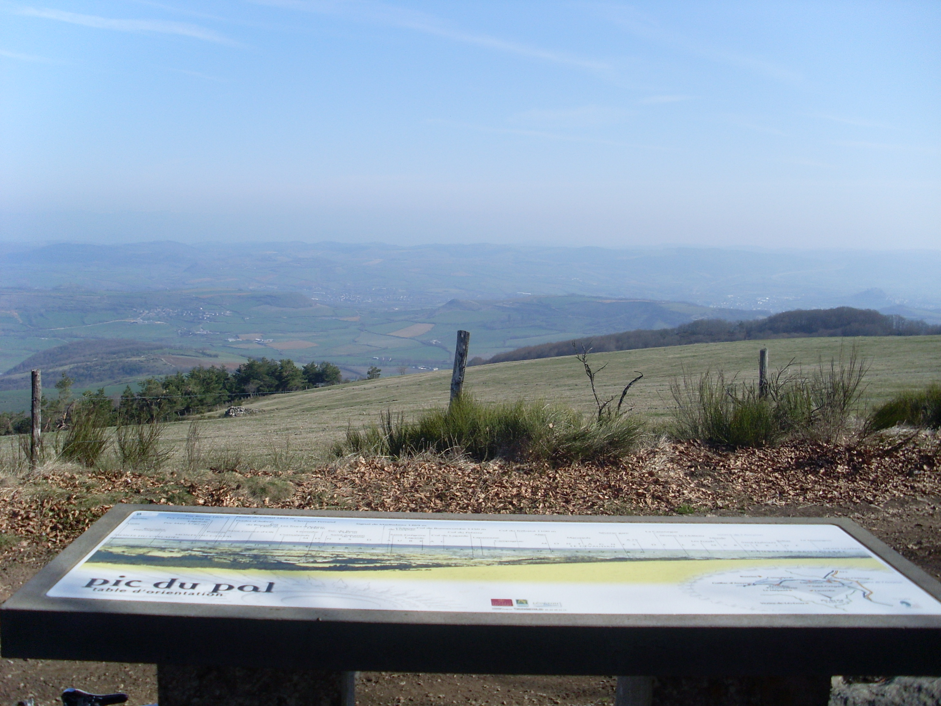
- Cross the field to rejoin the track which enters the pine forest (remember to close the gate behind you). A sweeping panorama of the Aveyron valley, the Larzac and the Lévezou unfolds before you. The orientation board can help you find your way!
Follow the track for about 3 kilometres. When you reach the RD 2, turn right for about 1 km, then left towards Destellious. Finally, take a path on the right which will lead you back to the La Clau car park.
- Departure : La Clau , Vezins-de-Lévézou
- Arrival : La Clau , Vezins-de-Lévézou
- Towns crossed : Vézins-de-Lévézou, Lavernhe, and Sévérac-le-Château
Forecast
Altimetric profile
Recommandations
1.5-litre water supply, energy supply, rain jacket
Information desks
Office de Tourisme Pareloup-Lévézou
Place de la Rivière, 12290 Pont-de-Salars
Access and parking
25 minutes from Millau. Take the D911 towards Cahors; on the downhill stretch, turn right onto the D28 just after the petrol station. At the next junction, turn right onto the D182 and follow it to the village of La Clau.
Parking :
On the left as you enter the village of La Clau
Accessibility
- Emergency number :
- 114
Source

Communauté de communes Millau Grands Causseshttps://www.cc-millaugrandscausses.fr/mes-pauses-loisirs-et-decouvertes/activites-de-pleine-nature

Report a problem or an error
If you have found an error on this page or if you have noticed any problems during your hike, please report them to us here: