
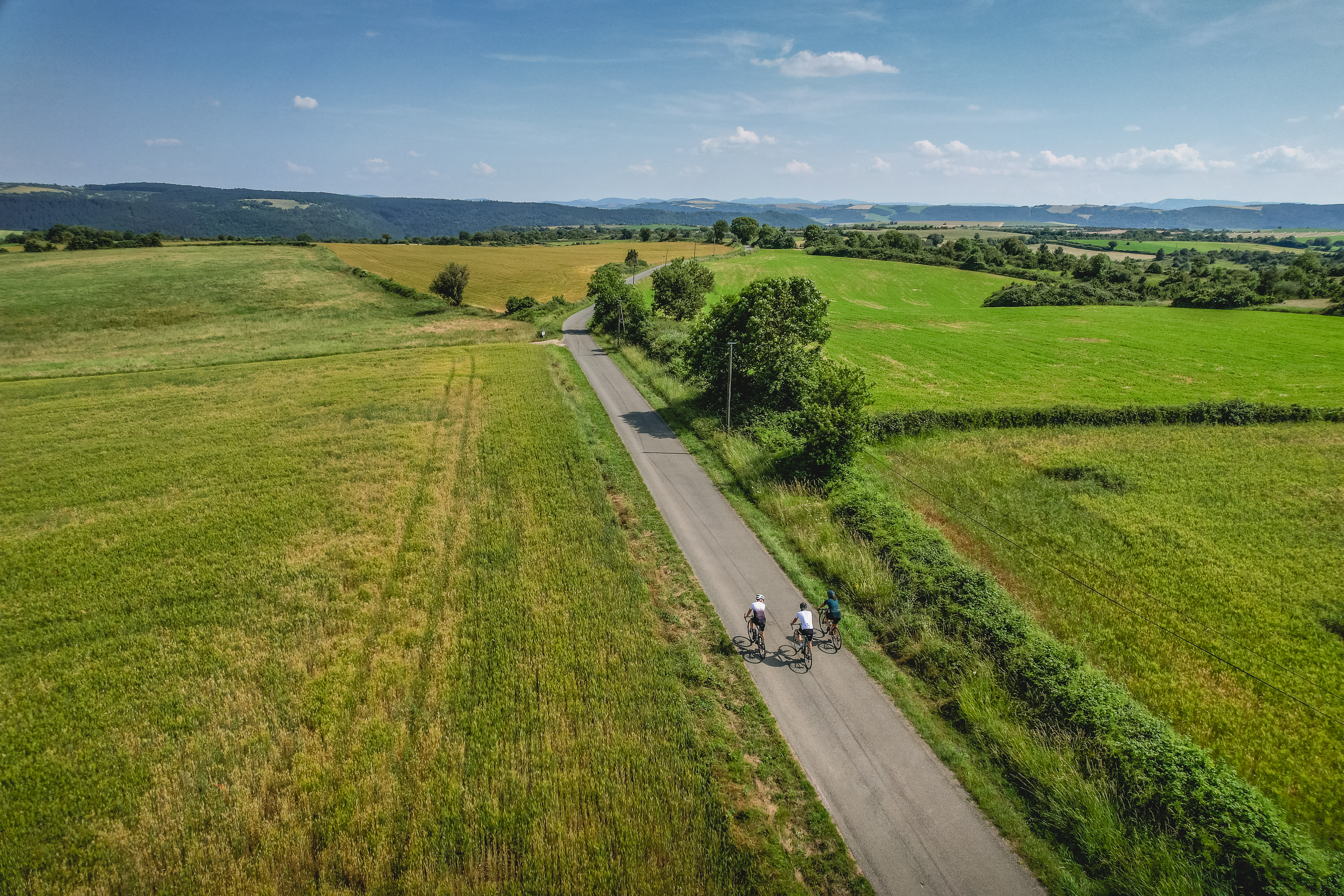
An Epic Journey in Pays du Roquefort
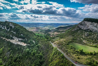
From the Templar Larzac to the Rance Valley, from the Raspes du Tarn to the Lacaune Mountains, via the iconic Combalou Rock in Roquefort, the production area of the king of cheeses will hold few secrets for you after these four cycling stages. Organise your journey (stages and accommodation) according to our recommendations, or simply follow the inspiring landscapes that await you!
4 steps
8 points of interest
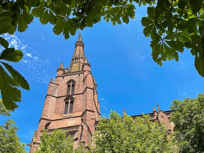
Eglise romane Saint-Martin - Virginie Govignon  History and heritage
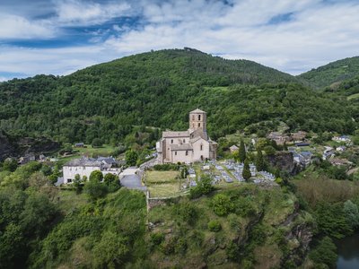
The Romanesque Church of Saint Martin
Listed as a Historic Monument, the Romanesque Church of Saint Martin is a true gem of medieval architecture. Built in the 12th century, it stands out for the harmonious blend of styles it displays: the choir and transept reflect southern Romanesque features, while the nave, enlarged in the 15th century, adopts Gothic lines. Perched on a rocky promontory overlooking three meanders of the Rance River, this modest building offers a remarkable panorama and is instantly recognizable by its slender octagonal bell tower. Visible from afar – especially when illuminated at night – it seems to watch over the Rance Valley. Inside, a 15th-century cross, a relic of the Knights Hospitaller of Jerusalem, bears witness to the site’s rich religious history.
Chaussée du Moulin de Saint-Izaire - Roquefort Tourisme History and heritageThe Saint-Izaire Mill
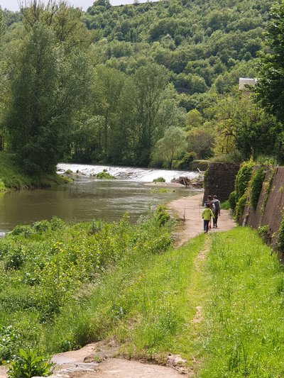
Mentioned as early as 1461, the Saint-Izaire mill was once used to grind wheat for the village inhabitants. A witness to the area’s rural past, it has endured through the centuries by adapting to the needs of each era.
Today, this historic mill operates as a small hydroelectric power station, continuing its energy-producing role at the heart of the village.
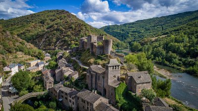
Village de Saint-Izaire - Virginie Govignon History and heritageVillage of Saint-Izaire
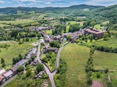
Saint-Izaire is a fortified village whose history is closely linked to its episcopal castle, the former summer residence of the bishops of Vabres. Mentioned as early as 862, the village gradually surrounded itself with ramparts during the 12th century to protect its inhabitants from feudal conflicts.
After the Wars of Religion, the fortifications lost their defensive role: openings were made in the walls, and some fortified gates were altered to allow carts to pass and houses to expand. Despite these changes, the layout of the streets, alleys, and houses has remained almost unchanged since the Middle Ages. The 15th- and 16th-century façades and windows still give the village its historic charm today.
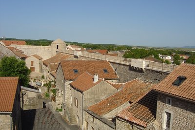
Chemin de ronde vu intérieure - Point Accueil La Cavalerie History and heritageThe ramparts of La Cavalerie
The fortifications of La Cavalerie, a centuries-old work against the test of time…
Situated at the north of the Larzac plateau, La Cavalerie was created in the 12th century by the Templars of Sainte-Eulalie commandery, settled on the Larzac Causse since 1152.The Sainte-Marie church (1180) was included in the Knights Templars dwelling and included several buildings around a small courtyard. The village developed around this building, where the inhabitants found refuge in case of danger.
However, this protection as well as that of the Commandery of Sainte-Eulalie was considered insufficient during the Hundred Years War, where the Larzac, a wide open plateau, badly defended but provided with cattle, attracted the people of war. The commander of Sainte-Eulalie, Bertrand d’Arpajon, fortified the important places of his commandery: Le Viala du Pas de Jaux in 1430, then La Cavalerie, La Couvertoirade in 1439 and finally Sainte-Eulalie in 1442.
Source : Point accueil La Cavalerie.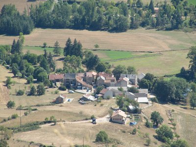
Ambouls depuis le Roc Nantais - Alain Bonnemayre History and heritageAmbouls
The village of Ambouls, municipality of Nant, built on the right bank of the Dourbie River, would date from the installation of the Romans in the area of Nant.
The hillock of Ambouls peak (641 m high) was fortified in the Iron Age from 700 or 600 BC., a clear sign of an older occupation.
On the peak or “gallo-Roman oppidum”, pieces of pottery were discovered 40 years ago and are preserved at the Museum of Montrozier.
On the east side we can still see todays the entrance of the “grotte des fées” (cave of the fairies), where Ernest André discovered in 1913 human bones dating from around 4500 BC.
Ambouls is one of those agricultural hamlets, emptied by the rural exodus, but which recovers now a new soul, thanks to the city dwellers who come back and restore the houses.
Some houses are typical with the external stone staircase, the porch and under the stable which opens on a wide arched porch.
You can also discover an original fireplace above an old bread oven and a stone cross from 1710.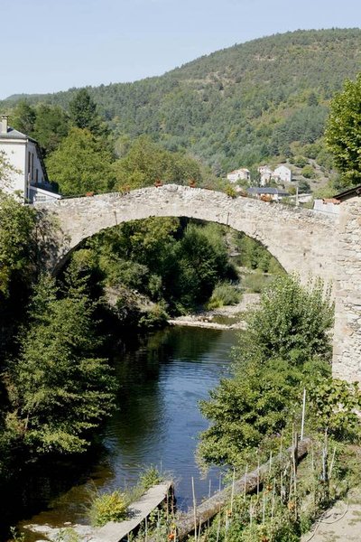
Le pont vieux - Studio Martin  Architecture
The old Bridge
Located in the oldest area of the village, this roman bridge with a single arch spans the Dourbie River.
Dating from the 13th century, it was the main bridge of the village until the 18th century. In the neighborhood of the old bridge, manholes still exist, hiding places dating from religion wars.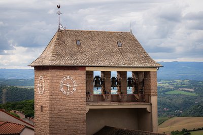
Eglise Saint-Pierre - Xavier Waerzeggers History and heritageSaint Pierre Parish Church
Built in 1853, the neo-Gothic Saint-Pierre Church stands out for its colourful stained glass windows, sculptures and bell tower that proudly overlooks the village. Dedicated to the apostle Saint Pierre, it invites you to discover its ornate interior, revealing 19th-century religious art.
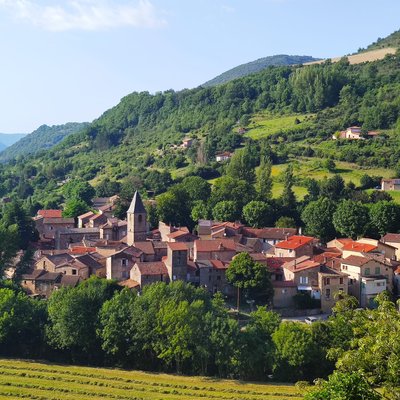
Village de Lapeyre - Roquefort Tourisme History and heritageVillage of Lapeyre
The name Lapeyre means “the stone” in Occitan, a reference to the rocky outcrop on which the village was built. Once part of the Knights Templar commandery in the 12th century, Lapeyre has preserved its medieval character, with narrow streets and old houses clustered around its tower.
Several historic features can still be seen in the village square, including mullioned windows, a medieval tower, and remains of a former convent. The current church, built in 1844, houses a remarkable Virgin and Child statue carved in Rome in 1860 from a single block of Carrara marble.
Lapeyre’s heritage is also closely linked to its textile industry. Established in the 17th century to process wool from the Causses, the former textile mill—still visible from the new bridge—stands as a reminder of an activity that shaped village life for centuries.
Description
A cycling journey through the heart of Pays du Roquefort, to be tailored as you wish !
4 recommended stages with accommodation bearing the "Bonnes adresses FFVélo" quality label :
Stage 1 : Saint-Affrique – Plaisance : 82km – 1558+ :
Possible detours along the route :
- Montaigut castle
- Hilltop village of Combret
- Notre-Dame d’Orient Monastery
Stage 2 : Plaisance – Saint-Rome de Tarn : 75km 1322+ :
Possible detours along the route :
- Coupiac castle
- Montclar viewpoint
- Saint-Izaire castle
- Brousse castle
- Hilltop village of Ayssènes (accommodation and dining)
Stage 3 : Saint-Rome de Tarn – Roquefort : 121km 1950+ :
Possible detours along the route :
- Hilltop village of La Bastide-Pradines
- Gaillac domain (restaurant, accommodation and museum)
- La Couvertoirade
- Croix de Gréponac viewpoint (300 m of accessible track, round trip)
Stage 4 : Roquefort – Saint-Affrique : 87.5km 1300+ :
Possible detours along the route:
- Fort of Saint-Jean-d’Alcas
- Saint-Beaulize – Mas Andral farm (La Caussenarde Brewery)
- Saint-Xist Chapel (Romanesque chapel and botanical garden) between Fondamente and Le Clapier
- Departure : Mountain Bike Station, Rue du 12 Étoiles, Saint-Affrique
- Arrival : Mountain Bike Station, Rue du 12 Étoiles, Saint-Affrique
- Towns crossed : Saint-Affrique, Vabres-l'Abbaye, Gissac, Montlaur, Camarès, Mounes-Prohencoux, Belmont-sur-Rance, Combret, Laval-Roquecezière, Pousthomy, Saint-Sernin-sur-Rance, Coupiac, Balaguier-sur-Rance, Plaisance, Montclar, Saint-Izaire, Broquiès, Brousse-le-Château, Villefranche-de-Panat, Le Truel, Saint-Victor-et-Melvieu, Viala-du-Tarn, Saint-Rome-de-Tarn, Saint-Rome-de-Cernon, La Bastide-Pradines, Lapanouse-de-Cernon, Sainte-Eulalie-de-Cernon, La Cavalerie, Nant, Saint-Jean-du-Bruel, Sauclières, La Couvertoirade, Les Rives, Cornus, Viala-du-Pas-de-Jaux, Tournemire, Roquefort-sur-Soulzon, Saint-Jean-et-Saint-Paul, Saint-Beaulize, Fondamente, Le Clapier, Montagnol, Fayet, Sylvanès, and Versols-et-Lapeyre
Forecast
Altimetric profile
Recommandations
Part of the route includes a series of 3 short tunnels. For greater safety, make sure you have suitable lighting.
Bring a supply of water and suitable clothing.
Information desks
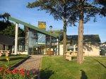
Avenue de Lauras, 12250 Roquefort/Soulzon
Situated in the Grands Causses Regional Natural Park, the cheese village of Roquefort stretches on the hillside over the famous scree of the Combalou Rock, in southern Larzac. The village is at an elevation of 630 m and has 700 inhabitants.
OPENING PERIODS:
The Tourist Office is open all year round:
- In July and August, Monday to Saturday: 9.30 to 18.30, Sunday: 10.00 to 17.00.
- April, May, June, September, October; Monday to Saturday: 9.30 to 12.15 & 13.00 to 17.30, closed on Sunday.
- January, February, November, December; Monday to Friday: 9.30 to 12.15 & 13.00 to 17.00, closed on Saturday and Sunday.
Transport
All the information is available on the Tourist Office website.
Access and parking
Saint-Affrique is situated 31 km southwest of Millau via the D992 and D999 roads.
Parking :

Report a problem or an error
If you have found an error on this page or if you have noticed any problems during your hike, please report them to us here: