
From Millau to Aigoual
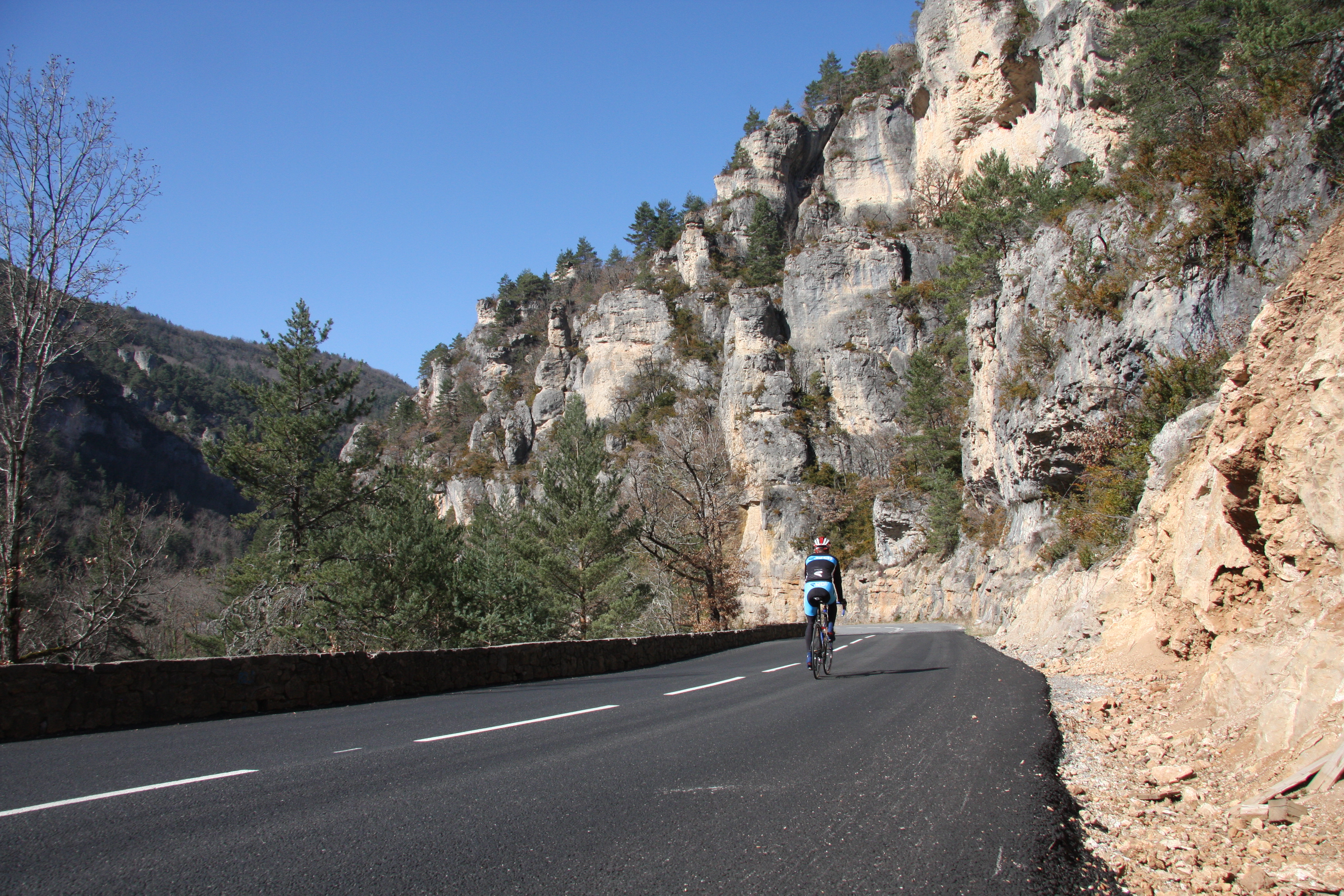
Millau
From Millau to Aigoual
Very hard
7h30
137,6km
+2199m
-2201m
Loop
Embed this item to access it offline
It is at the junction of the Dourbie and Trévezel Gorges, at the Cantobre bridge, that the climb up to the Aigoual begins. This magnificent 30km ascent, along roads with very little traffic, offers breathtaking views of the Aigoual massif, the highest point in the Gard. The return journey, which is mostly downhill through the Jonte Gorges, is also a real treat.
Description
- Leave the town via Avenue de l’Aigoual and its campsites, heading towards Nant – the Dourbie Valley. Pass through the hamlets of Massebiau and Le Monna, followed by the village of La Roque Sainte-Marguerite, still heading towards Nant.
- 35 km south of Millau, turn left onto the D145 towards Cantobre, a hilltop village overlooking the rivers Dourbie and Trèvezel. At the Aveyron/Gard departmental border, the D145 becomes the D157 and leads to Trèves. Carry on towards Camprieu. These first few kilometres of gentle uphill gradients towards Camprieu through the Trévezel valley are perfect for warming up before entering the Aigoual massif. Soak up the local atmosphere.
- At the junction with the D252 in Villemagne, cross the bridge on the right and continue on the D157.
- Pass through Camprieu and turn right. Follow the D986 to the Col de la Sereyrède. The second part of today’s trilogy, the Col de la Sereyrède continues the climb towards the highest point of the ride.
- Carry on to the left towards Prat Peyrot / Mont Aigoual. This is the final climb to the summit of Mont Aigoual. One last push for 7 km with no steep gradients. The road winds its way past the ski runs well known to locals. After the summit, continue on the D18 to the Col du Perjuret.
Then turn left onto the D996 towards Meyrueis. Drive through Meyrueis and take the D996 towards the Gorges de la Jonte. - Au Rozier, turn left onto the bridge over the Jonte via the D29, and in Peyreleau, take the first turn-off on your right towards La Cresse via the D187.
- Pass through La Cresse and Paulhe in turn, following the left bank of the Tarn, before reaching Millau via Avenue de Millau Plage.
- Departure : Millau, Confluence Roundabout
- Towns crossed : Millau, La Roque-Sainte-Marguerite, Saint-André-de-Vézines, Nant, Saint-Pierre-des-Tripiers, Le Rozier, Peyreleau, Mostuéjouls, Rivière-sur-Tarn, La Cresse, and Paulhe
Forecast
Altimetric profile
Sensitive areas
Along your trek, you will go through sensitive areas related to the presence of a specific species or environment. In these areas, an appropriate behaviour allows to contribute to their preservation. For detailed information, specific forms are accessible for each area.
- Impacted practices:
- Land
- Sensitivity periods:
- JanFebMarAprMayJunJulAugSepOctNovDec
- Contact:
- ONF - Agence territoriale Aveyron - Lot - Tarn - Tarn-et-Garonne
5, rue Christian d'Espic
81100 CASTRES
E-mail : ag.castres@onf.fr
Information desks
Tourist Office Millau Grands Causses
1, place du Beffroi, 12100 MILLAU
Access and parking
Parking :
Millau, Confluence Roundabout
Source

Club Cyclotourisme Millavoishttp://clubcyclomillavois.fr

Communauté de communes Millau Grands Causseshttps://www.cc-millaugrandscausses.fr/mes-pauses-loisirs-et-decouvertes/activites-de-pleine-nature

Report a problem or an error
If you have found an error on this page or if you have noticed any problems during your hike, please report them to us here: