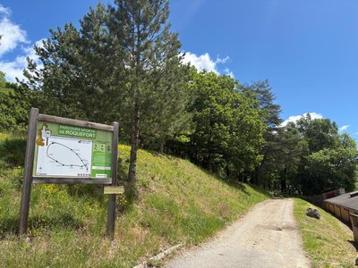
From St Affrique to Tournemire (maison de la vigne) (vine house)
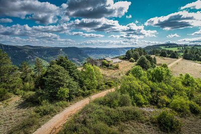
The hike that goes from the Caylus rock which towers above Saint-Affrique to the Combalou rock that watches over the caves of the king of cheeses, is a wonderful opportunity to get away through an agro-pastoral land. Scattered along the way with typical Caussenard buildings, the trail ends up with the beautiful cliffs of the Tournemire amphitheatre. This circuit is the first leg of the path that runs throughout the pays du Roquefort.
9 points of interest
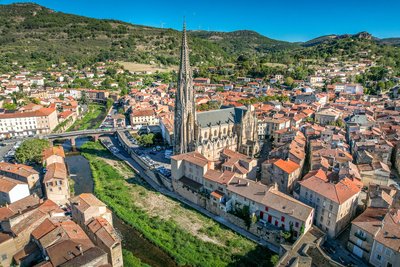
Ville de Saint-Affrique - Virginie Govignon  History and heritage
Town of Saint-Affrique
The name Saint-Affrique, with its two “F’s,” often raises curiosity. Its origin dates back to the 5th century, when Arian Visigoths were persecuting Catholic Christians. Africanus, a bishop exiled from Comminges, is said to have taken refuge near the Sorgues River, where he preached to the local population and performed various miracles – a story depicted in the stained-glass windows of the Church of Our Lady of Mercy. The name Saint-Affrique, attested as early as 942 in the archives of Vabres l’Abbaye, may come from the Visigothic term “Affric” or “Effric,” meaning “powerful and fearsome.”
Anecdote : during the French Revolution, the town was briefly renamed “Montagne sur Sorgues” to remove any religious reference, as was common practice at the time.
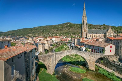
Le Pont Vieux - Virginie Govignon History and heritageThe Old Bridge of Saint-Affrique
Listed as a historic monument, the Old Bridge is one of the most beautiful medieval bridges in France, documented as early as 1408. With its bold yet elegant design, it spans the river with a central arch measuring 21.4 meters, flanked by two smaller arches. Built with a humpback profile and supported by slender triangular piers, it perfectly illustrates the skill of medieval builders. A true landmark of Saint-Affrique, this architectural gem offers a journey back in time through the city’s history.
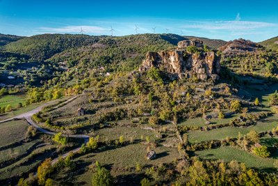
Rocher de Caylus - Virginie Govignon History and heritageThe Rock of Caylus
Perched at an altitude of 519 meters, the Rock of Caylus once supported the castle of the Counts of Caylus, built in the 11th century. Destroyed in 1238, the castle was the heart of a fortified complex that protected the local population. In 1808, the last remaining sections of the fortifications were dismantled to make way for the road to Tiergues. This site reveals a lesser-known chapter of Aveyron’s feudal history and power struggles.
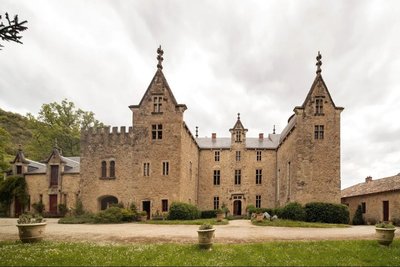
Château de Laumière - Roquefort Tourisme History and heritageLaumière Castle
Built in the 14th century and rebuilt after the French Revolution, Laumière Castle still overlooks the countryside near Saint-Rome-de-Cernon, just 3 km from the village. Over the centuries, it belonged to several prominent noble families, including the House of Armagnac and later the Vernhet de Laumière family. Among its notable figures was General Vernhet de Laumière, commander of the Imperial Guard's artillery during the Second French Empire. A witness to centuries of history, the castle is now available to rent for stays in an exceptional setting.
Bois de Conteynes et parcours de santé - Roquefort Tourisme  Flora
FloraConteynes Wood and Fitness Trail
Conteynes Wood is a dense forest where oaks stand proudly. Nature thrives here, hosting a variety of plants and animals. This area also helps protect the soil and regulate water. To enjoy it fully, a 600-meter fitness trail, which takes about an hour to complete, allows visitors to stroll, relax, and discover the wildlife and plants that make this forest so vibrant.
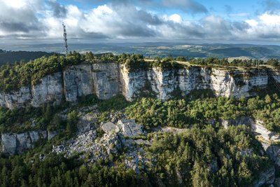
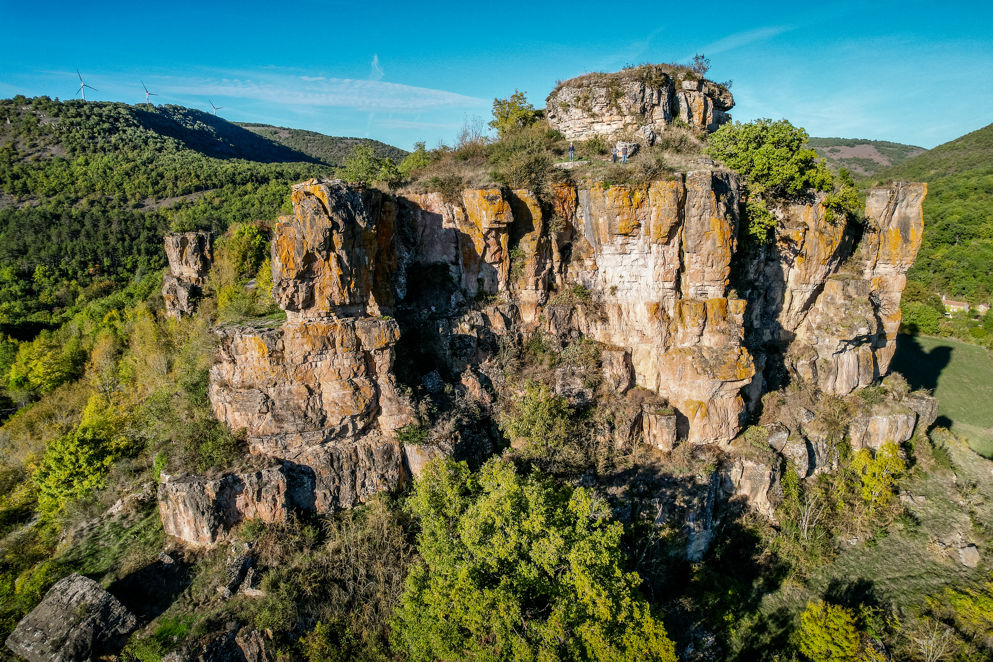
Eboulis du Combalou - Xavier Waerzeggers  Geology
The Combalou scree
The Combalou scree is an impressive rock formation, created by the many tectonic movements that shaped the limestone plateau. These piles of stones are the result of successive collapses and landslides that have shaped the landscape over the centuries. The rocks in this area reflect the region’s geological activity, where erosion has sculpted unique landscapes.
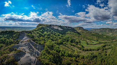
Le Plateau du Combalou - Roquefort Tourisme GeologyThe Combalou Plateau
The Combalou Plateau is a spectacular geological site located in the heart of the Roquefort region. Formed around 150 million years ago, when a shallow sea covered the area, this vast limestone landscape was shaped over time by layers of sediment.
Today, the Combalou is best known for its natural caves, which are essential to the production of Roquefort cheese. Crossed by natural fissures called “fleurines,” the plateau benefits from constant natural ventilation that maintains stable temperature and humidity levels. These unique conditions create the perfect environment for the aging of the famous Roquefort cheese.
Jasse du Combalou - Virginie Govignon  Agropastoralism
Jasse du Combalou
Jasses were buildings designed to shelter sheep during the summer season. Fairly well preserved, the Jasse du Combalou is organized over two levels. On the ground floor, two sheep pens, one of which is vaulted, housed the animals. Upstairs, a large barn was used to store hay for feeding the flocks during the winter months. Perfectly adapted to life in the highlands and the needs of pastoralism, this type of building provides an important testimony to rural life on the Causses.
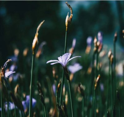
Aphyllanthes de Montpellier - Roquefort Tourisme FloraThe Montpellier Aphyllanthes
The Montpellier Aphyllanthes, also known as the “blue carnation of Montpellier,” is an emblematic plant of the Mediterranean garrigue. Perfectly adapted to dry soils, it blooms from April to June, brightening the landscape with its delicate light-blue flowers, which are highly appreciated by bees. Without leaves to limit water loss, it stands out with its long green stems, well suited to arid climates. In the past, its roots were used to make brushes, highlighting its place in local heritage.
Description
- From the Painlevé square, take the D993 towards Rodez for 100 m, then pass under the porch to the left and keep walking on the stony path. Take the road on the right and in the sharp curve go straight ahead on the path to carry on by a wider track which goes back to the road.
- Take right the stony path which wraps around the Caylus rock. To the North-East of the rock, take the path which rises progressively and overlooks the D993 to the right.
- At the crossroads, fork to the right on the track towards the ridges. The slope is steep. Walk along the cedar grove up to the ridge throughout pasturelands and groves of trees (enjoy the beautiful view over Caylus and St Affrique). Walk through the long bouissière that leads to the village of Tiergues.
- Walk across the village and before the exit, turn to the left to reach the graveyard. There, cross the old road and take the street between the sheepfold and the castle, walk around the castle surrounding walls and go through a tunnel under the road. At the tunnel exit, walk up to the left and cross the D3 road, take the path opposite that runs along the D993. Continue along this track.
- Cross the road and carry on to the right for 100 m, then take the path on your left. Walk down to the Laumière castle and continue on the small road up to the D992. Carry on opposite in the artisanal zone to reach a ford. Once you have crossed the stream, fork to the right and walk along the Soulzon up to the tarred bridge.
- In the first curve after the bridge, take the path on the left which runs uphill throughout the Conteyne woodland. Leave a path on the left, walk across the small road and carry on to reach the Roquefort Tourist Office. Walk around the Tourist Office, pass along the stadium and walk uphill on main street. Nearby a small carpark to your left, take the ascending street to the right beside a big building (ancient hotel). Do not take the covered street but instead turn to the right and just after, walk up to the left on a track running along the cliff (when on the ledge, turn back and take a look at the two Baragnaudes pillars). Go straight on these alleys under the cliffs. At the Caves entrance, under a porch, take the Créance Street, climb the stairs and enjoy the remains of the St Pierre chapel (viewpoint indicator).
- At the view point indicator, walk across the grassy land and climb up a steep uphill path. Carry on throughout the undergrowth, then on open ground. Walk along the base of the cliffs of the Combalou with their typical great fracture.
- When arriving at the endpoint of the cliff and at the intersection of tracks, take the left path, cross the road and walk your way down to Tournemire (ancient railway city) on the Trumpet path. Below, walk around the water treatment plant, carry on the path along the left bank of the Soulzon. Walk across the Soulzon, then cross the railroad at the level crossing. Take left the rue de la Barrière, then the rue Française. At the car park of the former railway station, go up to the right and walk across Main street. You then reach the house of the Plesiosaur, a marine reptile which was discovered in the black soils of Tournemire.
- Keep walking on the road lined up with plane trees. Opposite the ancient convent, turn left towards the Brias amphitheatre via the chemin de la Fous. Before the bridge that goes across the Brias brook, take left the path that leads to the Tournemire Sensitive Natural Space. Arrival at . Arrival at the gite “la maison de la vigne".
- Departure : Car park situated on Foch square in Saint-Affrique
- Arrival : Maison de Vigne, Tournemire
- Towns crossed : Saint-Affrique, Saint-Rome-de-Cernon, Roquefort-sur-Soulzon, and Tournemire
Forecast
Altimetric profile
Recommandations
Information desks

Avenue de Lauras, 12250 Roquefort/Soulzon
Situated in the Grands Causses Regional Natural Park, the cheese village of Roquefort stretches on the hillside over the famous scree of the Combalou Rock, in southern Larzac. The village is at an elevation of 630 m and has 700 inhabitants.
OPENING PERIODS:
The Tourist Office is open all year round:
- In July and August, Monday to Saturday: 9.30 to 18.30, Sunday: 10.00 to 17.00.
- April, May, June, September, October; Monday to Saturday: 9.30 to 12.15 & 13.00 to 17.30, closed on Sunday.
- January, February, November, December; Monday to Friday: 9.30 to 12.15 & 13.00 to 17.00, closed on Saturday and Sunday.
Transport
To get more details click on: site internet de l'Office de Tourisme and on Occitanie Transports
There is a bus station in St Affrique (lines 202, 2016, 2018) and a railway station in Tournemire (regional line).
Access and parking
Via the A75, 46 or 47, then follow the D999 towards Saint-Affrique / Albi. Arrival in Saint-Affrique via the D 999. From Millau drive across the town, cross the river Sorgues, Foch square is next to the bridge. From Albi, head towards the town centre, Foch square is next to the public park.
Report a problem or an error
If you have found an error on this page or if you have noticed any problems during your hike, please report them to us here: