Enjoy a touch of southern atmosphere between Larzac and Lévézou
This rural stroll offers you an alternative way of exploring Saint-Rome-de-Cernon by walking along dirt and stone tracks. Head your way to the esplanade of the old graveyard and enjoy the perfect panoramic viewpoint over the village. Contemplate the artistic heritage, throughout Greschny’s frescoes in the church, but also the rural heritage such as a lavogne which testifies to the agro-pastoral roots of the village.
1 point of interest

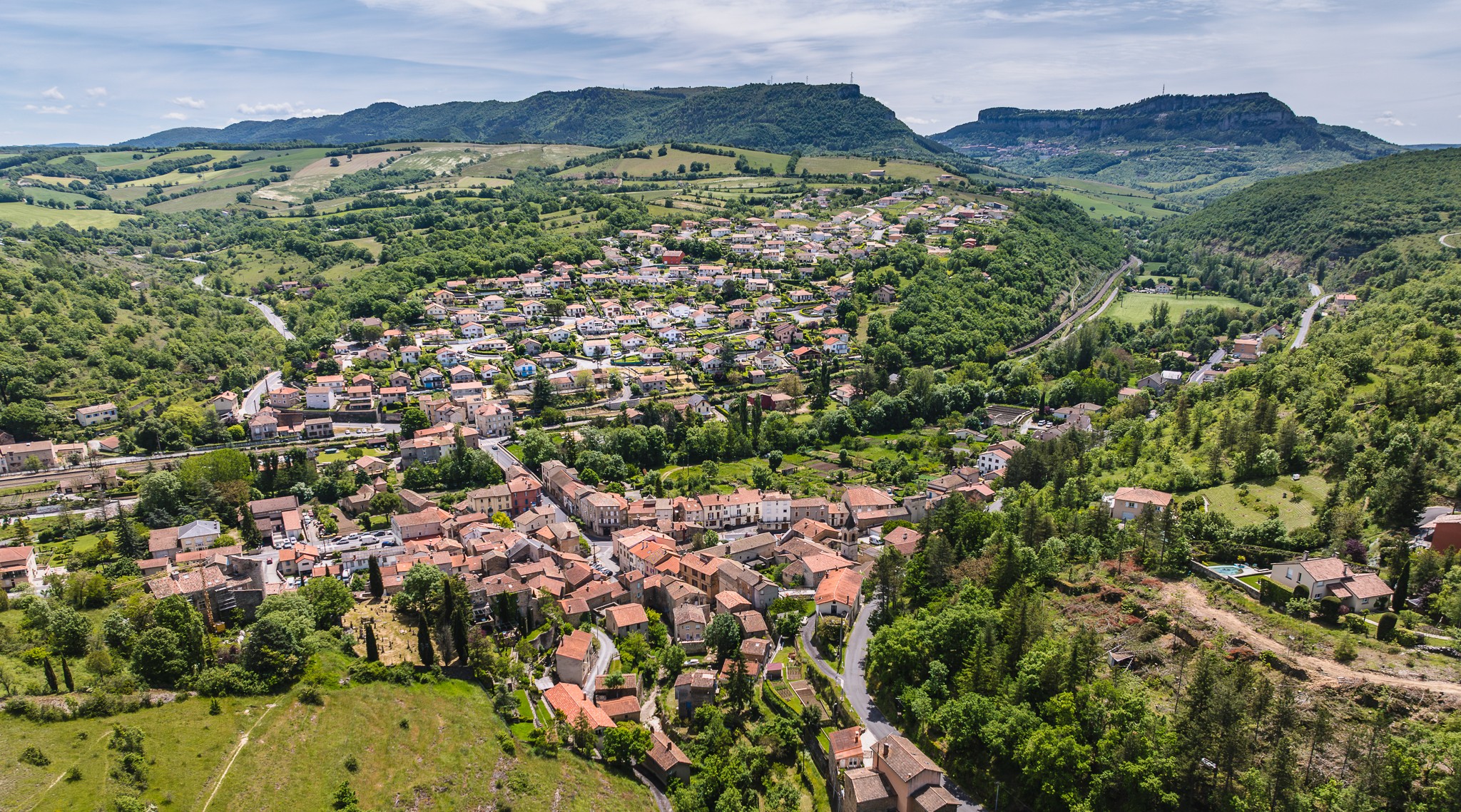
Village de Saint-Rome-de-Cernon - Virginie Govignon  History and heritage
Village of Saint-Rome-de-Cernon
Created through the merger of Saint-Rome-de-Cernon and Montclarat in 1840, the commune has a history dating back to prehistoric times, as evidenced by the Sargels caves and the dolmens of the Laumière woodland.
Located at a strategic crossroads between Millau, Saint-Affrique, and the Cernon Valley, the village long played an important role in regional trade. Overlooked by the remains of the castle of the Lords of Caylus, it is also home to several notable residences and castles, including Mélac, Montclarat, and Laumière.
Description
Starting point and finish of the hike are located at the carpark, which is on the left side when watching the castle. Walk across a small square and right at the first street (rue du château) take left for approximately 40 m. When reaching the fountain, take to the right the D999 for 40 m. Before the petrol station, take right and walk along the church an ascending slope. Keep on going for 100 m up to the D31, follow this road for 50 m, and then take a tarred track for 300 m.
Right at the first tarred hairpin bend to the left, carry straight on the dirt track. The path first goes through a wooded section then leads to a plateau. Take right up to the D31 and walk across the road to the left.
Turn immediately to the right on a tarred track towards Puech Ricard. Carry straight on for 800 m, leaving to your right the road that leads to the Cazals farm. 500 m further, look up at the lavogne (a paved pond to water the flock of sheep). Walk for 200 m and leave to your left a stone cross.
200 m further, fork to the right and take a stone path towards St-Rome-de-Cernon. Keep walking up to a steep path overlooking Saint-Rome and enjoy the panoramic view. Walk to the left side of the castle and the “old graveyard”, then follow to the left a cemented path and you're back to the carpark, the starting point of your hike.
- Departure : Parking de la Passade à Saint-Rome-de-Cernon
- Arrival : Parking de la Passade à Saint-Rome-de-Cernon
- Towns crossed : Saint-Rome-de-Cernon
Forecast
Altimetric profile
Recommandations
Box tree moths are active from May to October. During the caterpillar phase, they feed on the leaves of box trees. They crawl down trees and move on long silken threads, although these threads are annoying when hiking they do not pose any health risk
Information desks

Avenue de Lauras, 12250 Roquefort/Soulzon
Situated in the Grands Causses Regional Natural Park, the cheese village of Roquefort stretches on the hillside over the famous scree of the Combalou Rock, in southern Larzac. The village is at an elevation of 630 m and has 700 inhabitants.
OPENING PERIODS:
The Tourist Office is open all year round:
- In July and August, Monday to Saturday: 9.30 to 18.30, Sunday: 10.00 to 17.00.
- April, May, June, September, October; Monday to Saturday: 9.30 to 12.15 & 13.00 to 17.30, closed on Sunday.
- January, February, November, December; Monday to Friday: 9.30 to 12.15 & 13.00 to 17.00, closed on Saturday and Sunday.
Transport
Travel by bus or train: http://www.mobimipy.fr/
Carpooling : BlaBlaCar, Rézo Pouce, Covoiturage-libre, Idvroom, LaRoueVerte, Roulez malin
Access and parking
The village is situated on the D992, 15 km from Millau towards Saint-Affrique
Parking :
Accessibility
- Emergency number :
- 114
More information
Source

Report a problem or an error
If you have found an error on this page or if you have noticed any problems during your hike, please report them to us here: