VTT N°36 - Templar and Hospitaller Larzac
Almost 300m of vertical drop, a arduous climb, landscapes of the causses and wooded areas: along single-track paths, trails and alleys, explore the Larzac, its foothills, and the banks of the Cernon river. L'Hospitalet du Larzac, La Cavalerie and Sainte-Eulalie du Cernon are the three stopping places of this original route between causse and valley.
1 point of interest
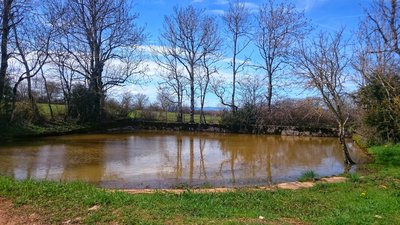
Mare du Lavagnol - Sandrine_Perego  Small heritage
The watering place of Lavagnol
On the Causses, the « lavognes » (cobbled watering place), are natural clay troughs, often circular, serving as a watering place for herds and fed exclusively by rainwater.
In the second haft of the 19th century, the number of sheep was more important, and people decided to build bigger cobbled watering places. They are the only permanent water points with the natural watering place for animals and as such, they are precious and well maintained.
Description
- From the “Place des Cygnes”, follow the road towards Viala-du-Pas-de-Jaux on 2,5km
- Go up on the right track. Continue straight until joining again the road D277. Cross the road and take the path that flows in front on the left.
- After 300m down, take the path to the left. Before the road, follow the single path on the right. Warning, at the crossroads at the bottom of the hill, go straight ahead on the track. After the farm, continue straight towards “Espace Nature Ladoux” (Nature area), then take the right path along the stream.
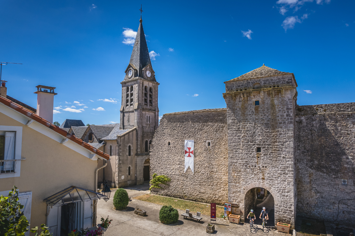
- Then follow the road to Sainte-Eulalie, enter into the ramparts through the main gate and join the square (information center and toilet). Take the covered lane then the street on the left until the road to Lapanouse de Cernon.
- At the exit of the village, follow “Le Mas de Roque” on the right. After “Le Frayssinet”, continue the ascent to the plateau. Once on the heights continue straight towards La Cavalerie. (At the end of the hill, you can access to a viewpoint taking the track on the right for 1km towards the relay).
- At the Townhall, take right the road “Route de la Tune” towards the stadium, then at the crossroads take straight.
- 100m after the stadium, turn right on a track to pass under the road, then the motorway. Join the pine woods towards L’Hospitalet-du-Larzac.
- After the downhill, take the road on the right at the crossroads.
- Departure : L'Hospitalet du Larzac
- Arrival : L'Hospitalet du Larzac
- Towns crossed : L'Hospitalet-du-Larzac, Sainte-Eulalie-de-Cernon, and La Cavalerie
Forecast
Altimetric profile
Information desks

Tourist Office Larzac et Vallées
Place du Claux, 12230 NANT
Located on the ground floor of the Town Hall (mansion of the 18th century), The Tourist Office welcomes you all year and offers tourist information on the Larzac and its valleys, the department of Aveyron, and also on neighboring counties. Free Wifi access.
Opening hours :
From Novembre to February: Tuesday morning 9:00-12:30
March and October : Tuesday to Friday 9:00-12:30
April : Tuesday to Friday 10:00-12:30 and 14:00-17:30
May, June : Tuesday to Saturday 10:00-12:30 and 14:00-17:30
July and August : every day 10:00-12:30 and 14:30-18:00
September : Tuesday to Saturday 10:00-12:30 and 14:00-17:30
Transport
To travel by bus or train, by carpooling Aires de covoiturage and hitchhiking Rezopouce.
Access and parking
25km at the south of Millau via D809. Exit 47 on the motorway A75.
Parking :
Accessibility
- Emergency number :
- 114


Report a problem or an error
If you have found an error on this page or if you have noticed any problems during your hike, please report them to us here: