Trail running No. 20 - St-Guiral Circus
Looking for a challenge… and breathtaking scenery? This trail circuit will meet your expectations: 28km of trails, winding between ridge paths, heathland and chestnut forests, with panoramic views of the Dourbie canyons and the Vis valley, and a final climb to the gateway of the Cévennes. A shorter 17km option is also available.
Description
The duration of the circuit can vary between 2.5 and 5 hours depending on the trail runner's level.
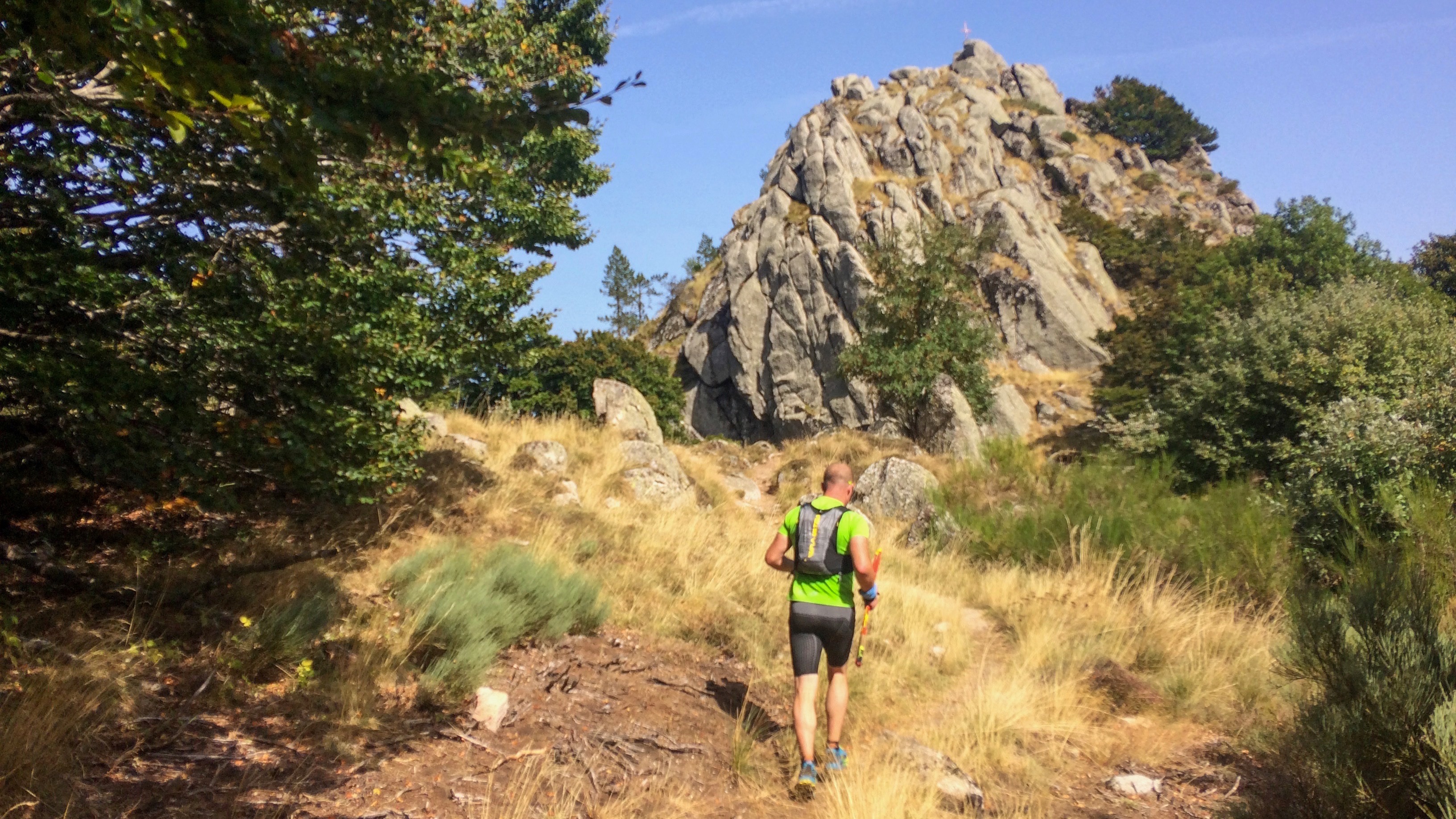
- This long-distance circuit follows the 11 km St-Guiral Vertical trail from the start. It's safe to say that this beginning is demanding; you quickly get into the thick of it with 10.8 km of very steady climbing, gaining 880 m and losing 70 m, along the ridge path of Montagne de Labarthe, offering a magnificent panorama of the Dourbie Valley.
- Once you cross the treeline at km 4, approaching 1000 m altitude, you'll traverse above a heathland ablaze with a thousand colors depending on the season. A surprising little togog, undulating along the watershed between the Crozes Valley to the north and the Viala Valley to the south, leads to Le Pal and the beautiful track to the Croix de la Guérite, a welcome respite before tackling the final climb to St-Guiral.
- Alternative route: a slight variation at kilometer 7.3 offers a shorter option for those who wish to take the wide track to the right, which rejoins the main circuit 200 meters lower. This creates a loop of 18.9 km and 770 m of elevation gain.
- At the entrance to the Cévennes National Park, the route connects with the GR71 long-distance hiking trail, which you follow to the right, heading due south to descend to the menhir, losing 300 m of elevation over 2.6 km. Despite the technical nature of this descent, take the time to admire the panorama of the Vis valley nestled within the landscape. To the left, you'll see the magnificent, deeply carved slopes of Mont Saint-Guiral, a haven of heather.
- At the menhir, the scenery changes as you enter the dense Guérite state forest. The route continues for 3.8 km on a gentle slope and downhill, offering occasional beautiful views of the steep-sided valleys where the isolated hamlet of Jaoul is hidden.
- From now on, we glide down towards St Jean du Bruel via a very long descent, occasionally interrupted by a short climb.
- Just before the Prisoners' Cross, we turn right, heading due north (km 23.3) and very quickly enter the typical landscape of these chestnut forests, following a small ridge above the Lavaur and Bruel ravines. The finish is near, with one last steep section; the gradient increases, so be careful, as this is the last technical section of this beautiful ride up the slopes of St-Guiral.
- Departure : Leisure base of La Roque (D114), St-Jean du Bruel
- Arrival : Leisure base of La Roque (D114), St-Jean du Bruel
- Towns crossed : Saint-Jean-du-Bruel and Sauclières
Forecast
Altimetric profile
Recommandations
1.5 l water reserve - energy reserve - rain jacket - winter clothing equipment if needed.
Information desks

Tourist Office Larzac et Vallées
Place du Claux, 12230 NANT
Located on the ground floor of the Town Hall (mansion of the 18th century), The Tourist Office welcomes you all year and offers tourist information on the Larzac and its valleys, the department of Aveyron, and also on neighboring counties. Free Wifi access.
Opening hours :
From Novembre to February: Tuesday morning 9:00-12:30
March and October : Tuesday to Friday 9:00-12:30
April : Tuesday to Friday 10:00-12:30 and 14:00-17:30
May, June : Tuesday to Saturday 10:00-12:30 and 14:00-17:30
July and August : every day 09:00-13:00
September : Tuesday to Saturday 10:00-12:30 and 14:00-17:30
Transport
To travel by bus or train, by carpooling Aires de covoiturage and hitchhiking Rezopouce.
Access and parking
42 km southeast of Millau via the D809, the D999 or via the D991 and the D999 (Gorges of the Dourbie), then the D114.
Parking :
Source


Report a problem or an error
If you have found an error on this page or if you have noticed any problems during your hike, please report them to us here: