Nougairolles path
2 points of interest
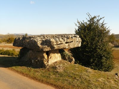
Dolmen de Crassous - Roquefort Tourisme  Dolmen
Crassous Dolmen
With nearly 1,000 dolmens, Aveyron is the French department with the highest number of these monuments. Contrary to popular belief, they were not built by the Celts, but by Neolithic communities more than 4,500 years ago.
The word “dolmen,” meaning “stone table” in Breton, refers to prehistoric collective burial sites. Visible from the road, this dolmen, along with the one at Tiergues, is well worth a visit. Nicknamed “l’Ercoulé,” it is linked to a local legend claiming that the demi-god Hercules, known for his superhuman strength, built this burial site.
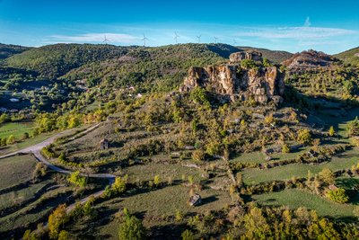
Rocher de Caylus - Virginie Govignon  History and heritage
The Rock of Caylus
Perched at an altitude of 519 meters, the Rock of Caylus once supported the castle of the Counts of Caylus, built in the 11th century. Destroyed in 1238, the castle was the heart of a fortified complex that protected the local population. In 1808, the last remaining sections of the fortifications were dismantled to make way for the road to Tiergues. This site reveals a lesser-known chapter of Aveyron’s feudal history and power struggles.
Description
Upon leaving the car park on the rue Lamartine, turn right and carry straight on to the Maison de la Mémoire. Walk down to the left on rue Pierre Cadias, then stay on your right to reach the rue des Potiers (graveyard road)
- Take the road that leads to the graveyard (D 50). Then, a bit further than the new graveyard, leave the road to take a left a dirt road.
- Walk along a brook and join up with the route de Bages that you take to the right. Make a wide turn.
- Walk off the road by turning to the left and head your way to the north towards Roubiac. After the last house, keep going on an ascending dirt road throughout the woodland.
- Reach the intersection south of Nougayrolles, carry on northward and walk close to a lavogne in leaving the access to the equestrian gite on the right (make sure you close the gate behind you). Continue on a small road up to the intersection with the route de Bages in Crassous. Take the road to the right and carry on for 1 km 100.
- Reach the road that leads to Boussac. Opposite, a path lined up with box-trees will lead you to the Puech Ibilié dolmen in a 15 minute time going there and back. Retrace your steps back and take the road towards Crassous in a north-easterly direction. A bit before the quarry to the right is another well-preserved dolmen, the Crassous dolmen.
- At the exit of Crassous, take to the right the boussière that gently slopes down to the D50 road. Walk across the road and carry on the track opposite. Walk across the stream on a lovely small wooden bridge and join up with the valley path which you take to the right.
- Keep going in the same direction. Walk along a sheepfold. Leave to the right the path that joins the D50 (alternative route towards Nougayolles). Reach the intersection with the trail coming from the crests.
- Carry on walking the path overlooking the D993 that can be seen below to the left. Walk around Caylus rock on a stone path and reach the tarmac road.
- At the intersection, take the road to the left and walk in a narrow path. Then, join a tarred road that goes downhill towards Saint-Affrique and leads you to the town centre.
This circuit has been designed and described by the hikers association Les Cardabelles
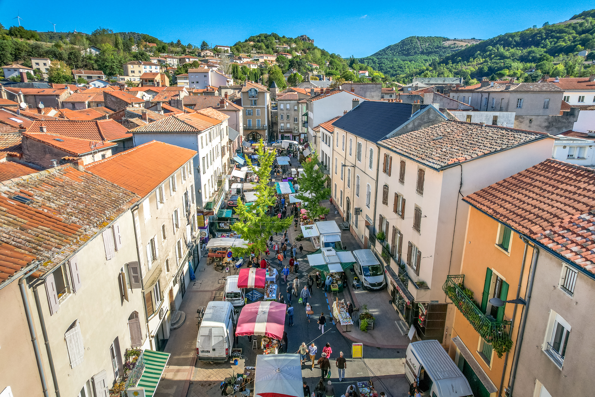
- Departure : rue Lamartine car park in St-Affrique
- Arrival : rue Lamartine car park in St-Affrique
- Towns crossed : Saint-Affrique
Forecast
Altimetric profile
Recommandations
Box tree moths are active from May to October. During the caterpillar phase, they feed on the leaves of box trees. They crawl down trees and move on long silken threads, although these threads are annoying when hiking they do not pose any health risk.
Information desks

Avenue de Lauras, 12250 Roquefort/Soulzon
Situated in the Grands Causses Regional Natural Park, the cheese village of Roquefort stretches on the hillside over the famous scree of the Combalou Rock, in southern Larzac. The village is at an elevation of 630 m and has 700 inhabitants.
OPENING PERIODS:
The Tourist Office is open all year round:
- In July and August, Monday to Saturday: 9.30 to 18.30, Sunday: 10.00 to 17.00.
- April, May, June, September, October; Monday to Saturday: 9.30 to 12.15 & 13.00 to 17.30, closed on Sunday.
- January, February, November, December; Monday to Friday: 9.30 to 12.15 & 13.00 to 17.00, closed on Saturday and Sunday.
Transport
Getting around by bus or train: https://lio.laregion.fr/
Carpooling: BlaBlaCar, Rézo Pouce, Mobicoop, Idvroom, LaRoueVerte, Roulez malin
Access and parking
Saint-Affrique is situated on the D999 road linking Millau to Albi
Parking :
More information
Report a problem or an error
If you have found an error on this page or if you have noticed any problems during your hike, please report them to us here: