
Cabanières' path: Roquefort-Montclarat
During the production run, the Cabanières from Montclarat paced up and down each day the landscape overlooked by the Combalou mound. Then, they would come back to their high perched village in the evening. This route which secretly keeps the imprint of their footsteps offers you to hike in a rural environment that has a rich rural tradition.
3 points of interest
Bois de Conteynes et parcours de santé - Roquefort Tourisme  Flora
FloraConteynes Wood and Fitness Trail
Conteynes Wood is a dense forest where oaks stand proudly. Nature thrives here, hosting a variety of plants and animals. This area also helps protect the soil and regulate water. To enjoy it fully, a 600-meter fitness trail, which takes about an hour to complete, allows visitors to stroll, relax, and discover the wildlife and plants that make this forest so vibrant.
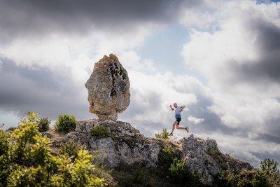
Rocher de Roucangel - Xavier Waerzeggers  Geology
Roucangel Rock
The name Roucangel comes from the Occitan word ròca, meaning “rock.” Shaped by erosion over thousands of years, the dolomitic rocks have formed a remarkable natural maze of streets, towers, and passageways. A true open-air stone village, perfect for discovering the region’s geological heritage.
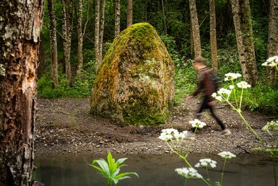
Menhir du Soulzon - Xavier Waerzeggers  Archeology
Soulzon Menhir
The Soulzon menhir is a large stone over three meters high, locally called a "menhir," even though it does not display all the usual characteristics of a traditional menhir. This type of standing stone dates back to the Bronze Age, and its exact role in the ancient landscape remains a subject of debate. Some believe it is simply a natural remnant of the Combalou, on which a cross may have been engraved during the Middle Ages, possibly to mark a territorial boundary. Others suggest it could be a prehistoric menhir that was Christianized, a common practice in the region. The two deeply carved crosses on its faces support this latter interpretation.
Description
In the early part of the last century, the Cabanières made this trip every day to get to work in Roquefort. Those who came from Mélac passed via Montclarat. You can read their stories in the points of interest section.
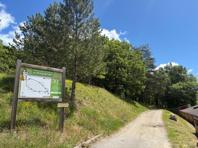
- When you stand opposite the Tourist Office, head to the left and take the leftmost path (the one which runs along the toilets). Follow the trail for 200 m.
- Turn left onto the path that goes downhill. Cross the road and carry on sloping down the track with the yellow marking.
- When you reach the crossroads situated at the bottom of the valley, take a left towards Montclarat. At the road junction, turn to the right to cross the stream over the bridge.
- Go up to the right of the building to traverse the level crossing at a place called Carcan. Then, get on the trail and carry on up to a road junction.
- Turn to the right and stay on the road for 1 km. Slope down the path on your left to go to the spring, carry on this path to go back to the road and reach Montclarat.
Retrace your steps back to Roquefort
- Departure : Tourist Office
- Arrival : Tourist Office
- Towns crossed : Roquefort-sur-Soulzon and Saint-Rome-de-Cernon
Forecast
Altimetric profile
Recommandations
Information desks

Avenue de Lauras, 12250 Roquefort/Soulzon
Situated in the Grands Causses Regional Natural Park, the cheese village of Roquefort stretches on the hillside over the famous scree of the Combalou Rock, in southern Larzac. The village is at an elevation of 630 m and has 700 inhabitants.
OPENING PERIODS:
The Tourist Office is open all year round:
- In July and August, Monday to Saturday: 9.30 to 18.30, Sunday: 10.00 to 17.00.
- April, May, June, September, October; Monday to Saturday: 9.30 to 12.15 & 13.00 to 17.30, closed on Sunday.
- January, February, November, December; Monday to Friday: 9.30 to 12.15 & 13.00 to 17.00, closed on Saturday and Sunday.
Transport
Getting around by bus or train: https://lio.laregion.fr/
Carpooling: BlaBlaCar, Rézo Pouce, Mobicoop, Idvroom, LaRoueVerte, Roulez malin
Access and parking
Situated 25 km southwest of Millau via the D 992, D 999 and D 23 towards Albi. Situated 14 km of St-Affrique via the D 999 towards Millau.
Parking :
Source

Report a problem or an error
If you have found an error on this page or if you have noticed any problems during your hike, please report them to us here: