The trumpet path
The name of this hiking path refers to the nickname of a Roquefort bricklayer whose house stands close to the path. The story goes that his workmates offered him as a joke a small trumpet that he would playfully blow when the merry team was on the move. That’s how the path has been named since.
3 points of interest
 History and heritage
Everybody has a ticket
The Tournemire-Le Vigan railway line was put into service on August 24th 1896. 2 hours were required to complete the journey, and it was then the only means used to transport Roquefort cheese. In 1897, the traffic was only 25 passengers per day and 15,000 tons of goods per year. In 1922 traffic peaked with 372 passengers per day and 33,000 tons of goods transported during the year. One still remembers these trains pulled by two steam locomotives that would transport cabanières (female staff working in the Roquefort caves), just as “migou” (sheep manure) intended, among others for the rice fields in Camargue. From 1920 onwards, road transport supplanted rail, and the line was finally closed on May 15th, 1939.
Source : Le chemin de fer Le Vigan-Tournemire-Roquefort - ed° Cévennes Magazine
 Geology
Sotch de Balhol
The cliff towering over our heads is really impressive with its steepness, the smooth appearance of the rock and the feeling of solidity it conveys. Actually, the huge screes we are walking on have been created by a rockslide. The bottom of this valley is called “sotch”, which is the local name for sinkholes
 History and heritage
La chapelle Saint-Pierre du XIe siècle coiffe le rocher en éperon du même nom. C'était la chapelle du château qui ne fût jamais
The Saint-Pierre chapel dates back to the 11th century and is located on top of a rocky spur of the same name. It was the chapel of the castle and was never a parish church. The castle, which dates from the same period, was attached to the rocky vertical face (remains of a tower). The structure of the chapel is made with a fine stone-setting and is proof of the quality of the construction of this small religious building. The squat and vaulted semi-dome choir was restricted by a semicircular arch with an enlarged triumphal arch that stood in front of it and led to the short nave.
Description
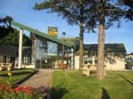
From the railway station, head towards the tennis court.
- Walk across the Soulzon brook and turn to your right. Follow the marked trail, turn to the left after the Waste water treatment plant then to the right before the small house.
- 50 m further on, leave the ascending path and carry on to the right towards Roquefort along the Bousquet farm. Walk through the woodland, then take a track on your left.
- Reach the D93 road, turn left and follow the road uphill for approximately 300 m.
- From this point, turn to your left towards Tournemire (from here the Ladder path can be joined by heading to the right towards Roquefort). Walk through a buissière (a path lined with box trees) and head your way down to the village of Tournemire. Once you reach the bottom take a right turn and retrace your way back to the railway station.
- Departure : Town Hall carpark in Tournemire
- Arrival : Town Hall carpark in Tournemire
- Towns crossed : Tournemire and Roquefort-sur-Soulzon
Altimetric profile
Recommandations
Information desks
Avenue de Lauras, 12250 Roquefort/Soulzon
Situated in the Grands Causses Regional Natural Park, the cheese village of Roquefort stretches on the hillside over the famous scree of the Combalou Rock, in southern Larzac. The village is at an elevation of 630 m and has 700 inhabitants.
OPENING PERIODS:
The Tourist Office is open all year round:
- In July and August, Monday to Saturday: 9.30 to 18.30, Sunday: 10.00 to 17.00.
- April, May, June, September, October; Monday to Saturday: 9.30 to 12.15 & 13.00 to 17.30, closed on Sunday.
- January, February, November, December; Monday to Friday: 9.30 to 12.15 & 13.00 to 17.00, closed on Saturday and Sunday.
Transport
Travel by bus or train: https://lio.laregion.fr/
Carpooling : BlaBlaCar, Rézo Pouce, Mobicoop, Idvroom, LaRoueVerte, Roulez malin
Access and parking
When driving from Saint-Affrique or from Millau, take the D999 up to the roundabout and follow the D23 towards Roquefort, then Tournemire for 6km.
Parking :
Accessibility
Source

Report a problem or an error
If you have found an error on this page or if you have noticed any problems during your hike, please report them to us here:

