The trumpet path
The name of this hiking path refers to the nickname of a Roquefort bricklayer whose house stands close to the path. The story goes that his workmates offered him as a joke a small trumpet that he would playfully blow when the merry team was on the move. That’s how the path has been named since.
3 points of interest
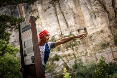
Xavier Waerzeggers  Geology
Saut de Bailhol
Le Saut de Bailhol, often – though incorrectly – referred to as a sotch* because of its hollowed shape, is in fact the rockfall detachment niche of the scree slopes visible further down. But, as is often the case in oral tradition, spectacle takes precedence over geology: legend has it that a man named Bailhol performed a true "swan dive" here, throwing himself from the 80-metre-high cliff. In any case, it is important not to confuse this site with a genuine caussenard sotch.
*Sotch : a closed depression of karstic origin, characteristic of the limestone plateaus (causses). Filled with runoff sediments or terra rossa, it is particularly fertile and hosts most cereal crops. When its outline is rounded, it is known as a doline.
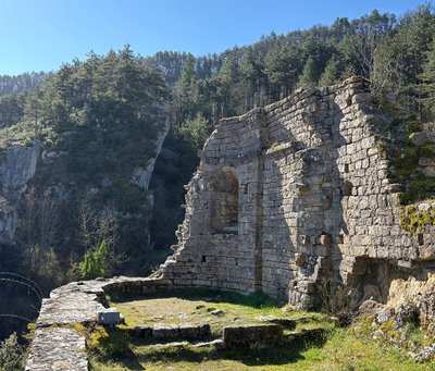
Chapelle Saint-Pierre - Roquefort Tourisme  History and heritage
Saint-Pierre Rock and Chapel
Saint-Pierre Chapel, dating from the 11th century, crowns the rock of the same name and was once the chapel of the now-vanished medieval castle. With its semi-dome choir, rounded arch, and narrow nave, this modest yet elegant building stands as a tribute to the craftsmanship of past builders. Steeped in history, the site invites contemplation and bears witness to the long-standing human presence in the area.
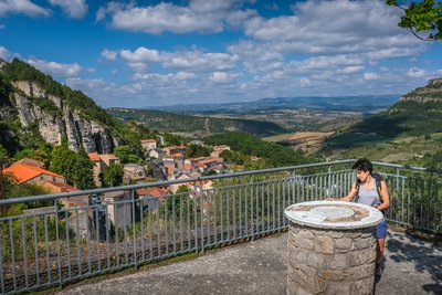
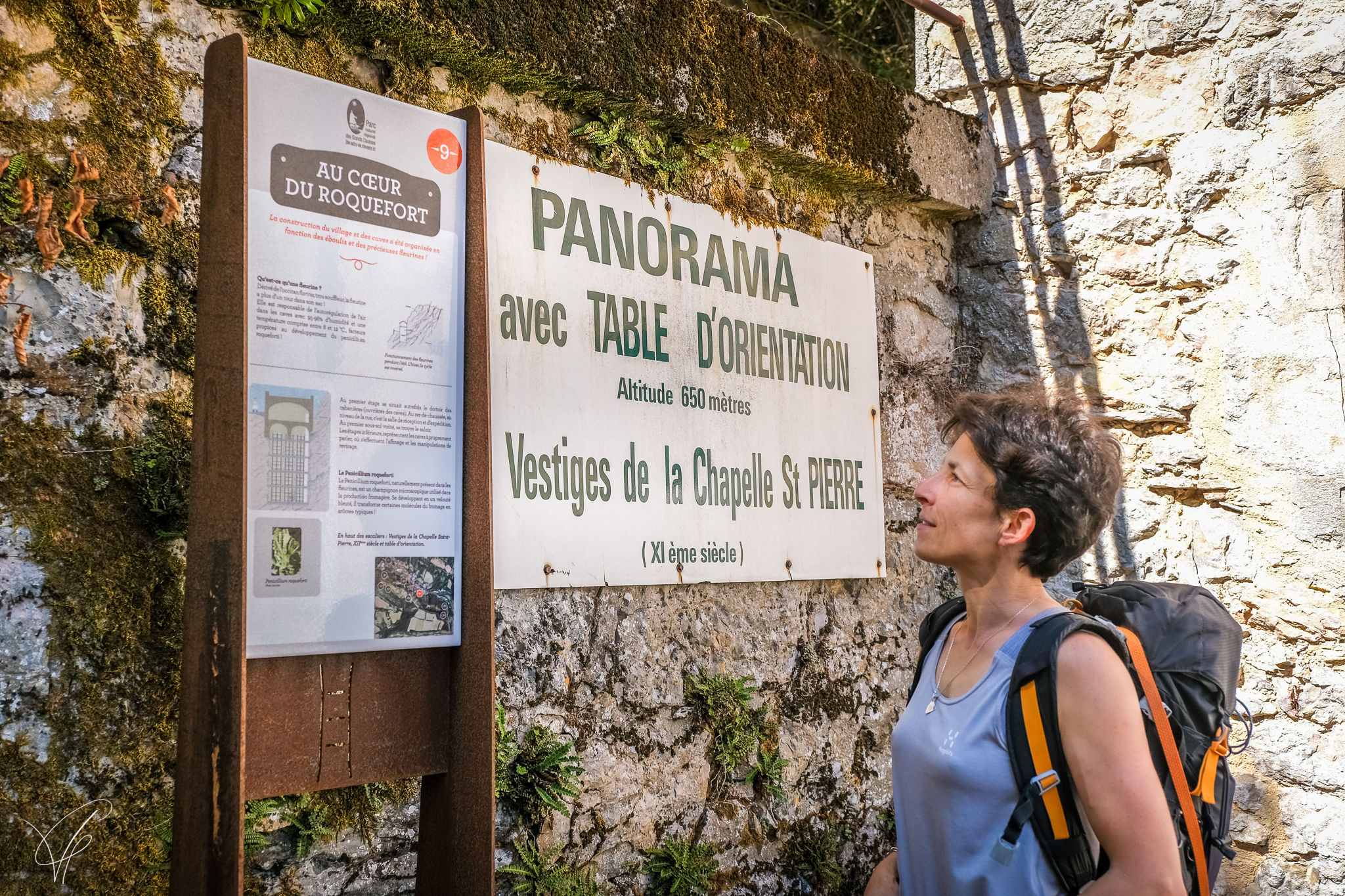
Table d'orientation de Roquefort - Virginie Govignon  Panorama
The Orientation Table
Located on the Saint-Pierre Rock, this orientation table offers a breathtaking panoramic view over Roquefort-sur-Soulzon, the Lévézou Mountains, the Larzac Plateau, and the Soulzon Valley. This viewpoint allows visitors to better understand the landscape and geography of the region while enjoying its natural beauty. An ideal spot to capture memories and soak in the grandeur of the area.
Description
From the railway station, head towards the tennis court.
- Walk across the Soulzon brook and turn to your right. Follow the marked trail, turn to the left after the Waste water treatment plant then to the right before the small house.
- 50 m further on, leave the ascending path and carry on to the right towards Roquefort along the Bousquet farm. Walk through the woodland, then take a track on your left.
- Reach the D93 road, turn left and follow the road uphill for approximately 300 m.
- From this point, turn to your left towards Tournemire (from here the Ladder path can be joined by heading to the right towards Roquefort). Walk through a buissière (a path lined with box trees) and head your way down to the village of Tournemire. Once you reach the bottom take a right turn and retrace your way back to the railway station.
- Departure : Town Hall carpark in Tournemire
- Arrival : Town Hall carpark in Tournemire
- Towns crossed : Tournemire and Roquefort-sur-Soulzon
Forecast
Altimetric profile
Recommandations
Box tree moths are active from May to October. During the caterpillar phase, they feed on the leaves of box trees. They crawl down trees and move on long silken threads, although these threads are annoying when hiking they do not pose any health risk.
Information desks

Avenue de Lauras, 12250 Roquefort/Soulzon
Situated in the Grands Causses Regional Natural Park, the cheese village of Roquefort stretches on the hillside over the famous scree of the Combalou Rock, in southern Larzac. The village is at an elevation of 630 m and has 700 inhabitants.
OPENING PERIODS:
The Tourist Office is open all year round:
- In July and August, Monday to Saturday: 9.30 to 18.30, Sunday: 10.00 to 17.00.
- April, May, June, September, October; Monday to Saturday: 9.30 to 12.15 & 13.00 to 17.30, closed on Sunday.
- January, February, November, December; Monday to Friday: 9.30 to 12.15 & 13.00 to 17.00, closed on Saturday and Sunday.
Transport
Travel by bus or train: https://lio.laregion.fr/
Carpooling : BlaBlaCar, Rézo Pouce, Mobicoop, Idvroom, LaRoueVerte, Roulez malin
Access and parking
When driving from Saint-Affrique or from Millau, take the D999 up to the roundabout and follow the D23 towards Roquefort, then Tournemire for 6km.
Parking :
Accessibility
- Emergency number :
- 114
Source

Report a problem or an error
If you have found an error on this page or if you have noticed any problems during your hike, please report them to us here: