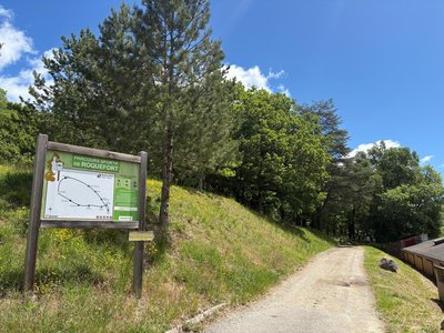
Track Menhir
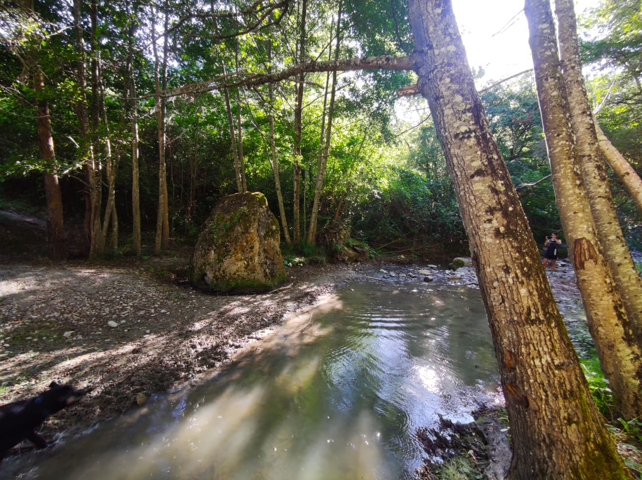
You will see on the creek bank an impressive 3 m metre high stone stuck in the ground. Different interpretations have been given about it: is it a mere remnant of the Combalou's fallen rocks, upon which two crosses were carved in the medieval times to turn it say, into a boundary stone between the Montclarat and the Tournemire communities? Or is it an ancient menhir that was Christianised as so many other megaliths were? In any case, this stone is an enthralling excuse to explore the Soulzon valley throughout a maze of rocks and lush vegetation.
5 points of interest
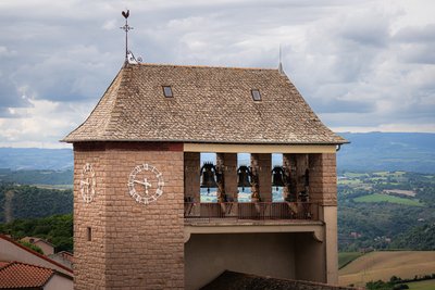
Eglise Saint-Pierre - Xavier Waerzeggers  History and heritage
Saint Pierre Parish Church
Built in 1853, the neo-Gothic Saint-Pierre Church stands out for its colourful stained glass windows, sculptures and bell tower that proudly overlooks the village. Dedicated to the apostle Saint Pierre, it invites you to discover its ornate interior, revealing 19th-century religious art.
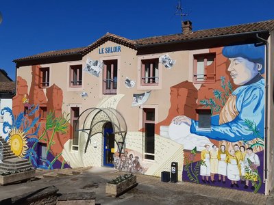
Le Saloir - Roquefort Tourisme History and heritageLe Saloir
A municipal resource center dedicated to Roquefort heritage, Le Saloir plays an essential role in preserving and sharing local history. It houses archives, objects, interviews, and iconographic materials that are not open to the public but are available to researchers by appointment. Le Saloir also organizes events and exhibitions to present this heritage to a wider audience, offering a rich place of discovery centered on the traditions of Roquefort-sur-Soulzon.
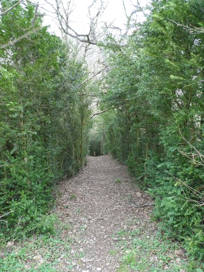
Buissière - Roquefort Tourisme  Agropastoralism
Buissière
A buissière is a path lined with boxwood hedges forming a narrow green corridor typical of the Causses, adapted to a harsh and contrasting climate. These dense double hedges once protected livestock from wind, winter snow, and summer heat, while preventing animals from straying.
Used by shepherds, local inhabitants, and carts alike, the buissière made travel easier between hamlets, pastures, sheepfolds, and water sources, bearing witness to traditional agricultural practices.
Today, the box tree moth, active from May to October, threatens these hedges by stripping them of their leaves. Although the caterpillars can be a nuisance for hikers, they are harmless.
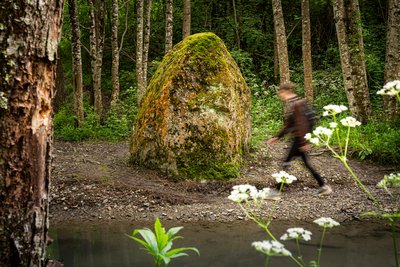
Menhir du Soulzon - Xavier Waerzeggers  Archeology
Soulzon Menhir
The Soulzon menhir is a large stone over three meters high, locally called a "menhir," even though it does not display all the usual characteristics of a traditional menhir. This type of standing stone dates back to the Bronze Age, and its exact role in the ancient landscape remains a subject of debate. Some believe it is simply a natural remnant of the Combalou, on which a cross may have been engraved during the Middle Ages, possibly to mark a territorial boundary. Others suggest it could be a prehistoric menhir that was Christianized, a common practice in the region. The two deeply carved crosses on its faces support this latter interpretation.
Bois de Conteynes et parcours de santé - Roquefort Tourisme  Flora
FloraConteynes Wood and Fitness Trail
Conteynes Wood is a dense forest where oaks stand proudly. Nature thrives here, hosting a variety of plants and animals. This area also helps protect the soil and regulate water. To enjoy it fully, a 600-meter fitness trail, which takes about an hour to complete, allows visitors to stroll, relax, and discover the wildlife and plants that make this forest so vibrant.
Description
1 - When you come out of the Tourist Office, turn right alongside the Conteynes wood to the drinking water fountain. Take the little path on the right, and pass through the housing estate on a tarmac road. Continue straight on to a large green and white building.
2 - Leave this on your right and head left behind the municipal workshops, then take a left down a little shaded pathway.
At the end of this path, go left down to the crossroads with a wide path and turn left until you reach the sharp bends.
Before crossing the river over the footbridge, you can take a return trip to the menhir which is further downstream.
3- Walk along the river on the bank opposite the menhir to the second footbridge.
Cross the river again. After 300 m and a small slope, turn left to get back onto the road.
4 - Cross this road to take a path up to the Tourist Office through the Conteynes wood.
- Departure : Roquefort Tourist Office
- Arrival : Roquefort Tourist Office
- Towns crossed : Roquefort-sur-Soulzon
Forecast
Altimetric profile
Recommandations
Box tree moths are active from May to October. During the caterpillar phase, they feed on the leaves of box trees. They crawl down trees and move on long silken threads, although these threads are annoying when hiking they do not pose any health risk
Information desks

Avenue de Lauras, 12250 Roquefort/Soulzon
Situated in the Grands Causses Regional Natural Park, the cheese village of Roquefort stretches on the hillside over the famous scree of the Combalou Rock, in southern Larzac. The village is at an elevation of 630 m and has 700 inhabitants.
OPENING PERIODS:
The Tourist Office is open all year round:
- In July and August, Monday to Saturday: 9.30 to 18.30, Sunday: 10.00 to 17.00.
- April, May, June, September, October; Monday to Saturday: 9.30 to 12.15 & 13.00 to 17.30, closed on Sunday.
- January, February, November, December; Monday to Friday: 9.30 to 12.15 & 13.00 to 17.00, closed on Saturday and Sunday.
Transport
Travel by bus or train: https://lio.laregion.fr/
Carpooling : BlaBlaCar, Rézo Pouce, Mobicoop, Idvroom, LaRoueVerte, Roulez malin
Access and parking
Parking :
More information
Report a problem or an error
If you have found an error on this page or if you have noticed any problems during your hike, please report them to us here: