
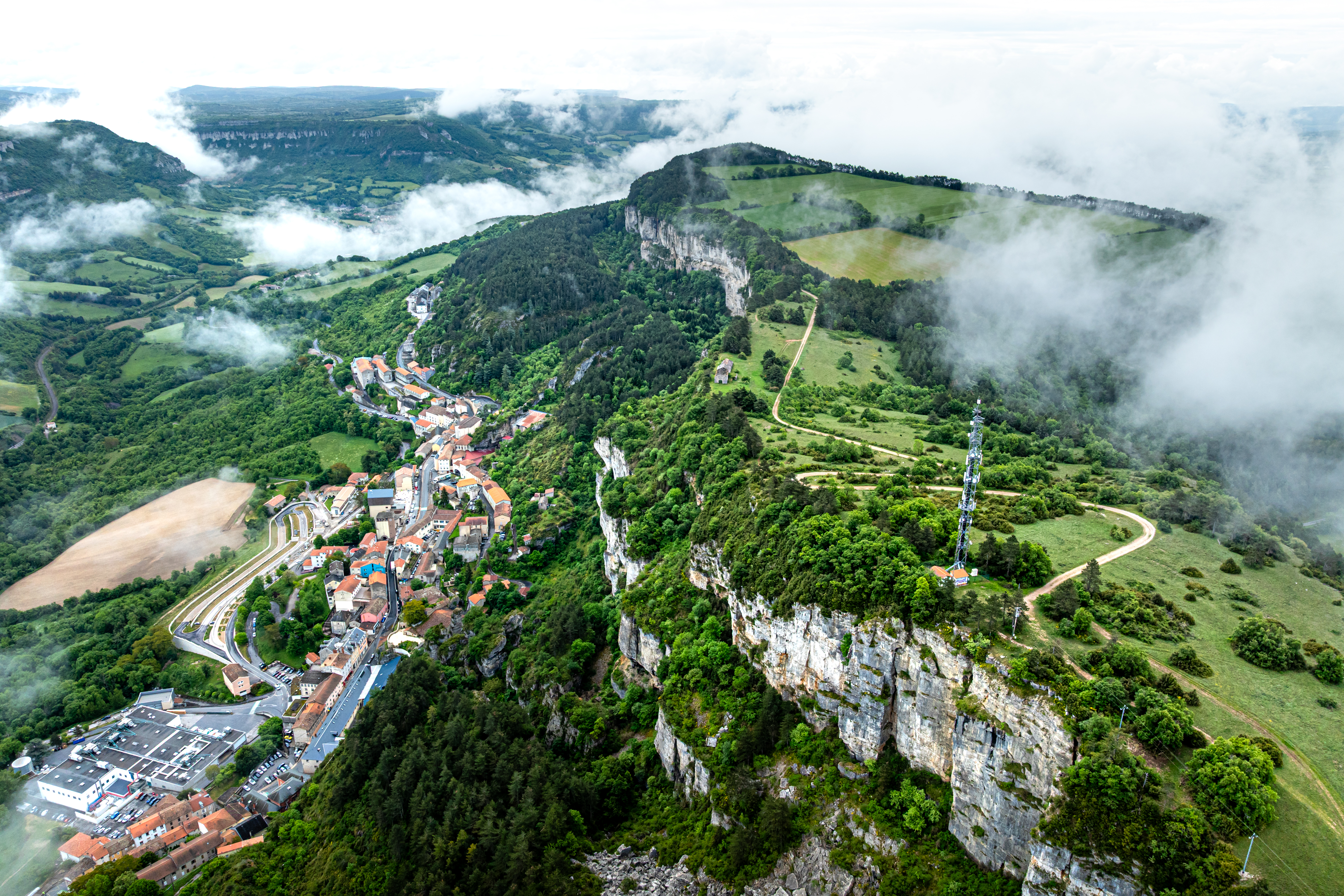
A path that runs throughout the pays du Roquefort
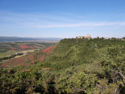
Along the Combalou cliffs and the rocky spur of the Montaigut castle, throughout the causse du Larzac and the impregnable Saint-Paul-des-Fonts amphitheatre, by the Viala medieval tower and the Sylvanès abbey, via the Sorgues and the Dourdou valleys, upon trails and into buissières explore a land of character which is the breeding ground for a typical cheese with lots of character to!
5 steps
20 points of interest
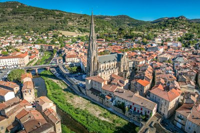
Ville de Saint-Affrique - Virginie Govignon  History and heritage
Town of Saint-Affrique
The name Saint-Affrique, with its two “F’s,” often raises curiosity. Its origin dates back to the 5th century, when Arian Visigoths were persecuting Catholic Christians. Africanus, a bishop exiled from Comminges, is said to have taken refuge near the Sorgues River, where he preached to the local population and performed various miracles – a story depicted in the stained-glass windows of the Church of Our Lady of Mercy. The name Saint-Affrique, attested as early as 942 in the archives of Vabres l’Abbaye, may come from the Visigothic term “Affric” or “Effric,” meaning “powerful and fearsome.”
Anecdote : during the French Revolution, the town was briefly renamed “Montagne sur Sorgues” to remove any religious reference, as was common practice at the time.
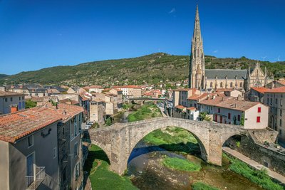
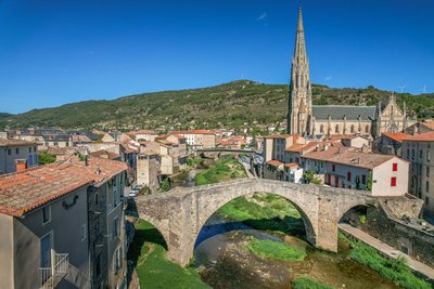
Le Pont Vieux - Virginie Govignon History and heritageThe Old Bridge of Saint-Affrique
Listed as a historic monument, the Old Bridge is one of the most beautiful medieval bridges in France, documented as early as 1408. With its bold yet elegant design, it spans the river with a central arch measuring 21.4 meters, flanked by two smaller arches. Built with a humpback profile and supported by slender triangular piers, it perfectly illustrates the skill of medieval builders. A true landmark of Saint-Affrique, this architectural gem offers a journey back in time through the city’s history.
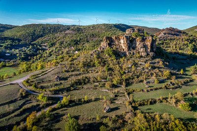
Rocher de Caylus - Virginie Govignon History and heritageThe Rock of Caylus
Perched at an altitude of 519 meters, the Rock of Caylus once supported the castle of the Counts of Caylus, built in the 11th century. Destroyed in 1238, the castle was the heart of a fortified complex that protected the local population. In 1808, the last remaining sections of the fortifications were dismantled to make way for the road to Tiergues. This site reveals a lesser-known chapter of Aveyron’s feudal history and power struggles.
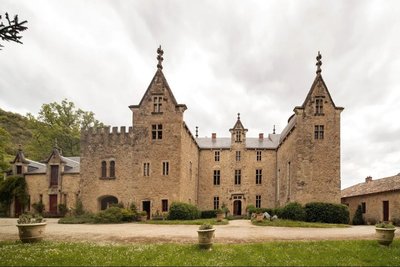
Château de Laumière - Roquefort Tourisme History and heritageLaumière Castle
Built in the 14th century and rebuilt after the French Revolution, Laumière Castle still overlooks the countryside near Saint-Rome-de-Cernon, just 3 km from the village. Over the centuries, it belonged to several prominent noble families, including the House of Armagnac and later the Vernhet de Laumière family. Among its notable figures was General Vernhet de Laumière, commander of the Imperial Guard's artillery during the Second French Empire. A witness to centuries of history, the castle is now available to rent for stays in an exceptional setting.
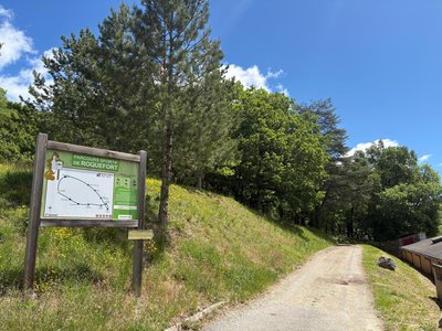
Bois de Conteynes et parcours de santé - Roquefort Tourisme  Flora
FloraConteynes Wood and Fitness Trail
Conteynes Wood is a dense forest where oaks stand proudly. Nature thrives here, hosting a variety of plants and animals. This area also helps protect the soil and regulate water. To enjoy it fully, a 600-meter fitness trail, which takes about an hour to complete, allows visitors to stroll, relax, and discover the wildlife and plants that make this forest so vibrant.
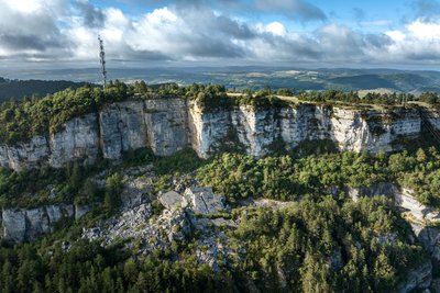
Eboulis du Combalou - Xavier Waerzeggers  Geology
The Combalou scree
The Combalou scree is an impressive rock formation, created by the many tectonic movements that shaped the limestone plateau. These piles of stones are the result of successive collapses and landslides that have shaped the landscape over the centuries. The rocks in this area reflect the region’s geological activity, where erosion has sculpted unique landscapes.
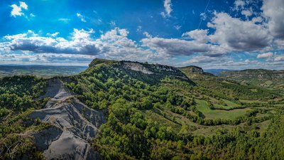
Vue depuis le Plateau du Combalou - Roquefort Tourisme GeologyThe Combalou Plateau
The Combalou Plateau is a spectacular geological site located in the heart of the Roquefort region. Formed around 150 million years ago, when a shallow sea covered the area, this vast limestone landscape was shaped over time by layers of sediment.
Today, the Combalou is best known for its natural caves, which are essential to the production of Roquefort cheese. Crossed by natural fissures called “fleurines,” the plateau benefits from constant natural ventilation that maintains stable temperature and humidity levels. These unique conditions create the perfect environment for the aging of the famous Roquefort cheese.
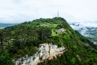
Jasse du Combalou - Xavier Waerzeggers  Agropastoralism
Jasse du Combalou
Jasses were buildings designed to shelter sheep during the summer season. Fairly well preserved, the Jasse du Combalou is organized over two levels. On the ground floor, two sheep pens, one of which is vaulted, housed the animals. Upstairs, a large barn was used to store hay for feeding the flocks during the winter months. Perfectly adapted to life in the highlands and the needs of pastoralism, this type of building provides an important testimony to rural life on the Causses.
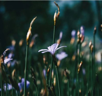
Aphyllanthes de Montpellier - Roquefort Tourisme FloraThe Montpellier Aphyllanthes
The Montpellier Aphyllanthes, also known as the “blue carnation of Montpellier,” is an emblematic plant of the Mediterranean garrigue. Perfectly adapted to dry soils, it blooms from April to June, brightening the landscape with its delicate light-blue flowers, which are highly appreciated by bees. Without leaves to limit water loss, it stands out with its long green stems, well suited to arid climates. In the past, its roots were used to make brushes, highlighting its place in local heritage.
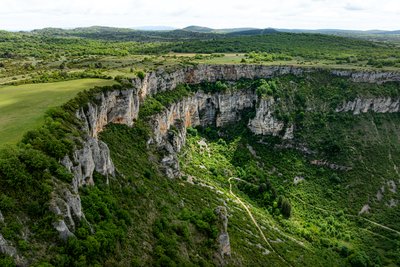
Le Cirque de Tournemire - Xavier Waerzeggers GeologyTournemire Cirque
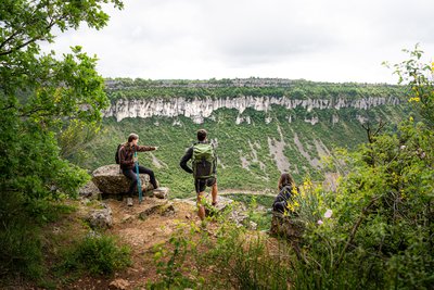
Designated as a Natura 2000 site, the Tournemire Cirque is one of the most remarkable geological landmarks on the western edge of the Larzac plateau. Its dark marl slopes contrast strikingly with the towering limestone and dolomitic cliffs above. Shaped by erosion over thousands of years, this spectacular landscape features dramatic rock formations that attract both geology enthusiasts and hikers seeking breathtaking scenery.
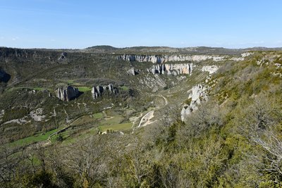
Le cirque de Tournemire - Claude Chambaud GeologyThe Tournemire cirque
Situated in the southwest of the Larzac Causse, the Tournemire Cirque is a remarkable geological area marking the bondary beetwen the fore-causses and the great causses. It presents limestone ledges and rocky escarpments with caves and cavities where raptors such as the eagle owl and the golden eagle nest.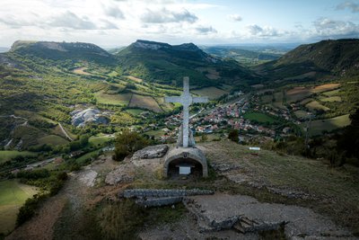
Croix de Gréponac - Xavier Waerzeggers  Panorama
Croix de Gréponac
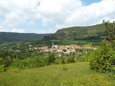
Perched above the Cirque of Tournemire, the stone Croix de Gréponac is a landmark of the landscape. It offers outstanding panoramic views over the village of Tournemire, the dramatic contours of the cirque, and the surrounding foothills of the Causses, making it an ideal spot to pause and take in the scenery.
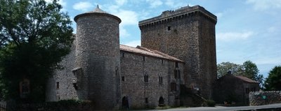
La Tour du Viala - Association La Tour du Viala History and heritageTower of Viala du Pas de Jaux
The Lord of Tournemire gave to the Templars knights the lands of Viala du Pas de Jaux in 1150. In the 12th and 13th centuries, the Viala consisted of a few farms.
After 1312, when the Hospitallers took possession of the Templars’ property, they decided to create in this place a village and for that they built farm buildings, managed by the brothers of the order. They constructed for them a dwelling and a church dedicated to St-Jean-Baptiste, the patron of the Hospitallers.
Until 1430, the inhabitants of Viala du Pas de Jaux and the surroundings took refuge in Ste-Eulalie de Cernon during the periods of insecurity which occurred on the Larzac. Because of the high distance between the two village, the inhabitants asked the authorization to the Grand Prior of Saint Gilles, to build a fortified tower to be able to take refuge inside with their possessions. This is the first fortification built on the plateau.
Today the 30 meters high tower has been restored. The vaulted ground floor, the five floors, its terrace and the dwelling dating from the 14th century are now accessible.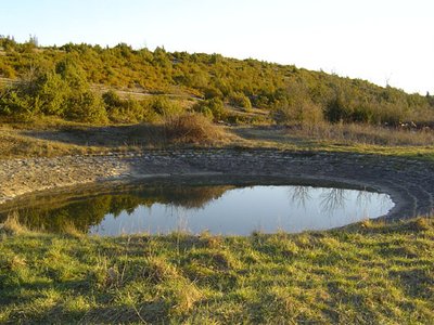
Lavogne de Font Rome - Association La Tour du Viala du Pas de Jaux AgropastoralismThe lavogne (cobbled watering place)of Font Rome
This lavogne (cobbled watering place) of Font Rome, built in 1910 near tank wells is was first situated on a waterproof clay background. Then, it was built of stones all around and cemented. So this type offers the advantage of forming a passage that resists the trampling of sheep, and the gentle slope of the surrounding area limits the risk of slipping and falling of the animals. It is supplied by rainwater.
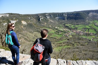
Le cirque de Saint Paul des Fonts - Claude Chambaud PanoramaCirque of St-Paul-des-Fonts
The cirque of St-Paul-des-Fonts is a semi-circular natural cirque formed by karst erosion.
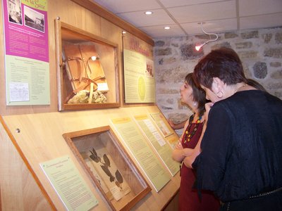
Espace Hippolyte Coste - OT Larzac et Vallées FloraBotanical Museum Hippolyte Coste
Established on the ground floor of the presbytery adjoining the church of Saint-Paul-des-Fonts, the botanical space is dedicated to the life and work of the canon Hippolyte Coste who shared his life between the duties of his ministry and his passion for botany.
This rouergate of modest peasant origins, which has been nicknamed "le curé des fleurs" (the priest of the flowers), knew how to rise in the yard of the greatest botanists by realizing in particular the remarkable and masterful «Flore descriptive et illustrée de la France, de la Corse et des contrées limitrophes» (1901 – 1906) which constitutes its masterpiece, known and still recognized today at the European scale.
With this museum Saint-Paul-des-Fonts becomes an unmissable destination for all those who wish to learn by discovering the botanical wealth of the Larzac and Aveyron.
Open from april to septembre. Free entrance.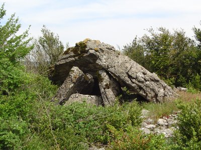
Dolmen Mascourbe 1 - PNR des Grands Causses  Dolmen
Mascourbe dolmen 1
The Mascourbe dolmens belong to the so-called “Treilles” group, named after the cave near the Treilles farm in Saint-Paul-des-Fonts. These prehistoric communities of the Grands Causses were known for their expertise in copper working and for practicing skull trepanation.
This dolmen, partially damaged, still retains an impressive trapezoidal end slab, a testament to these millennia-old constructions.
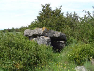
Dolmen Mascourbe 2 - PNR des Grands Causses DolmenMascourbe dolmen 2
Among the three Mascourbe dolmens, this second monument has a simpler structure, consisting of a stone cap resting on upright pillars, without an end slab. It belongs to the Neolithic heritage of the “Treilles” group and bears witness to the very early human occupation of the Grands Causses.
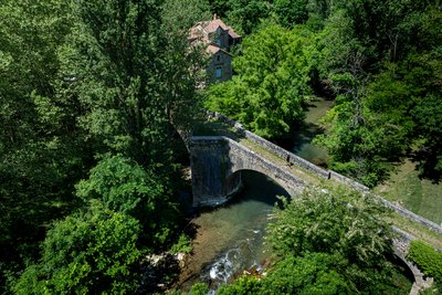
Pont Vieux de Saint-Félix-de-Sorgues - Xavier Waerzeggers History and heritageOld Bridge of Saint-Félix-de-Sorgues
The Old Bridge, a true masterpiece of medieval architecture, is one of the symbols of Saint-Félix-de-Sorgues. Stretching about 70 meters, this humpback bridge features three semicircular arches, including a main arch supported by sturdy piers with triangular cutwaters upstream and widened downstream buttresses that create small pedestrian refuges.
Its carefully crafted masonry and precisely assembled vaults likely date from the late 13th or early 14th century. Listed in the national heritage inventory but not formally protected as a historic monument, the bridge now requires maintenance work to preserve both its beauty and structural integrity.
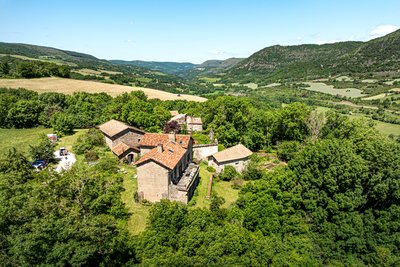
Hameau médiéval de Saint-Caprazy - Xavier Waerzeggers History and heritageSaint-Caprasy Estate
Recorded as early as 1026, Saint-Caprazy is an important historic site in Saint-Félix-de-Sorgues. Around 1150, Gaubert de Saint-Caprazy became the first commander of the Knights Hospitaller of Saint John in Saint-Félix, who maintained their authority there for more than six centuries.
This medieval hamlet still includes several buildings: a dwelling house, a barn, a sheepfold, a chapel, and other agricultural structures, all bearing witness to its rural and religious past.
Description
This hike which is full of character starts from St Affrique and offers a discovery tour from the sometime harsh landscape of the Causse, up to the lands of the Rougier bursting with colours and promises.
Time and people have left their marks along the route: rocky paths, long buissières (narrow passages between two rows of box trees), and sunken paths lined with dry stone walls.
You’ll walk along the great geological fracture and the cliffs of the Combalou mount which gave Roquefort its reputation. You will explore the Tournemire and St Paul des Fonts amphitheatres, the Viala du Pas de Jaux Tower, the Cistercian fort of Saint-Jean d'Alcas, the pleasant village of St Félix overlooking the Sorgues valley, the Sylvanès Abbey which is one of the jewels of Cistercian art and the Montaigut castle standing proudly on a rocky spur and towering over the Rougier de Camarès.
- Departure : Place Leclerc, Saint-Affrique
- Arrival : Place Leclerc, Saint-Affrique
- Towns crossed : Saint-Affrique, Saint-Rome-de-Cernon, Roquefort-sur-Soulzon, Tournemire, Viala-du-Pas-de-Jaux, Saint-Jean-et-Saint-Paul, Saint-Félix-de-Sorgues, Sylvanès, Gissac, and Versols-et-Lapeyre
Forecast
Altimetric profile
Recommandations

Information desks
Avenue de Lauras, 12250 Roquefort/Soulzon
Situated in the Grands Causses Regional Natural Park, the cheese village of Roquefort stretches on the hillside over the famous scree of the Combalou Rock, in southern Larzac. The village is at an elevation of 630 m and has 700 inhabitants.
OPENING PERIODS:
The Tourist Office is open all year round:
- In July and August, Monday to Saturday: 9.30 to 18.30, Sunday: 10.00 to 17.00.
- April, May, June, September, October; Monday to Saturday: 9.30 to 12.15 & 13.00 to 17.30, closed on Sunday.
- January, February, November, December; Monday to Friday: 9.30 to 12.15 & 13.00 to 17.00, closed on Saturday and Sunday.
Report a problem or an error
If you have found an error on this page or if you have noticed any problems during your hike, please report them to us here: