The Montagne des Anglais hiking circuit
Were the skeletons found in the medieval necropolis of Soulsou the remains of English soldiers dating back to the one hundred years war? The oral tradition says so! The Montagne des Anglais welcomes you to enjoy this pastoral hiking loop that goes up to the hamlet of Vailhauzy spread out across the hillsides. A point of interest worth seeing on the way is the Soulsou farm with its typical caussenarde architecture.
2 points of interest
Ville de Saint-Affrique - Virginie Govignon  History and heritage
Town of Saint-Affrique
The name Saint-Affrique, with its two “F’s,” often raises curiosity. Its origin dates back to the 5th century, when Arian Visigoths were persecuting Catholic Christians. Africanus, a bishop exiled from Comminges, is said to have taken refuge near the Sorgues River, where he preached to the local population and performed various miracles – a story depicted in the stained-glass windows of the Church of Our Lady of Mercy. The name Saint-Affrique, attested as early as 942 in the archives of Vabres l’Abbaye, may come from the Visigothic term “Affric” or “Effric,” meaning “powerful and fearsome.”
Anecdote : during the French Revolution, the town was briefly renamed “Montagne sur Sorgues” to remove any religious reference, as was common practice at the time.
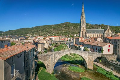
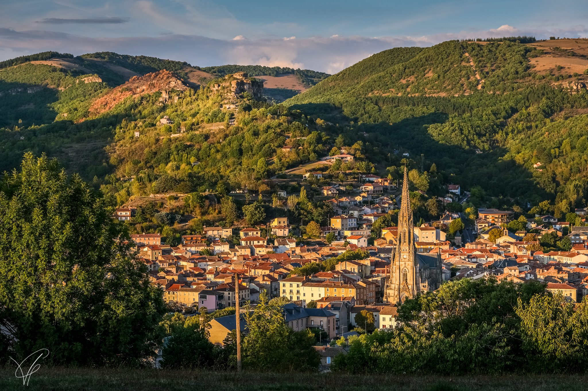
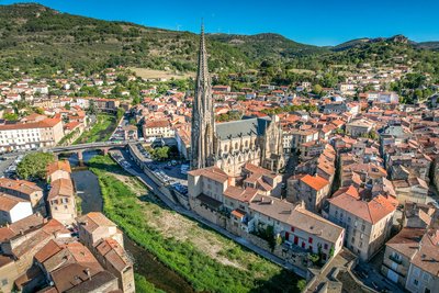
Le Pont Vieux - Virginie Govignon History and heritageThe Old Bridge of Saint-Affrique
Listed as a historic monument, the Old Bridge is one of the most beautiful medieval bridges in France, documented as early as 1408. With its bold yet elegant design, it spans the river with a central arch measuring 21.4 meters, flanked by two smaller arches. Built with a humpback profile and supported by slender triangular piers, it perfectly illustrates the skill of medieval builders. A true landmark of Saint-Affrique, this architectural gem offers a journey back in time through the city’s history.
Description
- As soon as you leave the carpark, turn immediately right and take the rue Baudin. Walk up the road, follow a large curve and on the second bend turn left. Follow the paved path that turns into a track up to the junction with the road. Follow the road to the left and walk past some houses at a place called «Julhac».
- Leave on the road to the right that goes to Vailhauzy. Turn left at the next intersection, 50 m further on leave the road and take the raised path to the right. Follow this path between some undergrowth and join a trail on your left that you follow up to the Soulsou farm. Exit the farm to your left and take the trail to your right. Carry on up to the Canissac farm.
- Leave the farm by taking the exit to the left, once past the hamlet take the trail that goes straight up to the right and leads to the Saint Privat farm. Walk alongside the farm and join a trail which turns into a path through some undergrowth. Walk along the brook down towards the Plô de Moussigny. Above the buildings of the Plô, leave the path by turning left and carry straight on to join a wide path, then reach the tarmac road that leads to Vailhauzy.
- Walk through the village from East to West, taking the tarmac track which you follow throughout its length. At the intersection at a crossroads, continue straight ahead and after approximately 2 km, leave the road.
- Take the descending path to the left towards Julhac and retrace your steps back to Saint-Affrique following the way you came.
- Departure : Saint-Gabriel carpark, rue Lamartine in Saint-Affrique
- Arrival : Saint-Gabriel carpark, rue Lamartine in Saint-Affrique
- Towns crossed : Saint-Affrique and Roquefort-sur-Soulzon
Forecast
Altimetric profile
Recommandations
Box tree months are active from May to October. During the caterpillar phase, they feed on the leaves of box trees. They crawl down trees and move on long silken threads, although these threads are annoying when hiking they do not pose any health risk
Information desks

Avenue de Lauras, 12250 Roquefort/Soulzon
Situated in the Grands Causses Regional Natural Park, the cheese village of Roquefort stretches on the hillside over the famous scree of the Combalou Rock, in southern Larzac. The village is at an elevation of 630 m and has 700 inhabitants.
OPENING PERIODS:
The Tourist Office is open all year round:
- In July and August, Monday to Saturday: 9.30 to 18.30, Sunday: 10.00 to 17.00.
- April, May, June, September, October; Monday to Saturday: 9.30 to 12.15 & 13.00 to 17.30, closed on Sunday.
- January, February, November, December; Monday to Friday: 9.30 to 12.15 & 13.00 to 17.00, closed on Saturday and Sunday.
Transport
Travel by bus or train: https://lio.laregion.fr/
Carpooling : BlaBlaCar, Rézo Pouce, Mobicoop, Idvroom, LaRoueVerte, Roulez malin
Access and parking
Saint-Affrique is situated 31 km South-West from Millau via the D992 and D999. From Clermont-Ferrand and Montpellier, via A75, exit 46, then follow the D999. From Toulouse/Albi via the D999.
Parking :
More information
Report a problem or an error
If you have found an error on this page or if you have noticed any problems during your hike, please report them to us here: